Yellowstone
Yellowstone National Park, ID
Artemisia Trailhead
This trailhead provides access to the upper end of the Upper Geyser Basin. Parking is available across the street in the Biscuit Basin parking lot. Use caution when crossing the road.
Artist Point Trailhead (4K8)
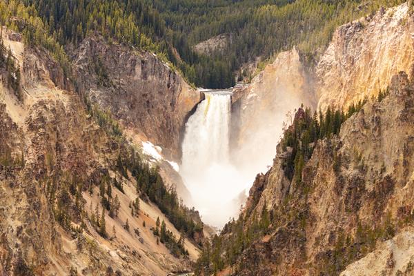
This trailhead starts at the eastern end of the Artist Point parking area. The trail leads to the popular Artist Point Overlook. East of the overlook where you can embark on the following trails:- Artist Point-Point Sublime Trail- Clear Lake-Ribbon Lake TrailThere is a large parking lot here, though it is often busy during the peak of the summer season. Vault toilets are located at the western end of the parking lot. Artist Point-Point Sublime Trail This 2.6-mile (4.2-km) the
Artists' Paintpot Trail
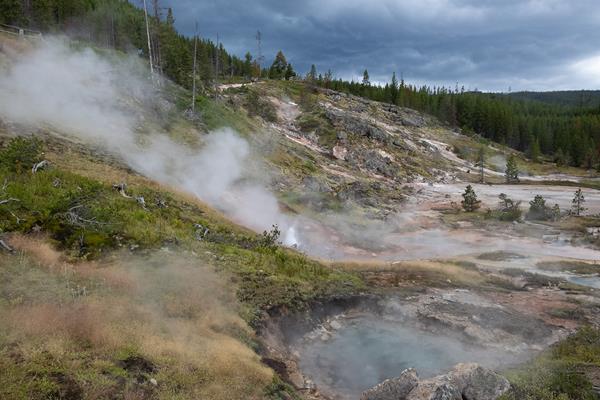
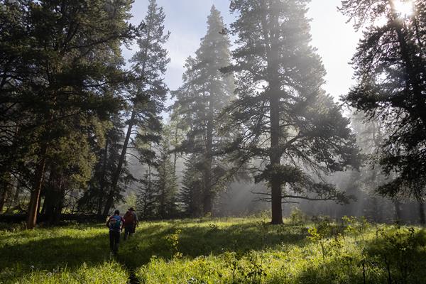
This is a one-mile (1.6 km) trail that enters a partially burned lodgepole pine forest, then winds across a wet meadow on a boardwalk. This trail is a short loop. The hydrothermal area has colorful hot springs, mudpots, and small geysers. Watch out for flying mud. Stay on the trail and boardwalks. AccessibilityThe trail is relatively flat from the parking lot to the hydrothermal features. The trail is over bare ground. There is a mixture of boardwalks and bare ground trails
Avalanche Peak Trailhead (5N2)
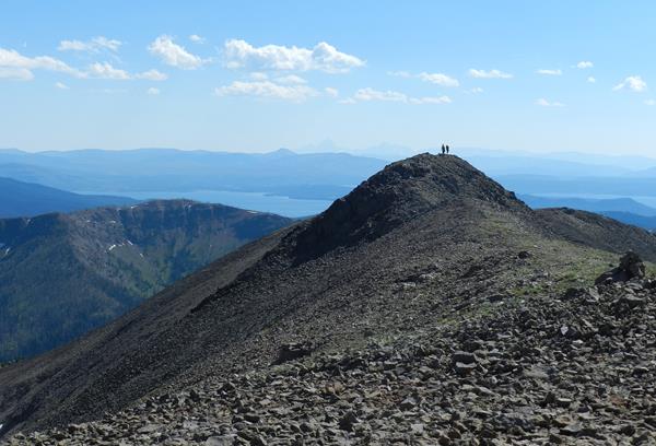
This trailhead is located on the north side of the East Entrance Road and provides access to the following trail:- Avalanche Peak Trail Avalanche Peak Trail This trail is often snow-covered until early July. This strenuous, high elevation 4.4-mile (7.1-km) there-and-back trail is not recommended for people with heart and/or respiratory problems. Be aware of lightning above treeline. Even on warm summer days, bring rain gear, wool hats, and gloves. Burned trees may fall withou
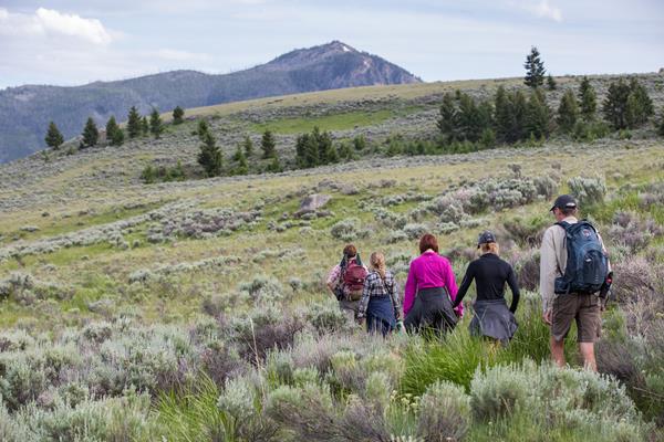
Bacon Rind Trailhead (WK4)
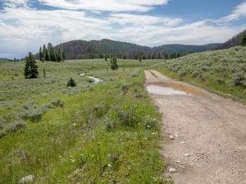
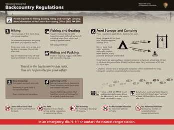
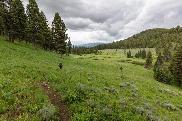
The Bacon Rind trailhead is on the northwest side of Yellowstone near U.S. Highway 191. From this trailhead, you can embark on the following trail:- Bacon Rind Trail Bacon Rind Trail A strenuous 10.2-mile (16.4 km) there-and-back trail that climbs 2,400 feet (731 m) through forest (some burned in 2017) and meadow to high alpine meadows and views. CAUTION: Grizzly bears frequent this area. Backcountry RegulationsPermit required for fishing, boating, riding, and overnight cam
Beaver Ponds Trailhead (1N4)
This trailhead is located behind the Mammoth Hot Springs Hotel, next to the start of the Old Gardiner Road. From this trailhead, you can access the following trails:- Beaver Ponds Trail- Selpulchar Mountain TrailThere is no parking at the trailhead. However, there is parking available nearby around the visitor center, hotel, and other nearby facilities. Beaver Ponds Trail A 5-mile (8.3-km) loop trail that begins and ends in the developed area of Mammoth Hot Springs. This mode
Bechler Ranger Station Trailhead (9K1)
This trailhead is located along the Cave Falls Road, just north of the southern park boundary. This trailhead provides access to the following trails:- Boundary Creek- Bechler River Cutoff Trail- Bechler River Trail- South Boundary Trail: Bechler Ranger Station-Grassy Lake- Robinson Creek Trail Boundary Creek Trail A moderate 17.2-mile (27.7-km) one-way trail that travels across relative flat lands, through forests and meadows, and past several waterfalls around the middle se
Beula Lake Trailhead (8K6)
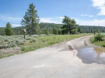
This more remote trailhead can be access by car and provides access to the following trail. The trailhead is at a steep pullout on the north side of the road at the east end of the reservoir.- Beula Lake Trail Beula Lake Trail This is a 5.2-mile (-km) there-and-back trail with a gentle climb at the start of the trail. Beula Lake covers about 107 acres (43 ha) and supports a population of Yellowstone cutthroat trout. If you are looking to fish here, remember to pick up a Yell
Bighorn Pass - Indian Creek Trailhead (1K5)
This trailhead is located at the small picnic area/winter warming hut just after thr turn-off from the Grand Loop Road. This trailhead provides access to these trails:- Bighorn Pass Trail- Bighorn Loop Ski Trail- Indian Creek Loop Ski Trail- Sheepeater Ski TrailParking is available near the vault toilets. Winter access is available via a snowcoach ride from the Mammoth Hot Springs Hotel. Bighorn Pass Trail A strenuous 19.4-mile (31.2 km) one-way trail with lot of open meadows
Bighorn Pass Trailhead (WK6)
The Bighorn Pass trailhead is on the northwest side of Yellowstone near U.S. Highway 191. From this trailhead, you can embark on the following trail:- Bighorn Pass Trail Bighorn Pass Trail This trail can either be a there and back 21.2-mile (35 km) strenuous hike to the top of Bighorn Pass or a 19-mile (30 km) through hike ending at a different trailhead south of Mammoth Hot Springs. (Either plan on leaving a vehicle at one end or arrange a shuttle back to the trailhead.) Th
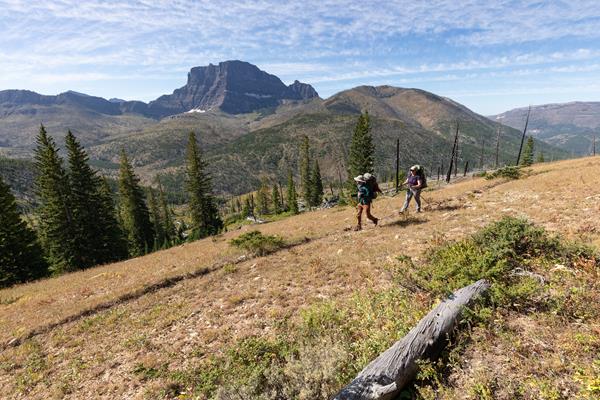
Black Butte Trailhead (WK2)
The Black Butte trailhead is on the northwest side of Yellowstone near US Highway 191. From this trailhead, you can embark on the following trail:- Black Butte Trail Black Butte Trail This is a strenuous 11.4-miles (18.3 km) there-and-back trail that climbs 3,100 feet (945 m) to the Sky Rim Trail and near Big Horn Peak. CAUTION: Grizzly bears frequent this area. Backcountry RegulationsPermit required for fishing, boating, riding, and overnight camping. More information at t
Black Sand Basin Trailhead
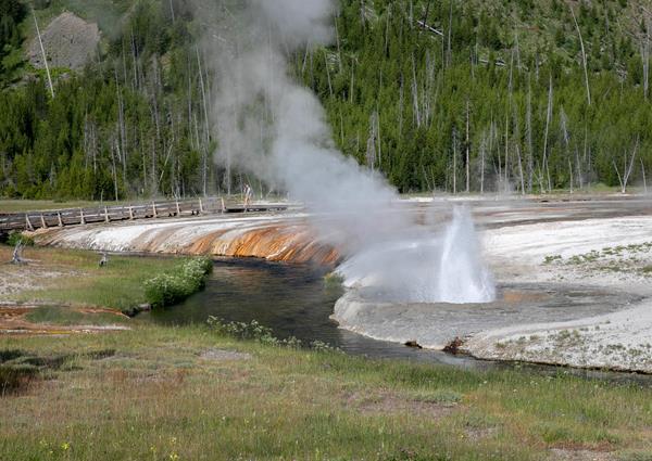
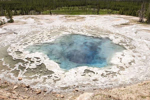
1 mile (1.6 km) walk to Black Sand Basin from Daisy Geyser or 1 mile (1.6 km) drive northwest of Old Faithful along the main road.Named for sand derived from black volcanic glass (obsidian), this basin features some of the most splendid hot springs in Yellowstone. Hydrothermal features here:- Emerald Pool- Rainbow Pool- Sunset Lake (actually a geyser, but its eruptions are infrequent and seldom noticed because of the heavy steam over the water)- Cliff Geyser, on the edge of I
Blacktail Deer Creek Trailhead (1N5)
This trailhead is located on the Grand Loop Road between Mammoth Hot Springs and Tower. From this trailhead, you can access the following trails:- Blacktail Deer Creek Trail- Blacktail Ponds Spur Trail- Rescue Creek Trail- Yellowstone River TrailParking at this trailhead can fill up quickly. There is additional parking nearby at the Blacktail Deer Creek Stock Trailhead. Blacktail Deer Creek Trail From the Blacktail Deer Creek trailhead it is moderate 11-mile (18-km) there-and
Bootjack Gap Trailhead (3N3)
This is a remote trailhead at the eastern boundary of the park that is not accessible by road. From this trailhead, you can embark on the following trails within the park:<br />- Bootjack Gap Trail<br />- Miller Creek Trail
Bridge Bay - Natural Bridge Trailhead
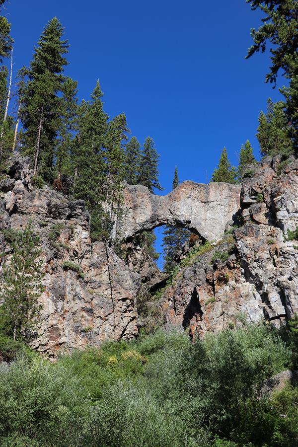
This trailhead is located in the Bridge Bay Developed Area. The following trail can be accessed from this trailhead:- Natural Bridge Trail Natural Bridge Trail An easy 2.5-mile (4-km) there-and-back trail that travels through a forest and along an old service road to a natural bridge, which was cut out of a cliff of rhyolite rock by Bridge Creek. Backcountry RegulationsPermit required for fishing, boating, riding, and overnight camping. More information at the Center Backcoun
Bridger Lake Trailhead (6K4)
This is a remote trailhead at the southeast boundary of the park that is not accessible by road. From this trailhead, you can embark on the following trails within the park:<br />- Yellowstone Meadows Cutoff Trail- Thorofare Trail<br />- Hawk's Lake Trail<br />- Thorofare-South Boundary Cutoff Trail<br />- South Boundary Trail: Lynx Creek
Buffalo Fork Trailhead (2N3)
This is a remote trailhead at the northern boundary of the park that is not accessible by road. From this trailhead, you can embark on the following trail within the park:<br />- Buffalo Fork Trail
Buffalo Lake / Boundary Creek Trailhead (9K8)
This is a remote trailhead at the western boundary of the park that is not accessible by road. From this trailhead, you can embark on the following trail within the park:<br />- Boundary Creek Trail
Buffalo Plateau Trailhead (2N2)
This is a remote trailhead at the northern boundary of the park that is not accessible by road. From this trailhead, you can embark on the following trail within the park:<br />- Buffalo Plateau Trail
Canoe Lake Trailhead (3N2)
This is a remote trailhead at the eastern boundary of the park that is not accessible by road. From this trailhead, you can embark on the following trails within the park:<br />- Canoe Lake Trail<br />- Miller Creek Trail
Cascade Creek Trailhead (4K4)
This trailhead allows you to embark on a series of trails in the north-central part of the park:- Cascade Creek Trail- Cascade Lake Trail- Observation Peak Trail- Howard Eaton Trail: Cascade Lake-Norris CampgroundA small parking lot is available at the trailhead. Cascade Creek Trail A 3.4-mile (5.5-km) there-and-back trail through Cascade Meadow that ends at the junction with the Cascade Lake Trail. Cascade Lake Trail A moderate 4.4-mile (7-km) there-and-back trail that passe
Cascade Creek Trailhead (9K5)
This is a more remote trailhead along the southern boundary of the park, which can be accessed by road. From this trailhead you can embark on the following trails within the park:<br />- Mountain Ash Creek Trail<br />- Terraced Falls Trail
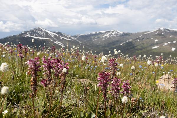
Cascade Lake Trailhead (4K5)
From this trailhead you can embark on the following trails:- Cascade Lake Trail- Observation Peak TrailThere is a dedicated parking lot at this trailhead. The nearest restrooms are location to the east at the Cascade Lake Picnic Area. Cascade Lake Trail A moderate 4.4-mile (7-km) there-and-back trail that passes through open meadows to Cascade Lake where wildflowers abound and wildlife is often seen. The trail can be wet and snowy through July. CAUTION Grizzly bears frequen
Cave Falls Trailhead (9K2)
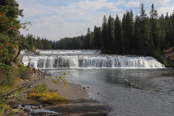
This trailhead is located along the Cave Falls Road, just north of the southern park boundary. This trailhead provides access to the following trails:- Bechler River Trail- South Boundary Trail: Bechler Ranger Station-Grassy Lake Bechler River Trail A classic, strenuous roughly 30-mile (48-km) one-way backpacking trail in the southwest part of the park that leads past waterfalls and hydrothermal features. The trail starts at either the Bechler Ranger Station or at Lone Star G
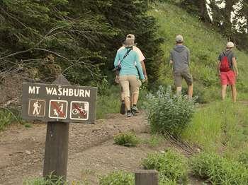
Chittenden Road / Mount Washburn North Trailhead (2K6)
CLOSED IN 2021 This trailhead provides access to the Chittenden Road-Mount Washburn Trail. Parking is limited at this very popular trail. This moderate 5.8-mile (9.3-km) there-and-back trail is the shortest route up to Mount Washburn. The trail follows a service road over a steady incline through forest and above treeline through alpine vegetation. CAUTION Grizzly bears frequent this area.
Clear Lake Trailhead
This trailhead is located on the southeast side of the Uncle Tom's parking lot on the South Rim Drive of the Grand Canyon of the Yellowstone. From this trailhead, you can access the following trails:- Ribbon Lake Trail Ribbon Lake Trail An easy 5.8-mile (9.3-km) there-and-back trail. The trail traverses through forest with views of the Grand Canyon. CAUTION: Grizzly bears frequent this area. Backcountry RegulationsPermit required for fishing, boating, riding, and overnight
Colter / Wolverine Trailhead (8K8)
This is a remote trailhead at the southern boundary of the park that is not accessible by road. From this trailhead, you can embark on the following trails within the park:- Colter / Wolverine Trail- South Boundary Trail: South Entrance-Harebell- Snake River Cutoff Trail- Snake River Canyon Trail- Heart Lake Trail Colter / Wolverine Trail An easy 0.5-mile (0.8-km) one-way trail that connects the South Boundary Trail: South Entrance-Harebell to the trails in the USDA Forest Se
Coyote Creek Trailhead (2N1)
This is a remote trailhead at the northern boundary of the park that is not accessible by road. From this trailhead, you can embark on the following trail within the park:<br />- Coyote Creek Trail
Cygnet Lakes Trailhead (4N3)
This trailhead in the middle of the park provides access to the following trail:- Cygnet Lakes TrailThere is parking at the trailhead. Cygnet Lakes Trail This 8.2-mile (13.2-km) there-and-back trail is relatively flat and exposed. The trail leads to a series of lakes where waterfowl may be seen. Backcountry RegulationsPermit required for fishing, boating, riding, and overnight camping. More information at the Center Backcountry Office: (307) 344-2160. Hiking Hike in groups of
Dailey Creek Trailhead (WK1)
This trailhead along Highway 191 in the western part of the park provides access to one trail:- Dailey Creek Trail Dailey Creek Trail A strenuous 10-mile (16-km) there-and-back trail that starts near Dailey Creek and heads up to Dailey Pass, where you can reach the Sky Rim Trail. This trail crosses open meadows and provides views of the surrounding Gallatin Range. Backcountry RegulationsPermit required for fishing, boating, riding, and overnight camping. More information at
DeLacy Creek Trailhead (7K2)
This trailhead provides access to the following trail:- DeLacy Creek Trail DeLacy Creek Trail A 5.8-mile (9.3-km) there-and-back trail that travels along a forest's edge and through open meadows to the shores of Yellowstone's largest backcountry lake. Look for sandhill cranes, moose, and water birds. Backcountry RegulationsPermit required for fishing, boating, riding, and overnight camping. More information at the Center Backcountry Office: (307) 344-2160. Hiking Hike in grou
Divide Trailhead
This trailhead provides access to the following trails:- Spring Creek Trail- Divide Trail Spring Creek Trail An easy 8-mile (12.9-km) there-and-back trail that follows a small creek along an old stagecoach route. This is a popular ski trail during the winter season. Divide Trail A moderate 3.4-mile (5.5-km) there-and-back trail that leads to the location where there was once a fire lookout. Backcountry RegulationsPermit required for fishing, boating, riding, and overnight cam
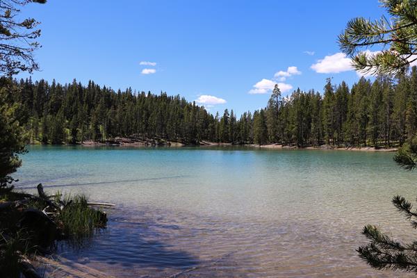
Duck Lake Trailhead
This trailhead provides access to the following trail:- Duck Lake Trail Duck Lake Trail This short, 0.8-mile (1.3-km) there-and-back trail climbs a small hill for a view of Duck and Yellowstone lakes, and the expanse of the 1988 fires that swept through this area. Trail descends to the shore of Duck Lake. Backcountry RegulationsPermit required for fishing, boating, riding, and overnight camping. More information at the Center Backcountry Office: (307) 344-2160. Hiking Hike in
Dunraven Pass - Mount Washburn Trailhead (4K9)
CLOSED IN 2021 This popular trailhead is situated right at Dunraven Pass. The Mount Washburn South Trail and Mount Washburn Spur Trails can be accessed from here. Due to the popularity of this location, parking can be very limited. A vault toilet is located in the middle of the parking lot. Mount Washburn South Trail is a moderate 6-mile (9.6-km) there-and-back trail to the top of Mount Washburn.
Eagle Pass Trailhead (6K1)
This is a remote trailhead at the southeast boundary of the park that is not accessible by road. From this trailhead, you can embark on the following trail within the park:<br />- Mountain Creek Trail
Elephant Back Trailhead
Located near Lake Village, this trailhead provides the following hiking opportunity:- Elephant Back Mountain Trail Elephant Back Mountain Trail A popular 3.5-mile (5.6-km) lollipop loop trail near Lake Village, this trail climbs 800 feet (244 m) in 1-½ miles (2.4 km) through the dense lodgepole forest. After 0.8 of a mile, the trail splits into a loop. The left fork is the shortest route to the top, though both join again at the overlook. The overlook provides a sweeping pan
Fairy Falls Trailhead (OK5)
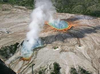
This trailhead provides access to the following trails:- Grand Prismatic Overlook Trail- Fairy Falls Trail Grand Prismatic Overlook Trail An easy 1.2-mile (1.9-km) hike that gradually climbs 105 feet over 0.6 miles from the Fairy Falls Trailhead to a view looking down on Grand Prismatic Spring and the Midway Geyser Basin. Fairy Falls Trail This relatively flat, easy 4.5-mile (7.2-km) there-and-back trail leads to Fairy Falls, which plunges 200 feet (61 m) to create one of Yel
Fawn Pass Trailhead (WK5)
The Fawn Pass trailhead is on the northwest side of Yellowstone near U.S. Highway 191. From this trailhead, you can embark on the following trail:- Fawn Pass Trail Fawn Pass Trail This trail can either be a there and back 18-mile (28.9 km) strenuous hike to the top of Fawn Pass or a 21-mile (34 km) through hike ending at a different trailhead south of Mammoth Hot Springs. (Either plan on leaving a vehicle at one end or arrange a shuttle back to the trailhead.) This trail is
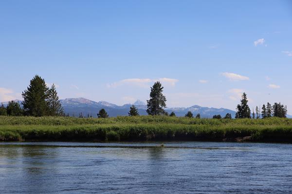
Fishing Bridge Trailhead (5K2)
This trailhead is located back behind the Fishing Bridge Developed Area. It provides access to the following trail:- Howard Eaton Trail: Fishing Bridge to Canyon Howard Eaton Trail: Fishing Bridge to Canyon This 13.5-mile (21.7-km) one-way trail follows the Yellowstone River after it leaves Yellowstone Lake. Backcountry RegulationsPermit required for fishing, boating, riding, and overnight camping. More information at the Center Backcountry Office: (307) 344-2160. Hiking Hike
Forces of the Northern Range Trailhead
This trailhead is the start of an enjoyable, short walk for visitors of all ages. The trailhead provides access to the following trail:<br />- Forces of the Northern Range Trail<br /><br />There is a large parking lot at the trailhead.<br /><br /> <b>Forces of the Northern Range Trail</b> <br />This easy, 0.5-mile (0.8-km) lollipop loop trail travels along a boardwalk through a small forest. Outdoor signs interpret the natural forces that shaped, and continue to shape, the surrounding landscape.