Yosemite
Yosemite, CA
Big Trees Loop Trailhead

Winding through an impressive forest with many giant sequoias, this trail offers numerous interpretive panels on the life and ecology of this unique place. This loop is relatively flat and is wheelchair accessible. Big Trees Loop (easy) 0.3 mile (0.5 km) loop-trip; 30-45 minutes.
Bridalveil Fall
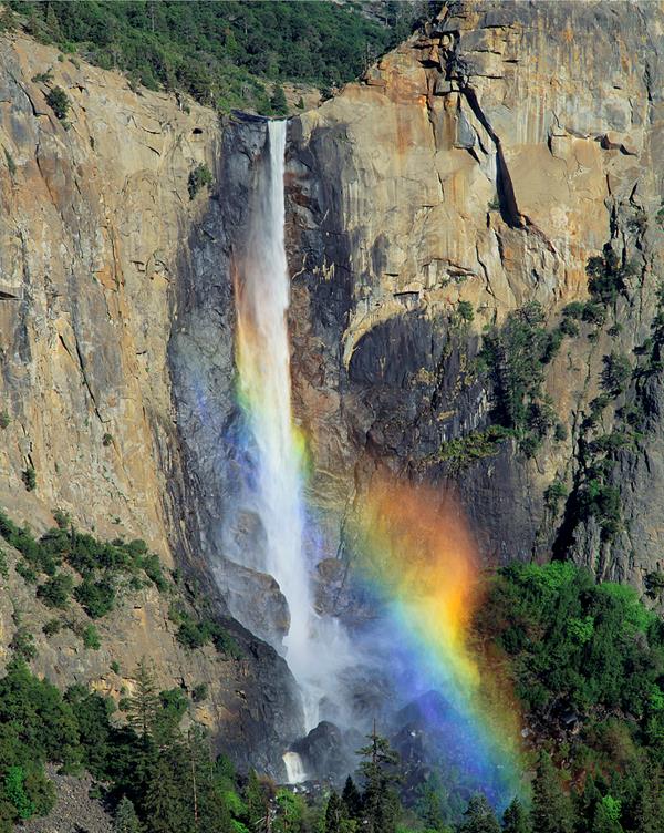
Enjoy an up close view from the base of this often-windswept waterfall. Especially in the spring, expect to get wet while standing at the base of this thundering waterfall that plunges 620 feet (189 meters). In some cases the spray off Bridalveil Fall is so strong, you may not even be able to easily access the end of the trail. During the rest of the year, look for its characteristic light, swaying flow. Expect icy and very slick conditions in winter.
Bridalveil Fall Parking Area
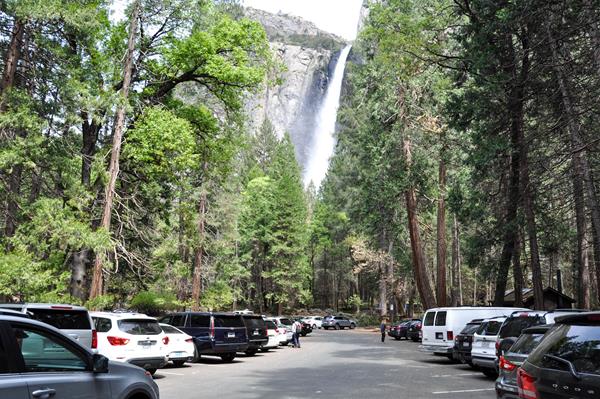
Prepare to be awed as you approach the misty bottom of Bridalveil Fall from this parking area. The Bridalveil Fall parking area often fills up quickly in summer and traffic jams are common when getting in and out of this parking lot. Parking is also available a little further east on Southside Drive into Yosemite Valley (a few hundred yards), where you'll find parking on either side of the road with a different trail option.
Bridalveil Fall Trailhead
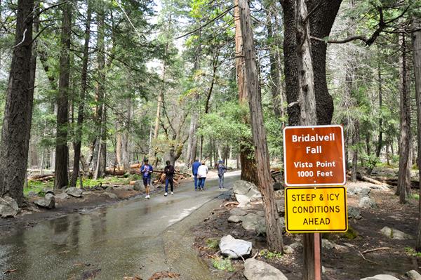
A short walk will lead you to the base of Bridalveil Fall, allowing you to get an up close view of this often-windswept waterfall. Plunging 620 feet (189 meters), Bridalveil Fall is the first major waterfall you'll see when entering Yosemite Valley. In spring, it thunders; you can expect to get wet! In some cases the spray is so strong, you may not even be able to easily access the end of the trail. During the rest of the year, look for its characteristic light, swaying flow.
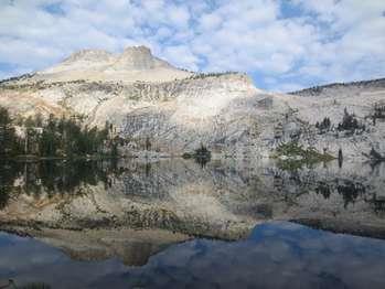
Cathedral Lakes Trailhead
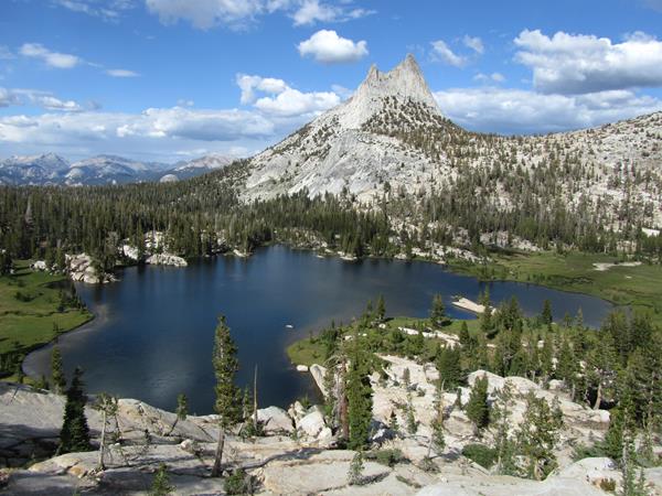
The shimmering waters of Cathedral Lakes rest below Cathedral Peak, named by the California Geological Survey (CGS) in 1863. The trail climbs steadily to Upper Cathedral Lake. Near the top of the climb, it passes a spur trail to Lower Cathedral Lake (0.5 mile to lake). The return hike follows the same route. This is one of the busiest trails in the Tuolumne Meadows area.
Chilnualna Falls Trailhead
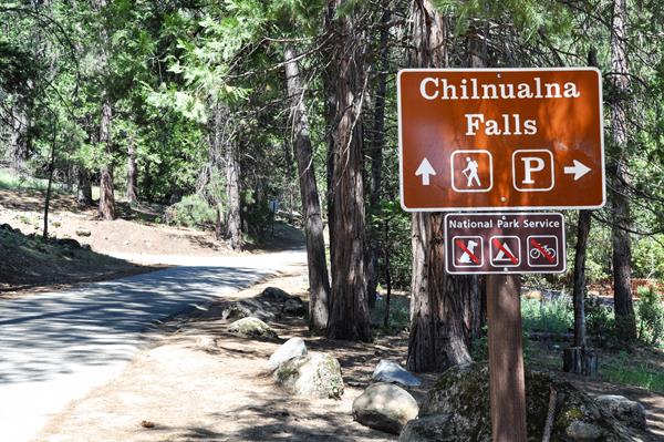
Chilnualna Falls, pronounced "Chil-noo-al-na," flows all year, with peak flow in May. It is a strenuous hike, but well worth it for its views of the falls and Wawona Dome. Chilnualna Falls are comprised of five large cascades sliding through and over large granite formations above the Wawona basin - water here is fullest in spring and early summer. This strenuous trail allows for you to view the Chilnualna Falls cascades in many locations along the hike.
Cook's Meadow Loop Trailhead
Walk through the heart of it all! Enjoy views of Yosemite Falls, Half Dome, Sentinel Rock, and Royal Arches from the center of Yosemite Valley as you saunter through this large open meadow. This short, easy walk offers stunning views of Yosemite Falls, Half Dome, Glacier Point, and Sentinel Rock. From the visitor center, walk west along the bicycle path toward Lower Yosemite Fall. At shuttle stop #6, cross the street and follow the bike path, bearing left as the path forks.
Elizabeth Lake Trailhead
Enjoy the shimmering waters of Elizabeth Lake, in the heart of the Cathedral Range.<br /><br />The trail climbs steadily to a glacier-carved lake at the base of Unicorn Peak. The return hike follows the same route.<br /> <br /><br /><br /> <b>Elizabeth Lake</b> (moderately strenuous)<br />4.8 miles (7.7 km) round-trip; 4-5 hours <br />1,000 ft (305 m) elevation gain<br /><br />For hiking and trail information, please visit a Wilderness Center or Visitor Center. <br /><br /><br /><br /> <b>Hours</b> :<br />Accessible only while Tioga Road is open to vehicles, from late May or early June to sometime in October or November.<br /><br /> <b>Getting Here</b> :<br />Begin in the B loop of the Tuolumne Meadows Campground.<br /><br /> <b>Rules & Regulations</b> :<br />- Stay on established trails<br />- Pets are not allowed on hiking trails<br />- Pack out what you pack in<br />- Bears and other wildlife can be present on trails at any time of the day or night. Feeding and approaching wildlife is dangerous and illegal! Be sure to properly store your food.<br />- Tioga Road closes after the first significant snowfall. Overnight parking on this road ends October 15. For current road and weather information, please call 209/372-0200.<br /><br /> <b>Hazards & Warnings</b> :<br />- Carry (and drink) plenty of water: a leading cause of injuries on the trail is dehydration. Be sure to treat river, stream, lake, or spring water.<br />- Always carry a map and compass, and know how to use them, and wear sturdy footwear with good traction.<br />- Be prepared for sudden changes in weather and conditions.<br /><br /><br /> <b>Accessibility</b> :<br />This trail is not accessible.
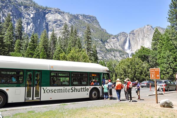
Four Mile Trail (from Glacier Point)
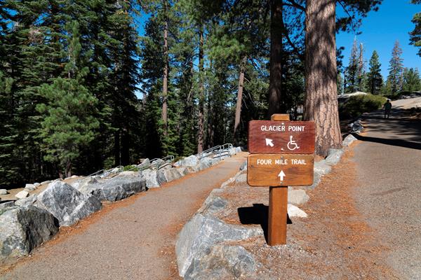
Awe-inspiring views of Yosemite Falls and Yosemite Valley await hikers on the descent down into Yosemite Valley. The Four Mile Trail follows a series of switchbacks down the south wall of Yosemite Valley. Although lacking shade during the heat of summer, this trail has no lack of views-El Capitan and the Cathedral Rocks tower to the west, while Yosemite Falls plummets in the north and Half Dome looms eastward. The trail ends about a mile west of Yosemite Village.
Four Mile Trailhead
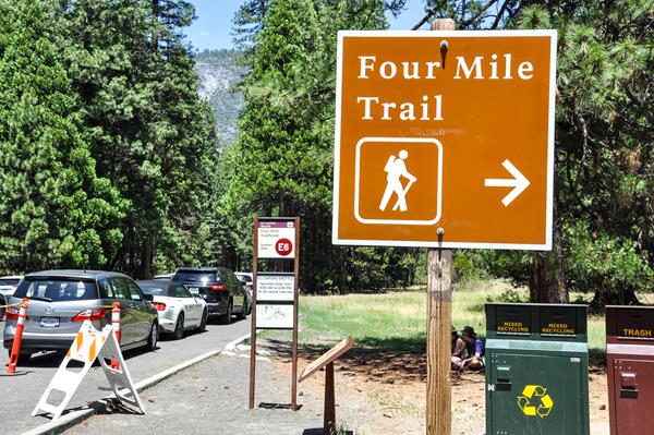
Awe-inspiring views of Yosemite Falls and Yosemite Valley await hikers on this trail to Glacier Point. The Four Mile Trail has no lack of views; El Capitan and the Cathedral Rocks tower to the west, while Yosemite Falls plummets in the north and Half Dome looms eastward. The Four Mile Trail ends at Glacier Point, where restrooms, parking, and a snack stand (summer only) may be available.
Gaylor Lakes Trailhead
Take in views of beautiful alpine lakes and lofty granite peaks on this picturesque day hike. This hike offers some of the most spectacular high-country views off of Tioga Road.
Grizzly Giant Trailhead (Accessible)
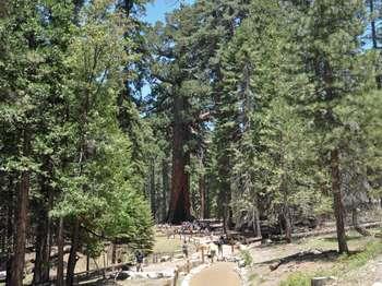
This tour begins at the Grizzly Giant Accessible Parking area. Winding through a forest with many giant sequoias, this trail features the Grizzly Giant, the largest sequoia tree in the park, the California Tunnel Tree, and interpretive panels on the life and ecology of giant sequoias. This trail is relatively flat and is wheelchair accessible.<br /><br /><br /> <b>Grizzly Giant/California Tunnel Tree </b> (easy)<br />0.26 mile (0.42 km) round-trip; 30-45 minutes<br /><br /><br /> <b>Hours</b> :<br />From approximately December to March, the Mariposa Grove Road is closed to vehicles and the shuttle no longer operates. The road, along with all trails within the Grove, remain open to hikers, snowshoers, and skiers.<br /><br />See <a href="https://www.nps.gov/yose/planyourvisit/mg.htm">website</a> for more information.<br /><br /> <b>Getting Here</b> :<br />Located near Yosemite National Park's South Entrance. Park at the Mariposa Grove Welcome Plaza and take the free shuttle to the Mariposa Grove, when operating. Private vehicles may only enter the Mariposa Grove when the road is open and the shuttle is not operating. Only vehicles displaying a disability placard are permitted to drive into the Grove at any time.<br /><br /> <b>Rules & Regulations</b> :<br />- Stay on established trails<br />- Pets are not allowed on hiking trails<br />- Bears and other wildlife can be present on trails at any time. Feeding or approaching wildlife is dangerous and illegal! Be sure to keep your food within arm's reach at all times, or store properly.<br />- Overnight camping is allowed in the Mariposa Grove from December 1 through April 15, if the Mariposa Grove Road is closed to cars. A wilderness permit is required to camp. Camping is only allowed above the Clothespin Tree.<br />- In the winter, water is only available at the welcome plaza and pit toilets are available in the Mariposa Grove at the arrival area, near the Grizzly Giant, and near the Mariposa Grove Cabin.<br /><br /> <b>Accessibility</b> :<br />Vehicles displaying a disability placard can drive to the Mariposa Grove Arrival Area or Grizzly Giant Accessible Parking, where designated accessible parking spaces are available.
Harden Lake Trailhead
Admire the views as you hike through a pine forest and pass by small granite domes before reaching boulder-dotted Harden Lake. <br /><br />Hike along a gravel road-part of the original Tioga Road-that follows the Middle Fork of the Tuolumne River for part of the route. At a trail junction 1.75 miles (2.8 km) down the road, follow the signs to the lake. <br /><br /> <b>Harden Lake</b> (Moderate)<br />5.8 miles (9.3 km) round trip; 2-4 hours,<br />355-foot (122-m) elevation gain on the<br />return trip. <br /><br /> <b>Hours</b> :<br />Accessible only while Tioga Road is open to vehicles, from late May or early June to sometime in October or November. <br /><br /> <b>Getting Here</b> :<br />Begin across from White Wolf Lodge. If the road to White Wolf is closed, add at least two additional miles, roundtrip, to these hikes. <br /><br /> <b>Rules & Regulations</b> :<br />- Stay on established trails<br />- Pets are not allowed on hiking trails<br />- Pack out what you pack in<br />- Overnight backpackers need a wilderness permit, which can be obtained at the Big Oak Flat Information Station. <br />- Bear canisters are required for wilderness food storage for overnight hikers.<br />- Bears and other wildlife can be present on trails at any time of the day or night. Feeding and approaching wildlife is dangerous and illegal! Be sure to properly store your food.<br />- Tioga Road closes after the first significant snowfall. Overnight parking on this road ends October 15. For current road and weather information, please call (209) 372-0200.<br /><br /> <b>Hazards & Warnings</b> :<br />- Carry (and drink) plenty of water: a leading cause of injuries on the trail is dehydration. Be sure to treat river, stream, lake, or spring water.<br />- Always carry a map and compass, and know how to use them, and wear sturdy footwear with good traction.<br />- Be prepared for sudden changes in weather and conditions.<br /><br /> <b>Accessibility</b> :<br />This trail is not accessible.
Hetch Hetchy Entrance
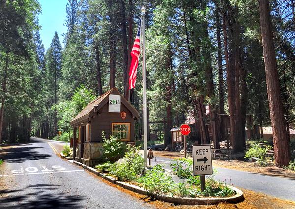
Hidden in Yosemite National Park's peaceful northwest corner, Hetch Hetchy Valley is a treasure worth visiting in all seasons. Located at 3,900 feet, Hetch Hetchy boasts one of the longest hiking seasons in the park and is an ideal place for thundering spring waterfalls and wildflower displays. The Hetch Hetchy Road is open from 8 am - 5 pm.
Hetch Hetchy Reservoir - O'Shaugnessy Dam
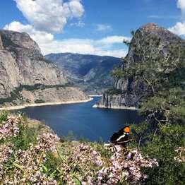
Stand on the O'Shaughnessy Dam and ask yourself, where does my drinking water come from? This reservoir currently supplies drinking water to 2.7 million San Francisco Bay Area residents.After parking your vehicle, take a short walk onto the O'Shaughnessy Dam to get views of the reservoir and two waterfalls, Tueeulala Fall and Wapama Fall, in the distance.The O'Shaughnessy Dam (named for the chief engineer) was completed in 1938. Today, this 117-billion-gallon reservoir suppli
Hetch Hetchy Trailhead
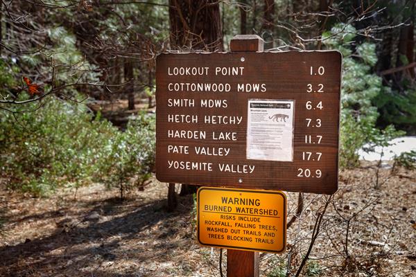
Get a bird's-eye view of the Hetch Hetchy area from one of two popular hiking destinations, Lookout Point or Smith Peak. Hetch Hetchy's relatively low elevation provides for one of the longest hiking seasons in Yosemite, and the varied trails include something for everyone.
John Muir Trail
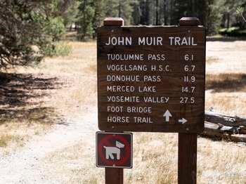
Let the overwhelming views of Tuolumne Meadows' peaks and meadows compete for your attention as you venture into Lyell Canyon via the John Muir Trail. <br /><br />Begin across the road from Dog Lake parking area. This trail passes through Lyell Canyon, along the Lyell Fork of the Tuolumne River. Early in the season, the trail can be muddy in places. There are several creek crossings, including Rafferty Creek (bridged) and Ireland Creek (unbridged). Spectacular Kuna Creek cascades down the side of the east canyon wall near the eight-mile mark. For a shorter trip, walk 1/2 hour each way to the Lyell Fork and "Twin Bridges."<br /><br /><br /> <b>John Muir Trail</b> <br />Tuolumne Pass, Vogelsang High Sierra Camp, Donohue Pass, Merced Lake, and Yosemite Valley are all destinations beginning from this trailhead. <br /> <br />A Donohue Pass exit quota is in effect for John Muir Trail hikers exiting Yosemite over Donohue Pass. You can apply for this on your wilderness permit application. (This does not apply if you're hiking the John Muir Trail only within Yosemite.)<br /><br /><br /> <b>Lyell Canyon</b> (easy)<br />8 miles (12.8 km) one-way; 4 hours <br />200 ft (61 m) elevation gain<br /><br />For hiking and trail information, please visit a Wilderness Center or Visitor Center. <br /><br /><br /><br /> <b>Hours</b> :<br />Accessible only while Tioga Road is open to vehicles, from late May or early June to sometime in October or November.<br /><br /> <b>Getting Here</b> :<br />Begin across the street from the Dog Lake parking area, just west of Tuolumne Meadows Lodge. <br /><br /> <b>Rules & Regulations</b> :<br />- Stay on established trails<br />- Pets are not allowed on hiking trails<br />- Pack out what you pack in<br />- Bears and other wildlife can be present on trails at any time of the day or night. Feeding and approaching wildlife is dangerous and illegal! Be sure to properly store your food.<br />- Tioga Road closes after the first significant snowfall. Overnight parking on this road ends October 15. For current road and weather information, please call 209/372-0200.<br /><br /> <b>Hazards & Warnings</b> :<br />- Stay off domes during thunderstorms!<br />- Carry (and drink) plenty of water: a leading cause of injuries on the trail is dehydration. Be sure to treat river, stream, lake, or spring water.<br />- Always carry a map and compass, and know how to use them, and wear sturdy footwear with good traction.<br />- Be prepared for sudden changes in weather and conditions.<br /><br /><br /> <b>Accessibility</b> :<br />This trail is not accessible.
Lembert Dome and Dog Lake Trailhead
Let the overwhelming views of Tuolumne Meadows' peaks, meadows, and river compete for your attention atop Lembert Dome, then take in the sparkling waters of Dog Lake. Lembert Dome The trail climbs through the forest to the bare rock of the dome. There is no trail on the rock. Follow the easiest path for panoramic views of Tuolumne Meadows and the surrounding peaks. Lembert Dome was sculpted by glaciers, which have filled Tuolumne Meadows many times over millions of years. D
Lower Yosemite Fall Trailhead
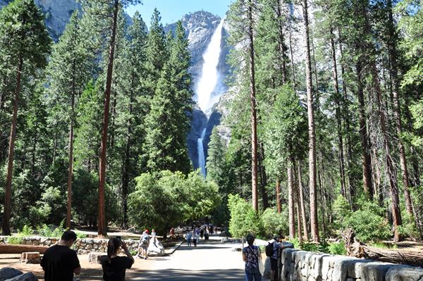
Witness the strength of this mighty waterfall by site, sound, and the feel of its mist, when you stand at its base in spring and early summer when the waterfall peaks in volume. The falls are often only a trickle or completely dry by August.
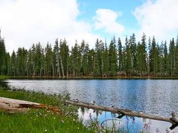
Lukens Lake Trailhead from Tioga Road
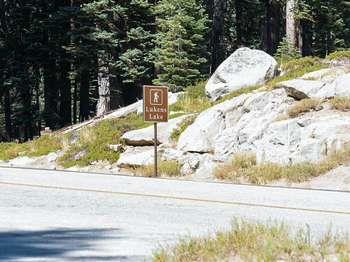
Enjoy fishing, swimming, or viewing the wildflower display that often wraps around the lake in the summer. This short trail winds through a mixed conifer forest, then over a saddle and down to a small mountain lake surrounded by a meadow. Shooting stars and dozens of other species of wildflowers abound, often through July. Please stay on designated trails to protect the meadow, even if the trail is wet or muddy.
Lukens Lake Trailhead from White Wolf
Enjoy this small mountain lake surround by a meadow full of shooting stars and dozens of other species of wildflowers in the summer. <br /><br />Follow the trail through a mixed conifer forest to Lukens Lake. The trail crosses the Middle Fork of the Tuolumne River and is wet and muddy until early August. <br /><br /> <b>Lukens Lake from White Wolf</b> (Moderate)<br />4.6 miles (7.4 km) round trip; 2-3 hours,<br />400-foot (122-m) elevation gain. <br /><br /><br /><br /> <b>Hours</b> :<br />Accessible only while Tioga Road is open to vehicles, from late May or early June to sometime in October or November. <br /><br /> <b>Getting Here</b> :<br />Begin across from White Wolf Lodge. If the road to White Wolf is closed, add at least two additional miles, roundtrip, to these hikes. <br /><br /> <b>Rules & Regulations</b> :<br />- Stay on established trails to protect the meadow<br />- Pets are not allowed on hiking trails<br />- Pack out what you pack in<br />- Overnight backpackers need a wilderness permit, which can be obtained at the Big Oak Flat Information Station. <br />- Bear canisters are required for wilderness food storage for overnight hikers.<br />- Bears and other wildlife can be present on trails at any time of the day or night. Feeding and approaching wildlife is dangerous and illegal! Be sure to properly store your food.<br />- Tioga Road closes after the first significant snowfall. Overnight parking on this road ends October 15. For current road and weather information, please call (209) 372-0200.<br /><br /> <b>Hazards & Warnings</b> :<br />- Carry (and drink) plenty of water: a leading cause of injuries on the trail is dehydration. Be sure to treat river, stream, lake, or spring water.<br />- Always carry a map and compass, and know how to use them, and wear sturdy footwear with good traction.<br />- Be prepared for sudden changes in weather and conditions.<br /><br /> <b>Accessibility</b> :<br />This trail is not accessible.
Mariposa Grove Arrival Area Trailhead
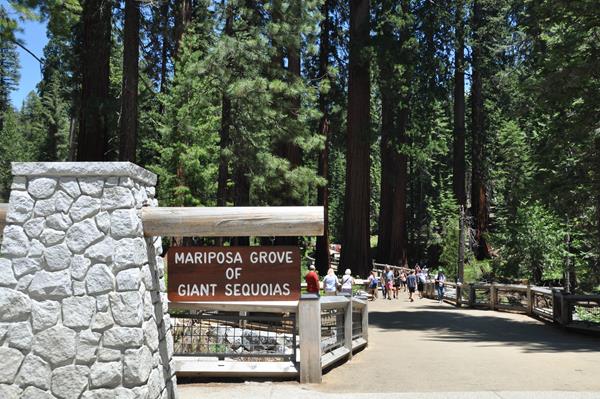
Explore and experience the wonder of being surrounded by some of the rarest and most remarkable living things on the planet in the Mariposa Grove of Giant Sequoias. Marvel at the towering giant sequoias in the Mariposa Grove Arrival Area, as you prepare to embark on your grand adventure into the grove. All trails begin here at the Mariposa Grove Arrival Area.
Mariposa Grove Shuttle Stop 1: Mariposa Grove Arrival Area
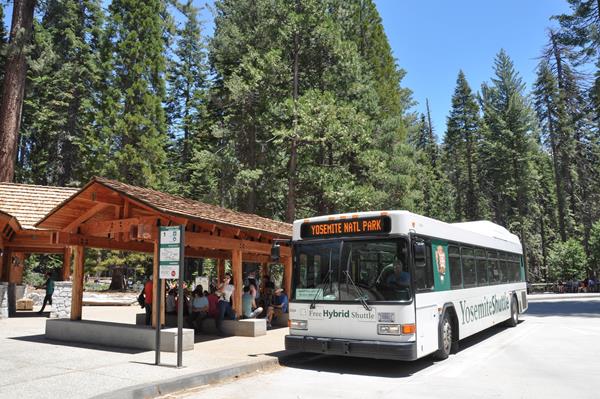
Park at the Mariposa Grove Welcome Plaza and board the free shuttle bus to get a glimpse of these giants. The Mariposa Grove Shuttle provides free shuttle service between the Mariposa Grove Welcome Plaza, near Yosemite's South Entrance, and the Mariposa Grove from early March through late November. This is the primary way to get to the Mariposa Grove. From approximately December to March, the Mariposa Grove Road is closed to vehicles and the shuttle no longer operates.
May Lake Trailhead
Spend a day, or a night, at this stunning alpine lake that reflects a picturesque view of Mt. Hoffmann. A short trail leads through a conifer forest and across granite slabs to reach May Lake. Enjoy views of Half Dome and surrounding mountains on the way.If the dirt road is closed, the trailhead will require an additional 2 mile hike uproad, one way. May Lake (moderate)2.4 mi (3.9 km) round-trip; 1-2 hours 485 ft (150 m) elevation gainFor hiking and trail information, plea
McGurk Meadow Trailhead
Traipse through a meadow of wildflowers (while staying on the trail, of course), and embrace the cool sub-alpine air this remarkable hike has to offer.<br /><br />The trail leads downhill to McGurk Meadow and the site of an old cabin that belonged to sheepherder John McGurk. During early summer, look for a tremendous show of wildflowers. You can continue along the trail an additional mile (1.6 km) to reach the Pohono Trail, which runs west to Dewey Point and Tunnel View and east to Bridalveil Creek, Taft Point, and Glacier Point. <br /><br /> <b>McGurk Meadow</b> (strenuous)<br />1.6 miles (2.5 km) round-trip; 1-2 hours,<br />150 ft (50 m) elevation gain<br /><br /> <b>Dewey Point </b> <br />8.2 miles (13.2 km) round-trip; 4-6 hours,<br />750 ft (225 m) elevation gain<br /><br /> <b>Hours</b> :<br />The trail is only accessible when the Glacier Point Road is open, approximately late May through October or November. <br /><br />When Badger Pass Ski Area is open (mid to late December through March), the Glacier Point Road is groomed for cross-country skiing beyond the ski area. See <a href="https://www.nps.gov/yose/planyourvisit/upload/badger-winter.pdf">website</a> for more information. <br /><br /> <b>Getting Here</b> :<br />Begin at McGurk Meadow Trailhead, 0.2 miles west of Bridalveil Creek Campground turnoff, along the Glacier Point Road.<br /><br /> <b>Rules & Regulations</b> :<br />The Glacier Point Road closes after the first significant snowfall. Overnight parking on this road ends October 15. For current road and weather information, please call (209) 372-0200.<br /><br /><br /> <b>Hazards & Warnings</b> :<br />- Carry (and drink) plenty of water: a leading cause of injuries on the trail is dehydration. Be sure to treat stream or spring water.<br />- Always carry a map and compass, and know how to use them, and wear sturdy footwear with good traction.<br />- Be prepared for sudden changes in weather and conditions.<br /><br /> <b>Accessibility</b> :<br />This trail is not accessible.
Merced Grove
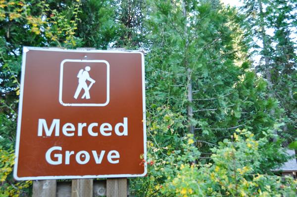
Visit Yosemite's quietest stand of giant sequoias at the Merced Grove.The Merced Grove is home to approximately 20 mature giant sequoias, accessible only on foot. This trail follows an old road that curves down into the Merced Grove, the smallest and most secluded of Yosemite's three sequoia groves. The trail drops down 1.5 miles, making this a moderate hike on the uphill portion.
Mirror Lake Trailhead
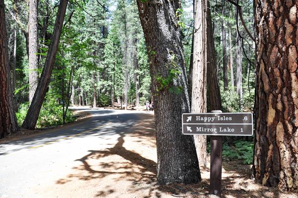
With a fresh perspective looking up at Half Dome directly from its base, you'll be rewarded with views of Tenaya Canyon, Mount Watkins, Washington Column, and more. While pleasant at any time of year, Mirror Lake is fullest in spring and early summer. When water is calm, the lake offers beautiful reflections of surrounding cliffs. Mirror Lake is often referred to as Mirror Meadow in late summer due to the lack of water.
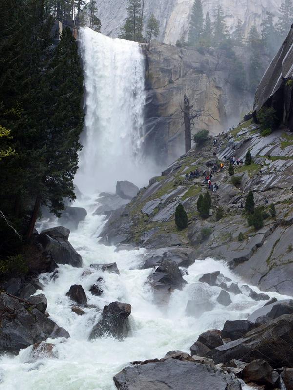
Mist Trail and John Muir Trail Trailhead
Climb along nature's "giant staircase," where you will be rewarded with close-up views of two waterfalls and numerous geologic features (depending on how far you choose to hike). Powerful and turbulent, these two waterfalls will soak you in spring and entice you year-round.
Mono Meadows Trailhead
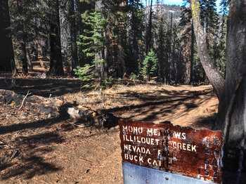
Enjoy magnificent views of the Clark Range, Mount Starr King, and Half Dome, from Mono Meadow.<br /><br />The trail descends steeply to Mono Meadow-an area that is very wet throughout the summer. Expect log crossings over creeks and lots of mud. Follow the trail from the east end of the meadow for a half mile (0.8 km) to an unmarked clearing. From here, the views will open up to the Clark Range and beyond.<br /><br /> <b>Mono Meadow</b> (strenuous)<br />3 miles (4.8 km) round-trip; 2-3 hours<br /><br /><br /><br /><br /> <b>Hours</b> :<br />The trail is only accessible when the Glacier Point Road is open, approximately late May through October or November. <br /><br /><br /> <b>Getting Here</b> :<br />Begin at Mono Meadow parking area (2.5 miles east of Bridalveil Creek Campground), along the Glacier Point Road.<br /><br /> <b>Rules & Regulations</b> :<br />The Glacier Point Road closes after the first significant snowfall. Overnight parking is prohibited beginning October 15. For current road and weather information, please call (209) 372-0200.<br /><br /><br /> <b>Hazards & Warnings</b> :<br />- Carry (and drink) plenty of water: a leading cause of injuries on the trail is dehydration. Be sure to treat stream or spring water.<br />- Always carry a map and compass, and know how to use them, and wear sturdy footwear with good traction.<br />- Be prepared for sudden changes in weather and conditions.<br /><br /> <b>Accessibility</b> :<br />This trail is not accessible.
Mono Pass Trailhead
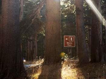
Follow the path of Yosemite's first people, over their trade route to the east. This historic, trans-Sierra trail climbs gently at first from the Mono Pass parking area, through wet meadows and rushing creeks. At the Spillway Lake junction, the trail climbs steadily and more steeply to Mono Pass (elevation 10,600 feet). Don't miss the spectacular view of Mono Lake and Bloody Canyon.
Ostrander Lake Trailhead
Retreat to nature and encounter the beauty and radiance of this glimmering lake.<br /><br />The first half of this hike gently inclines through forest and meadow where you can observe severe scars and regrowth from a 1987 lodgepole pine forest fire. A steep 1,500 foot (450 m) elevation gain opens up to views of granite domes, Mt. Starr King, and the Clark Range just prior to arriving at Ostrander Lake. <br /><br /> <b>Ostrander Lake</b> (strenuous)<br />11.4 miles (20 km) round-trip; 8-10 hours,<br />1,500 ft (450 m) elevation gain<br /><br /><br /><br /><br /> <b>Hours</b> :<br />The trail is only accessible when the Glacier Point Road is open, approximately late May through October or November. <br /><br />When Badger Pass Ski Area is open (mid to late December through March), the Glacier Point Road is groomed for cross-country skiing beyond the ski area. See <a href="https://www.nps.gov/yose/planyourvisit/upload/badger-winter.pdf">website</a> for more information.<br /><br /> <b>Getting Here</b> :<br />Begin at Ostrander Lake Trailhead, located along the Glacier Point Road.<br /><br /> <b>Rules & Regulations</b> :<br />The Glacier Point Road closes after the first significant snowfall. Overnight parking is prohibited beginning October 15. For current road and weather information, please call (209) 372-0200.<br /><br /><br /> <b>Hazards & Warnings</b> :<br />- Carry (and drink) plenty of water: a leading cause of injuries on the trail is dehydration. Be sure to treat stream or spring water.<br />- Always carry a map and compass, and know how to use them, and wear sturdy footwear with good traction.<br />- Be prepared for sudden changes in weather and conditions.<br /><br /> <b>Accessibility</b> :<br />This trail is not accessible.
Panorama and Pohono Trailheads
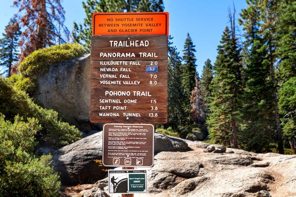
Some of Yosemite's most iconic natural features can be seen and experienced along these trails. Panorama Trail: This longer route to Yosemite Valley brings hikers past Illilouette, Nevada, and Vernal Falls. Combining this trail with the Four Mile Trail will make for a long, strenuous loop! Pohono Trail: This trail rewards hikers with several viewpoints of Yosemite Valley from the south rim. East to west, these views include Taft Point, Dewey Point, Crocker Point, and others.
Poopenaut Valley Trailhead
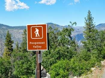
Enjoy the wildflowers in spring as you hike down to the Tuolumne River in Poopenaut Valley. Poopenaut Valley (strenuous)2.5 miles (4 km) round-trip; 3 to 4 hours1,229 feet (375 m) elevation gainVisit the Hetch Hetchy Entrance to get more information about hikes in this area. Hours :Year-round, however, winter weather conditions may cause road closures. Call 209-372-0200 for the latest road and weather conditions,Hetch Hetchy Road Daily Hours:8am to 7pm, (April 1 to April 3
Porcupine Creek Trailhead
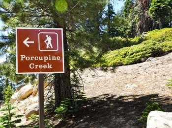
A day hike to North Dome will reward you with exceptional views of the dome of all domes, Half Dome, and the landscape that makes up Yosemite Valley and beyond.<br /><br />Wind through mixed-conifer forest for 0.7 miles (1 km) on a paved path, and cross Porcupine Creek. At each of several trail junctions, follow the signs toward North Dome. The trail passes through a small grassy meadow and descends along a ridge. Near the end of the hike, descend steep rock steps to the base of North Dome. Climb the dome's rounded summit to take in a magnificent view of Half Dome and Yosemite Valley. On the return trip you can take a short detour on a side trail, 0.3 mile (0.5 km) to an unusual natural arch, Indian Rock.<br /><br /><br /><br /> <b>North Dome</b> (strenuous)<br />10.4 mi (16.7 km) round-trip.; 5-8 hours <br />580 ft (180 m) elevation gain <br /><br />Other hiking destinations accessible from this trailhead include the top of Yosemite Falls and Yosemite Valley via the Snow Creek Trail or the Yosemite Falls Trail. <br /><br />For hiking and trail information, please visit a wilderness center or visitor center. <br /><br /> <b>Hours</b> :<br />Accessible only while Tioga Road is open to vehicles, from late May or early June to sometime in November.<br /><br /> <b>Getting Here</b> :<br />Begin at the Porcupine Creek Trailhead, along Tioga Road, 1.2 miles (1.9 km) east of Porcupine Flat Campground<br /><br /> <b>Rules & Regulations</b> :<br />- Stay on established trails<br />- Pets are not allowed on hiking trails<br />- Pack out what you pack in<br />- Overnight backpackers need a wilderness permit, which can be obtained at the Big Oak Flat Information Station. <br />- Bear canisters are required for wilderness food storage for overnight hikers.<br />- Bears and other wildlife can be present on trails at any time of the day or night. Feeding and approaching wildlife is dangerous and illegal! Be sure to properly store your food.<br />- Tioga Road closes after the first significant snowfall. Overnight parking on this road ends October 15.For current road and weather information, please call (209) 372-0200.<br /><br /> <b>Hazards & Warnings</b> :<br />- Carry (and drink) plenty of water: a leading cause of injuries on the trail is dehydration. Be sure to treat river, stream, lake, or spring water.<br />- Always carry a map and compass, and know how to use them, and wear sturdy footwear with good traction.<br />- Be prepared for sudden changes in weather and conditions.<br /><br /> <b>Accessibility</b> :<br />This trail is not accessible.
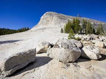
Pothole Dome Meadow
Gain magnificent views of Tuolumne Meadows' most iconic peaks, domes, and meadows. Pothole Dome Meadow showcases Tuolumne Meadow's most notable natural features. A trail along the western edge of the meadow curves around to the east side of Pothole Dome, an approachable hiking route that accesses the top of the dome along with its unobstructed, exciting panoramic views.
Sentinel Dome and Taft Point Trailhead
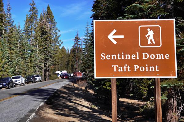
Get a 360-degree view of the park at Sentinel Dome and/or hike to an expanse on the south rim of Yosemite Valley, getting a close view of El Capitan and Yosemite Valley, at Taft Point.
Soda Springs and Parsons Memorial Lodge Trailhead
Explore the mystery that is Soda Springs and delve into the history of Parsons Lodge on this delightful walk through Tuolumne Meadows. Walk along the gravel road and pass the locked gate (signed Glen Aulin and Soda Springs). Soda Springs-cold, carbonated water bubbling out of the ground-is protected within a log enclosure. Historic Parsons Memorial Lodge offers exhibits (limited hours-see Yosemite Guide for schedule). A path to the bridge below the lodge continues to the Tuol
Soda Springs, Glen Aulin, Waterwheel Falls Trailhead
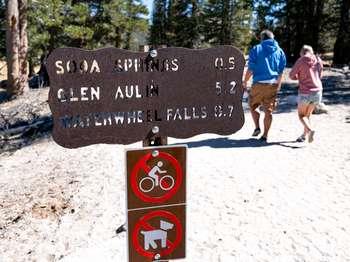
Hike through meadow and forest on this scenic trail that leads you to Glen Aulin and beyond. <br /><br /> <b>Soda Springs</b> <br />Soda Springs-carbonated, cold water bubbling out of the ground-is protected within a log enclosure. A side path leads to the nearby historic Parsons Memorial Lodge, which offers exhibits in the summer. (limited hours-see Yosemite Guide for schedule). <br /><br /> <b>Glen Aulin</b> <br />Follow the Tuolumne River as it drops to Glen Aulin. Tuolumne Fall and White Cascade are four miles from the trailhead. Beyond Glen Aulin are California Fall (13 miles roundtrip), LeConte Fall (15 miles roundtrip), and Waterwheel Falls (18 miles roundtrip). The return hike follows the same route.<br /> <br /><br /><br /> <b>Soda Springs</b> (easy)<br />1 mile (1.6 km) round-trip; 30 minutes <br />No elevation gain<br /><br /> <b>Glen Aulin</b> (moderately strenuous)<br />10.4 miles (16.7 km) round-trip; 6-8 hours <br />800 ft (244 m) elevation gain<br /><br />Waterwheel Fall is also accessible via this trailhead. For hiking and trail information, please visit a wilderness center or visitor center. <br /><br /> <b>Hours</b> :<br />Accessible only while Tioga Road is open to vehicles, from late May or early June to sometime in October or November.<br /><br /> <b>Getting Here</b> :<br />The trailhead is located along Tioga Road, approximately a quarter mile east of the Tuolumne Meadows Visitor Center, across from the dump station. <br /><br /> <b>Rules & Regulations</b> :<br />- Stay on established trails<br />- Pets are not allowed on hiking trails<br />- Pack out what you pack in<br />- Overnight backpackers need a wilderness permit, which can be obtained at the Yosemite Valley Wilderness Center. <br />- Bear canisters are required for wilderness food storage for overnight hikers.<br />- Bears and other wildlife can be present on trails at any time of the day or night. Feeding and approaching wildlife is dangerous and illegal! Be sure to properly store your food.<br />- Tioga Road closes after the first significant snowfall. Overnight parking on this road ends October 15. For current road and weather information, please call 209/372-0200.<br /><br /> <b>Hazards & Warnings</b> :<br />- Stay off domes during thunderstorms!<br />- Carry (and drink) plenty of water: a leading cause of injuries on the trail is dehydration. Be sure to treat river, stream, lake, or spring water.<br />- Always carry a map and compass, and know how to use them, and wear sturdy footwear with good traction.<br />- Be prepared for sudden changes in weather and conditions.<br /><br /><br /> <b>Accessibility</b> :<br />The first quarter mile of the dirt trail is flat, with small paved sections, however, is not considered accessible.
Sunrise Lakes Trailhead
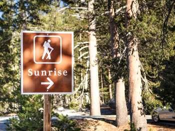
If you're seeking a challenge with a picturesque payoff, Sunrise Lakes won't disappoint. Indeed, a beautiful place to see a sunrise, the lakes at Sunrise reflect the colors in the sky as well as the domed peaks that surround it. There is also a High Sierra Camp located at Sunrise, whose origin dates back to 1916, the earliest days of the National Park Service.
Tenaya Lake Picnic Area
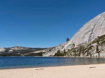
Enjoy this magnificent high-country lake surrounded by granite domes, lodgepole forests, and Yosemite's vast wilderness. Picnic tables are available at this pleasant spot near Tenaya Lake. Picnic areas are available on a first-come, first-served basis (reservations not accepted).
Tuolumne Grove
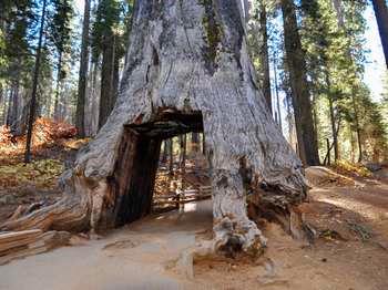
Marvel at nearly two dozen mature giant sequoias in the Tuolumne Grove of Giant Sequoias.Begin at Tuolumne Grove parking lot and follow the Old Big Oak Flat Road-one of the first roads into Yosemite Valley-steeply downhill through sugar pines and white firs. The trail drops 500 feet (150 meters) in one mile. The way down can seem much easier than the uphill return to the parking lot. The trip is moderate on the uphill portion. Within the Tuolumne Grove there is an easy, half-
Upper Yosemite Fall Trailhead
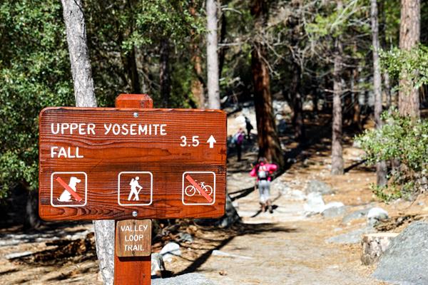
A steep climb is well rewarded with close-up views of Upper Yosemite Fall and distant views of Half Dome and other Sierra peaks. Along the hike, enjoy a bird's eye view of Yosemite Valley's meadows and the meandering Merced River. Enjoy the views from Columbia Rock, located one mile (and dozens of switchbacks) from the trailhead. The Yosemite Falls Trail is one of Yosemite's oldest historic trails, built 1873 to 1877.
Valley Shuttle Stop #11: Four Mile Trailhead (Valleywide Shuttle)
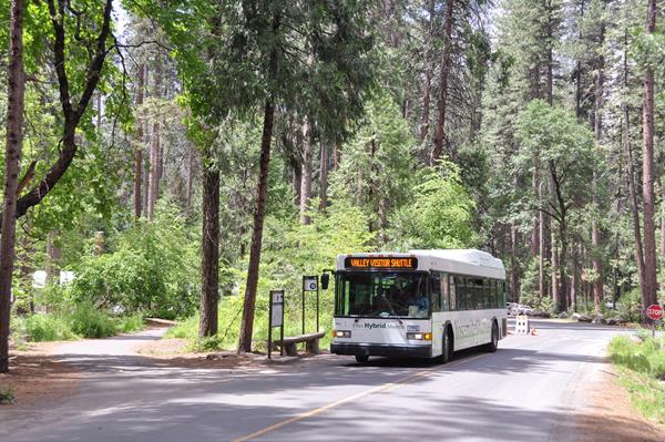
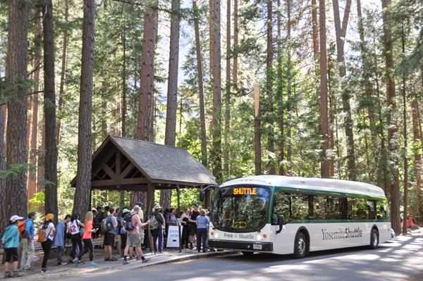
When you arrive, park your car and enjoy the ease and convenience of our free Yosemite Valley shuttle system. Our eco-friendly shuttles will take you throughout Yosemite Valley. The Valleywide shuttle serves all stops in Yosemite Valley, including lodges, food service, campgrounds, and trailheads. Buses arrive every 12 to 22 minutes (depending on conditions) during hours of operation. You can get off and on the shuttle wherever and whenever you wish.
Valley Shuttle Stop #15: Upper Pines Campground (Valleywide and East Valley Shuttles)
When you arrive, park your car and enjoy the ease and convenience of our free shuttle system. The Valleywide shuttle serves all stops in Yosemite Valley, including lodges, food service, campgrounds, and trailheads. Buses arrive every 12 to 22 minutes. The East Valley shuttle is limited to Yosemite Village, Curry Village, Pines Campgrounds, and trailheads in eastern Yosemite Valley. Buses arrive every 8 to 12 minutes. This stop is part of both routes.
Valley Shuttle Stop #16: Happy Isles (Valleywide and East Valley Shuttles)
When you arrive, park your car and enjoy the ease and convenience of our free shuttle system. The Valleywide shuttle serves all stops in Yosemite Valley, including lodges, food service, campgrounds, and trailheads. Buses arrive every 12 to 22 minutes. The East Valley shuttle is limited to Yosemite Village, Curry Village, Pines Campgrounds, and trailheads in eastern Yosemite Valley. Buses arrive every 8 to 12 minutes. This stop is part of both routes.
Valley Shuttle Stop #17: Mirror Lake Trailhead (Valleywide and East Valley Shuttles)
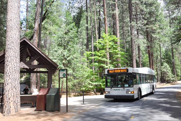
When you arrive, park your car and enjoy the ease and convenience of our free shuttle system. The Valleywide shuttle serves all stops in Yosemite Valley, including lodges, food service, campgrounds, and trailheads. Buses arrive every 12 to 22 minutes. The East Valley shuttle is limited to Yosemite Village, Curry Village, Pines Campgrounds, and trailheads in eastern Yosemite Valley. Buses arrive every 8 to 12 minutes. This stop is part of both routes.
Valley Shuttle Stop #6: Lower Yosemite Fall (Valleywide Shuttle)
When you arrive, park your car and enjoy the ease and convenience of our free Yosemite Valley shuttle system. Our eco-friendly shuttles will take you throughout Yosemite Valley. The Valleywide shuttle serves all stops in Yosemite Valley, including lodges, food service, campgrounds, and trailheads. Buses arrive every 12 to 22 minutes (depending on conditions) during hours of operation. You can get off and on the shuttle wherever and whenever you wish.
Wapama and Rancheria Fall Trailhead
Hetch Hetchy is home to a diverse array of plants and animals, and in spring and early summer, home to brightly colored wildflowers. Enjoy a day hike or overnight backpacking trip (wilderness permit required) in this area at any time throughout the year.Hetch Hetchy's relatively low elevation provides for one of the longest hiking seasons in Yosemite, and the varied trails include something for everyone. Wapama Fall five-mile, round-trip hike follows the shoreline of the rese
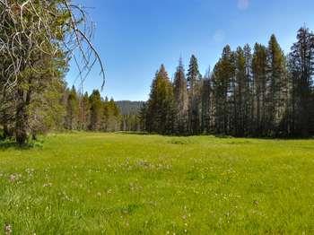
Wawona Meadow Loop Trailhead
Take a relaxing and scenic stroll along a trail that offers breathtaking views of the Wawona Basin and gives the opportunity to see wildlife and wildflowers. Walk on the paved road across the Wawona Golf Course. Once across the golf course, take a left at the sign-posted trailhead. The trail is an unpaved fire road which loops around the meadow and returns to the Wawona Road. You will be sharing the trail with horses, bicyclists, and those that wish to hike with their pets, s
Yosemite Chapel
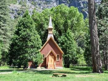
The Yosemite Chapel, the oldest structure in Yosemite Valley, has been a place of worship, teaching, fellowship, and weddings for residents and visitors alike for over 140 years. The chapel was listed on the prestigious National Register of Historic Places in 1973.The Yosemite Chapel was originally erected near where the present Four Mile trailhead is located today.