Olympic
Port Angeles, WA
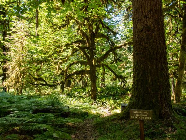
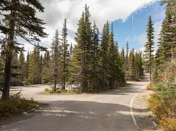
Ancient Groves Main Trailhead
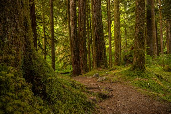
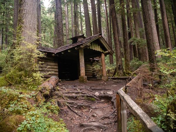
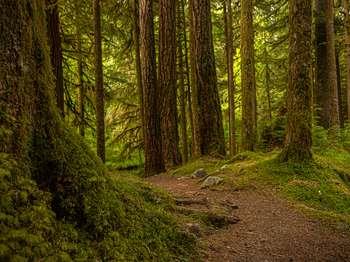
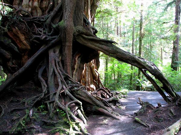
At just 0.6 miles (1 km), this lovely loop trail is a bit of peace just off the Sol Duc Hot Springs Road. Within moments, you are immersed in the deep green of classic Olympic Old Growth. The Olympic Peninsula lowlands, with their mild climate, deep soils and generous rainfall, grow giant trees. These old survivors record centuries of history in their massive trunks. When scientists use the term old growth, they are usually referring to Douglas-fir/western hemlock forests wi
Ancient Groves Trail, Secondary Trailhead
At just 0.6 miles (1 km), this lovely loop trail is a bit of peace just off the Sol Duc Hot Springs Road. Within moments, you are immersed in the deep green of classic Olympic Old Growth. The Olympic Peninsula lowlands, with their mild climate, deep soils and generous rainfall, grow giant trees. These old survivors record centuries of history in their massive trunks. When scientists use the term old growth, they are usually referring to Douglas-fir/western hemlock forests wi
Aurora Ridge Trailhead

This trail is a starting point for overnight backpacking trips. Visit nps.gov/olym/planyourvisit/wic.htm to plan a backpacking trip!
Beach 1 Trailhead
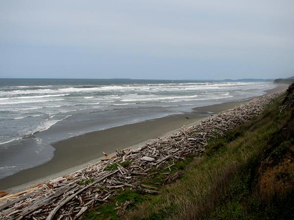
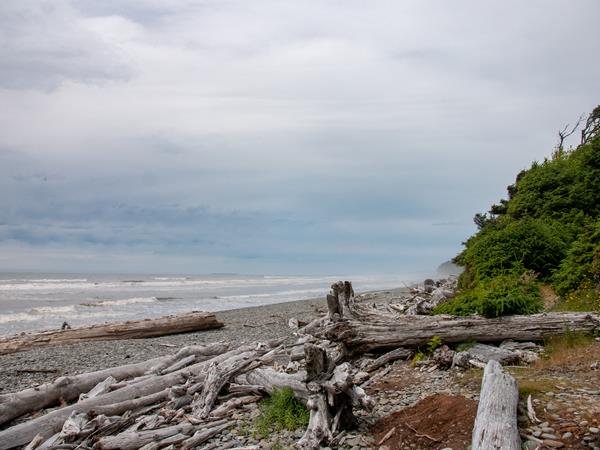
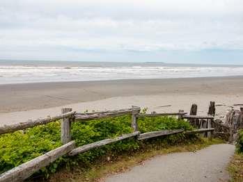
A trail through Sitka spruce trees, many of them with large, knobby burls, leads to this less-visited beach north of South Beach. The beach itself has countless massive drift-logs, weathered by their time at sea. Look for bald eagles nesting nearby!
Beach 2 Trailhead
Parking is VERY limited for Beach 2, so if spaces are full, choose another beach rather than parking unsafely along Highway 101. The short trail to this beach features distinctive "burls" on the spruce trees.
Beach 3 Trailhead
Parking is limited on the shoulder of Highway 101, but this charming beach is worth visiting when you can find a space and brave the steep trail.
Beach 4 - Trailhead and Parking Area
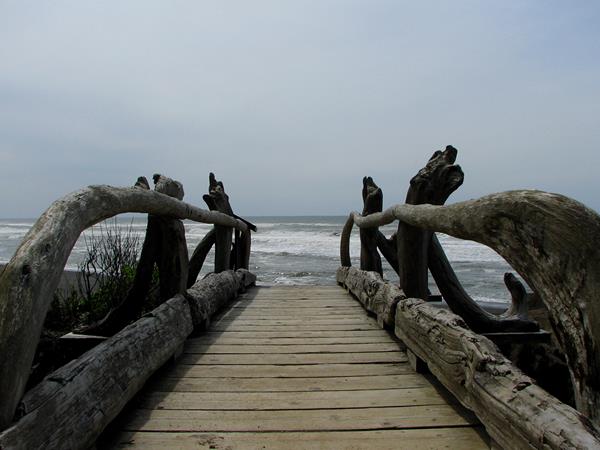
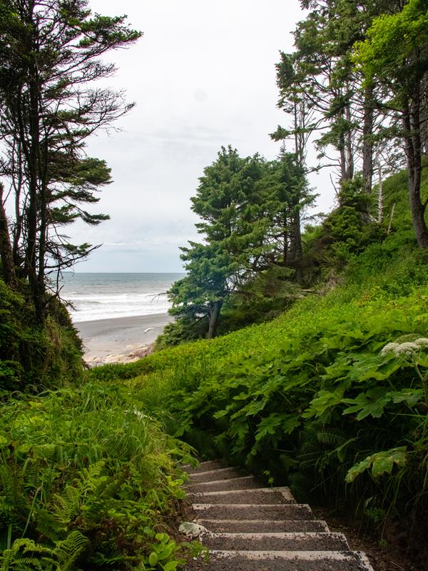
A short but rather steep trail through coastal forest leads to a lovely driftwood footbridge and Beach 4. A wonderful place to tidepool and look for seals, with particular treats for those interested in geology - Swiss cheese textured stone! The phenomenon is caused by piddock clams, which burrow into solid rock to protect themselves from the pounding surf.
Beach 6 Overlook
There is no trail at Beach 6, but it's perfect for a quick view of the Pacific. Pull off highway 101 to park safely at the overlook. Bring binoculars to look for sea otters and migrating whales!
Beach Access Trail from Kalaloch Campground
This wide, sandy beach is very popular! The so-called Tree of Life is a beloved photo subject, but it is NOT a safe place to hang your hammock or practice your parallel bars routine. The creek has slowly eroded the earth beneath the tree's roots, and we hope it can hang in there for a long time.
Cape Flattery Trailhead
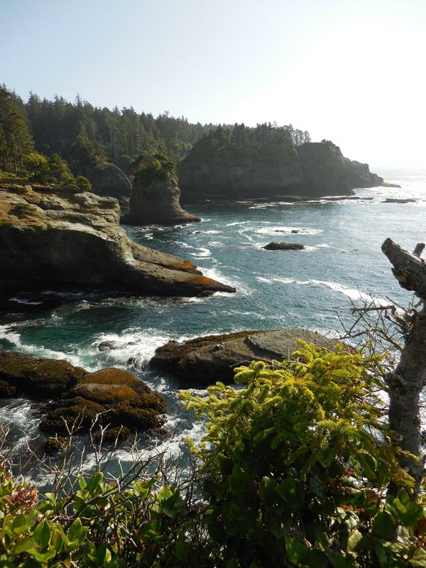
Located in the Makah Reservation, outside Olympic National Park near the town of Neah Bay. The short (¾ miles/1.2 km each way) trail leads through the forest to a viewing platform, perched on a cliff with a dramatic view overlooking the Pacific. Cape Flattery is the Northwest most point on the contiguous United States. To park at the trailhead, obtain a permit from the Makah Tribe. There is a restroom at the trailhead, and daytime parking for cars and RVs. Please pack out al
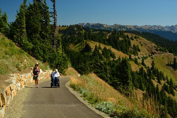
Cirque Rim Overlook
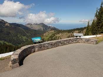
This half-mile (0.8 km), easy, paved trail has views of Port Angeles and the Strait of Juan de Fuca. While exploring the ridge please keep your distance from wildlife and stay on paved paths or snow to avoid damaging fragile meadows.
Dosewallips Road Trailhead
No longer accessible to vehicles, the first part of this trail is a former road that begins a trek into the wilderness of the Olympic Mountains. If you plan to make this the start of an overnight backpacking trip, check in with the Wilderness Information Center https://www.nps.gov/olym/planyourvisit/wic.htm
Dungeness National Wildlife Refuge
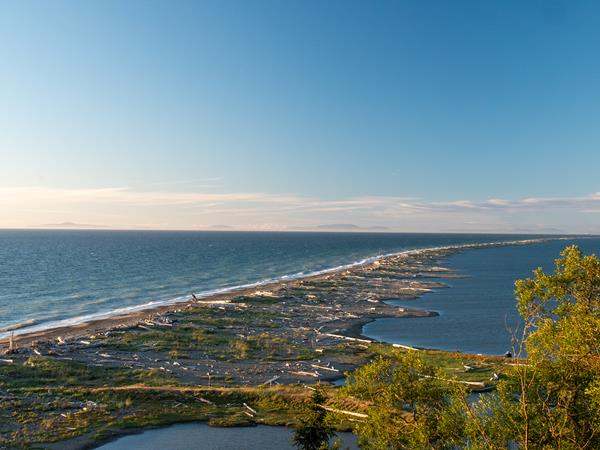
Located on the northern edge of the Olympic Peninsula, just outside of the town of Sequim, WA, Dungeness Spit offers a haven for wild birds and a historic lighthouse. While it is not a part of Olympic National Park, it is popular with locals and visitors alike for its hiking and bird-watching. From the refuge: "At Dungeness National Wildlife Refuge one of the world's longest natural sand spits softens the rough sea waves to form a tranquil bay, fertile tideflats, and beaches
Elwha Dam Overlook Trailhead
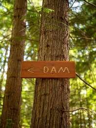
A short hike from the Elwha River Restoration Interpretive Center leads to the site of one of the former dams, where you can see just how much the river valley has changed in the ongoing restoration process. Depending on the time of year, foliage may make it difficult to see the site of the dam.
Explore Hurricane Ridge Loop Trailhead
For those looking for longer hikes, you can continue from the High Ridge trail out toward Klahanne Ridge and Mount Angeles, where you may connect to other trails, or simply turn back to Hurricane Ridge.
Fairholme Campground Loop Alternate Trailhead

A 0.8 mile (1.3 km) loop through old growth forest.
Fairholme Campground Loop Trailhead

A 0.8 mile (1.3 km) loop through old growth forest.
Glines Canyon Dam Overlook
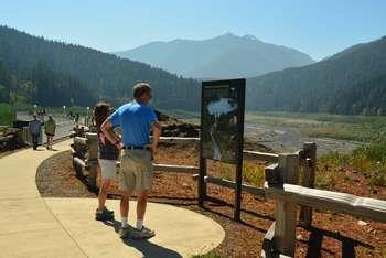
Accessible via a 3.4 mile ( 5.5 km) hike on the road and bypass trail from the Madison Falls parking lot. Perched on what was once the spillway of the Glines Canyon Dam, visitors can enjoy expansive views of the wide valley that formerly held the Lake Mills reservoir. Lake Mills formed when the Glines Canyon Dam was built between 1925 and 1927, flooding an area known at the time as Smokey Bottom. The overlook also gives people the chance to look down and watch the Elwha's blu
Graves Creek Nature Trail Loop
A one mile (1.6 km) loop through the rain forest. Find the trailhead across from the restrooms in the Graves Creek Campground.
Graves Creek Trailhead
Graves Creek Trailhead is a gateway to the Wilderness, where many backpackers begin their journeys (to make your own backcountry plans, contact the Wilderness Information Center nps.gov/olym/planyourvisit/wilderness.htm. For more information on Wilderness Information Center locations and hours, go to nps.gov/olymp/planyourvisit/wic.htm.) Shorter day trips on this trail will take you over a high bridge above Graves Creek, the first of many creeks the trail traverses through th
Griff Creek Trailhead

A steep, 2.8 mile (4.5 km) each way trail, with views of the Elwha River. Due to road washout, park at Madison Falls and take the road and bypass trail to get to the trailhead, about 1.8 miles (2.9 km) down the road. The trail starts behind the (currently non-operational) Elwha Ranger Station.
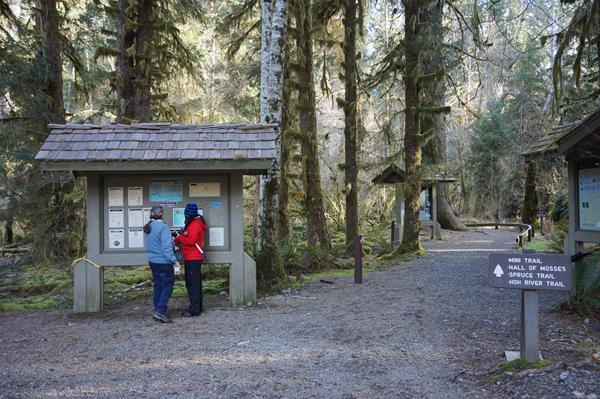
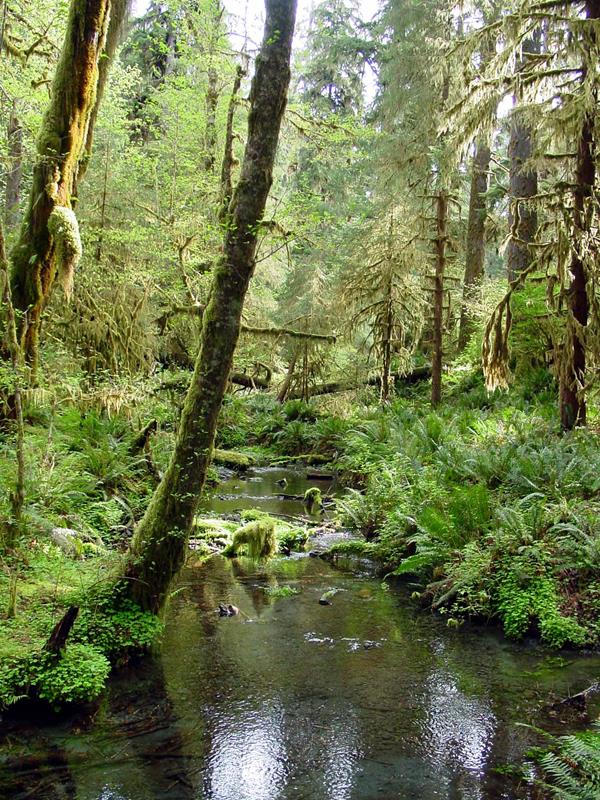
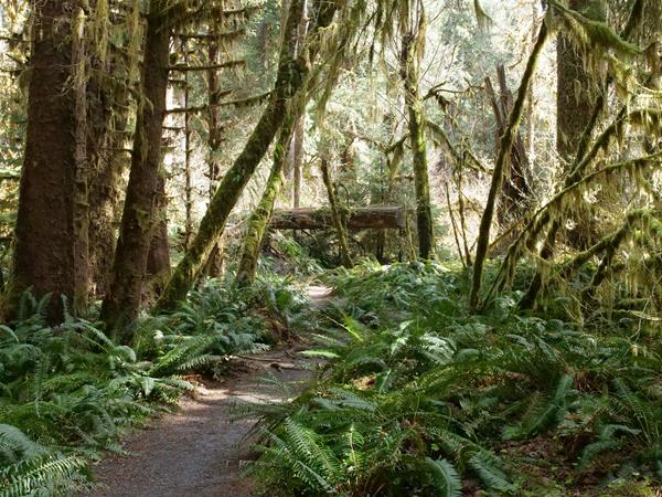
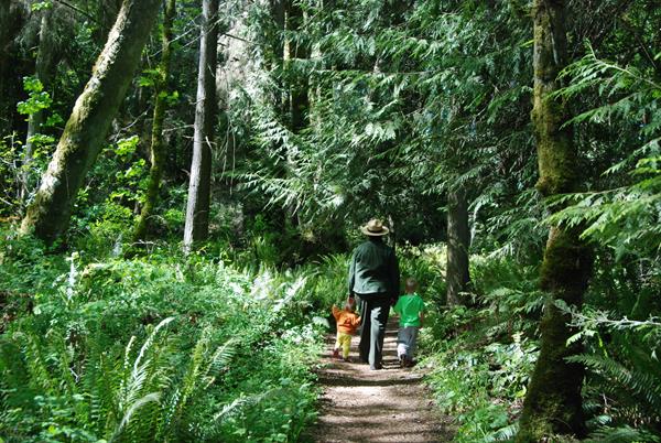
Hall of Mosses Trailhead
This short and sweet loop is the definitive rain forest experience. Look for young Coho salmon as you cross Taft Creek, then wander through a wonderland of moss, trees, and ferns - including an iconic moss-draped archway. The trail is just 0.8 miles (1.3 km) long, but you may be tempted to stay for hours!
Heart O' The Forest Trailhead
This 2.3 mile (3.7) km one way trail is a lovely, level trek through the forest. Starts at Loop E in the Heart O' the Hills campground.
Hoh River Trail junction
The Hoh River Trail (17.3 miles/27.8 km one way) is a starting point for backpackers headed toward Mount Olympus, but there's no rule that says you have to go that far! (If you do want to, contact the Wilderness Information Center to make a backpacking plan. www.nps.gov/olym/planyourvisit/wilderness.htm has locations and hours). For a peaceful out-and-back day hike (aka just turn around and come back when you're ready), the first section of the Hoh River Trail is mostly level
Hoh River Trailhead
Three trails begin just outside the Hoh Rain Forest Visitor Center: The Hoh River Trail (17.4 miles/28 km one way), a starting point for backpackers headed toward Mount Olympus or for a longer day hike, and two short loop trails, the Hall of Mosses and the Spruce Nature Trail. The Hoh is a wildlife hot spot - within just a few steps of the trailhead, you might see Roosevelt elk, river otters, birds, Coho salmon, black bears, or even a bobcat! In winter when the Coho return fr
Hoodsport Wilderness Information Center
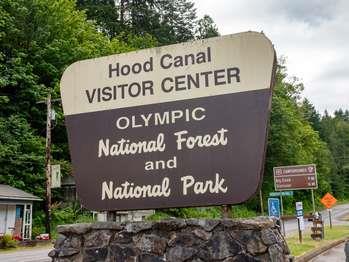
Rangers present intermittently in summer. Located inside the Hoodsport Visitor Information Center, the Hoodsport Wilderness Information Center issues back-country permits and bear cans for safe food storage, and provides current trail and in-depth backpacking information. Get a head start by visiting https://www.nps.gov/olym/planyourvisit/wic.htm
Hurricane Hill Picnic Area A
Open only in summer, located one mile (1.6 km) beyond the visitor center. Lovely meadow area with mountain views, restrooms, water, and paved trails to tables.
Hurricane Hill Picnic Area B
Open summer only, located one mile (1.6 km) beyond the visitor center, with restrooms, water and paved trails to tables. The parking area doubles as overflow parking for the Hurricane Hill Trail, just a short walk through the forest away.
Hurricane Hill Trailhead
One of the most popular day hikes is the Hurricane Hill trail, about 3 miles (4.8 km) round trip and climbing 700 feet (213 meters) to a high point with 360-degree views in clear weather. The trailhead is at the end of the road, just 1.3 miles (2.1 km) past the Hurricane Ridge Visitor Center. Overflow parking is available at Picnic Area B.
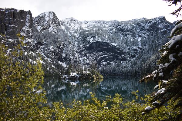
Irely Lake Trailhead

This 2.8 mile/4.5 km round trip, creek-side hike leads through the forest to Irely Lake. There may be stream crossings, and there is a ladder at the end that you will need both hands to climb. Always carry your Ten Essentials, and contact the Wilderness Information Center for trail conditions or to plan an overnight trip in the backcountry.<br />https://www.nps.gov/olym/planyourvisit/wic.htm<br />https://www.nps.gov/articles/10essentials.htm
James Pond Trailhead
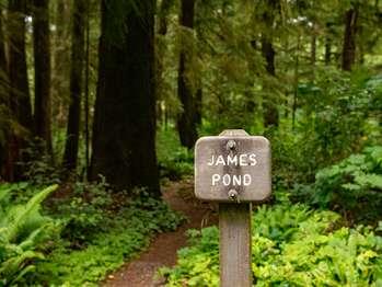
This flat, 0.4 mile (0.6 km) loop trail winds through the forest to James Pond. Look for yellow pond lilies in summer!
July Creek Picnic Area Trailhead
July Creek Picnic Area has a short trail to tables for a picnic with a view on the North shore of Lake Quinault.
Kalaloch Big Cedar Tree - Parking Area
An easy one-mile loop trail leads to this forest giant. Even half-fallen, its height and mass are incredible.
Kalaloch Creek Nature Trail
Kalaloch Creek Nature Trail is a short (0.8 mile/1.3 km) loop through coastal rain forest, starting in Loop A of the Kalaloch campground.
Kalaloch Lodge Trailhead
Be careful on this trail from Kalaloch Campground to Kalaloch Lodge, much of the short route is right alongside Highway 101.
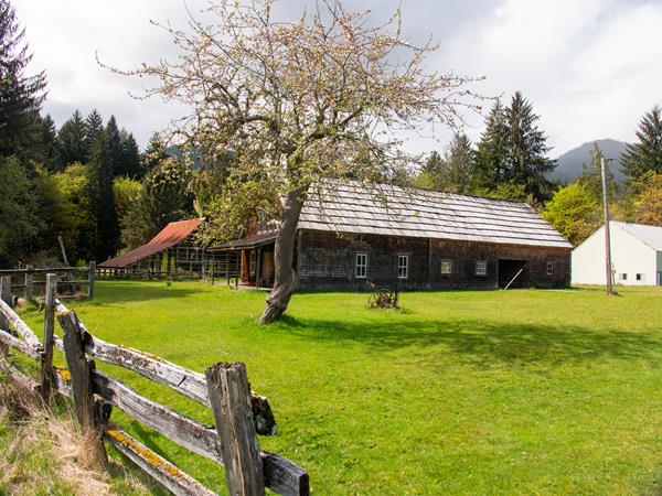
Kestner Homestead Loop Trail
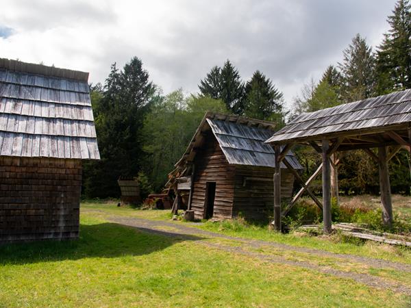
Learn about homestead life on this flat, self-guided 1.3-mile (2.1 km) loop from the Quinault Rain Forest Ranger Station.
Kestner Homestead Trailhead
Learn about homestead life on this flat, self-guided 1.3-mile (2.1 km) loop from the Quinault Rain Forest Ranger Station.
Lake Angeles and Heather Park Trailheads
To reach this trailhead, make sure to drive to the end of the road (you will pass some buildings with parking areas, but these are private housing - not for public use). From here, climb 4 miles (6.4 km) to the wildflower meadows of Heather Park, or 3.4 miles (5.4 km) to the mirror-like waters of Lake Angeles.
Living Forest Trailhead
This short 0.4 mile (0.64 km) loop trail starts beside the historic Beaumont cabin, behind the Olympic National Park Visitor Center in Port Angeles. May be wheelchair accessible with assistance.