Mesa Verde
Cortez and Mancos, CO
Balcony House Parking Area
The Balcony House Parking Area is where ranger-guided tours of Balcony House begin. Balcony House is a cliff dwelling with 38 rooms and 2 kivas.
Cliff Palace Loop Road
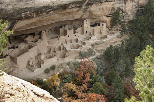
Cliff Palace Loop Road is a 6-mile (10-km) drive with overlooks of various cliff dwellings and access to ranger-guided tours at Cliff Palace and Balcony House.
Far View Community Sites
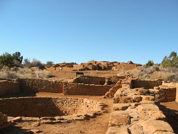
The level, unpaved ¾-mile trail (1.2 km) leads you through a mesa top community includes Far View House, four other villages, and a dry reservoir. Long before and even after the famous cliff dwellings were built, this area was a well-established Ancestral Puebloan farming community supporting dozens of families. In ancient times, the community was a place of modest homes interspersed with small farm fields. It was a place filled with people, vibrant life, and constant change.
Farming Terrace Trail
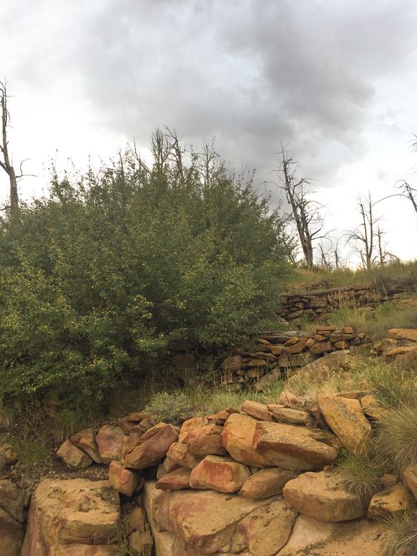
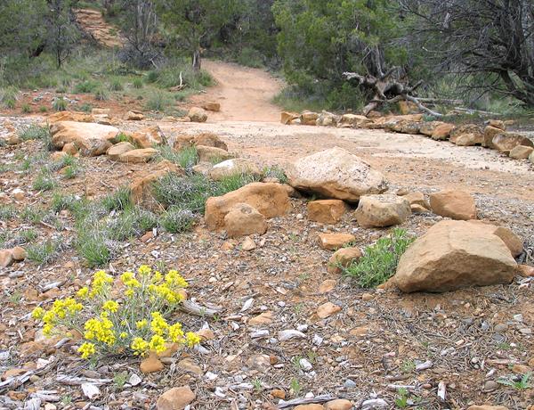
Beginning and ending on the spur road to Cedar Tree Tower, this 0.5-mile (0.8 km) loop trail leads through a series of check dams built by the Ancestral Pueblo people over 800 years ago.
Knife Edge Trail
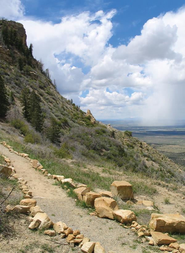
Named after the historic Knife Edge Road which was known for it's scenic value, this fairly level trail follows the old roadway and leads to a viewpoint that affords excellent views across Montezuma Valley.
Park Point
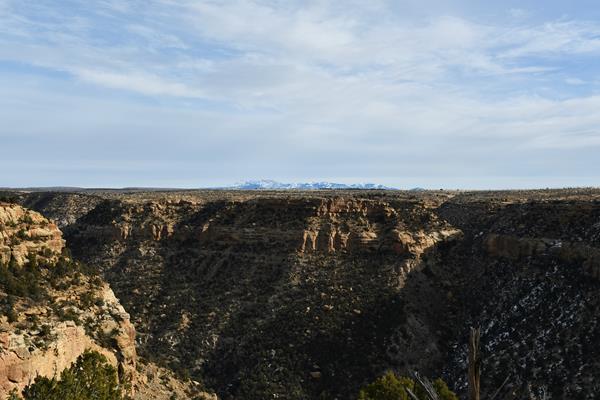
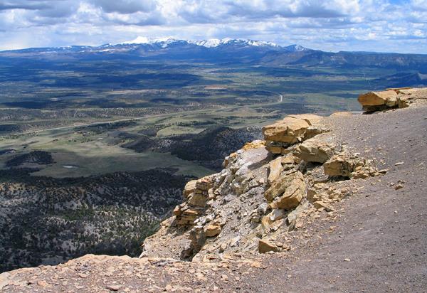
The highest elevation in the park at 8,572 feet (2,612 m) above sea level, Park Point is a breezy and cool place to picnic or take in the view. To the north, the 13,000 and 14,000-foot (4,000+ meters) peaks of the San Juan Mountains are visible. To the south, the high deserts of New Mexico stretch out across rocky canyons. To the West is Sleeping Ute Mountain and to the East lies the La Plata Mountains.
Petroglyph Point Trail
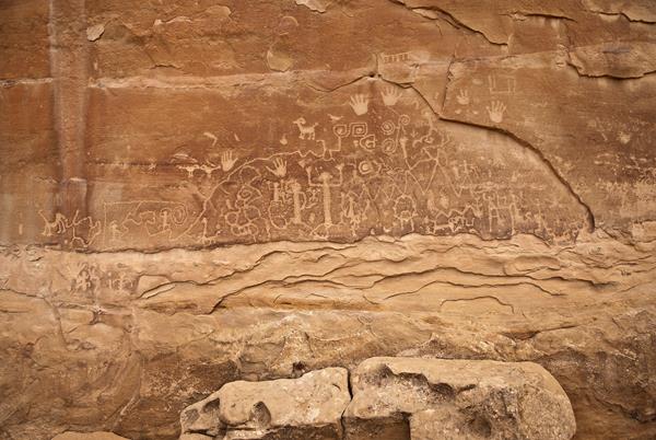
This moderately strenuous, 2.4-mile (3.9 km) Petroglyph Point Trail offers excellent views of Spruce and Navajo Canyons and takes you past a large petroglyph panel located 1.4 miles (2.3 km) south of the trailhead. The trail is narrow and rocky, with several steep drop-offs along the canyon wall on the way to the petroglyph panel. After the panel, you’ll scramble up a large stone staircase using hands and feet to climb to the top, then enjoy an easy return.
Point Lookout Trail
The 2.2-mile (3.5 km) Point Lookout Trail switchbacks up the west side of the iconic Point Lookout, the geological formation that towers above the park entrance. The trail offers magnificent views of the San Juan and La Plata Mountains, as well as the Mancos and Montezuma Valleys.
Prater Ridge Trail
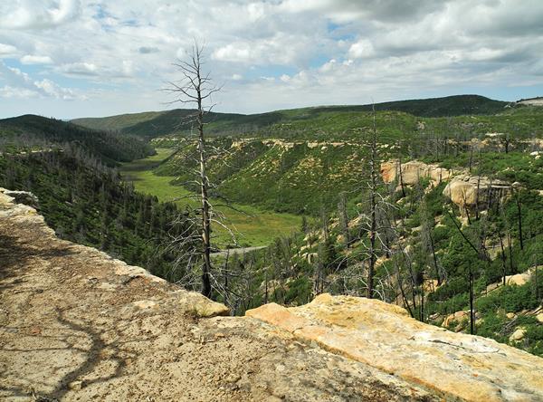
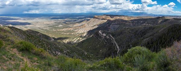
This trail traverses Prater Ridge which divides Prater and Morefield Canyons. The complete 7.8-mile (12.5 km) Prater Ridge Trail contains two loops. The South loop offers views into Prater Canyon, named for an early pioneer family. The North loop ascends for views into Montezuma Valley and the beautiful San Juan Mountains.
Soda Canyon Overlook Trail
This easy, 1.2-mile (2 km) roundtrip trail meanders through the mesa top pinyon-juniper forest to three overlooks at the edge of Soda Canyon. Hikers are rewarded with views of Balcony House and several other cliff dwellings across the canyon. The canyon was named for the white, calcium carbonate deposits visible below the rim. These are the evaporative remains of seeps springs once used by the Ancestral Pueblo people.
Spruce Canyon Trail
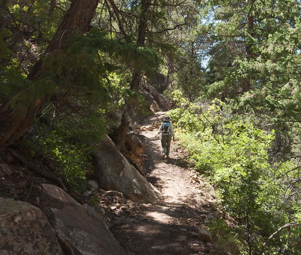
The moderately strenuous, 2.4-mile (3.9 km) Spruce Canyon Trail offers an opportunity to explore the canyon bottoms of Mesa Verde and discover the plants and wildlife that live in this habitat. Starting from the top of Chapin Mesa and following the bottom of Spruce Canyon, this scenic trail winds through excellent wildlife habitat. A steep climb leads out of the canyon and then passes through the picnic area before returning to the museum.