Guadalupe Mountains
Salt Flat, TX
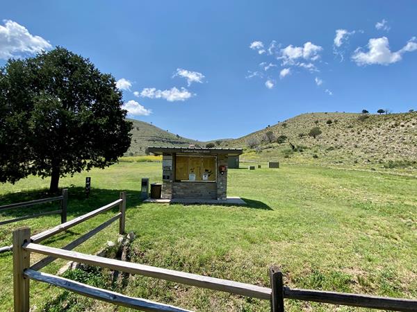
Campground Junction
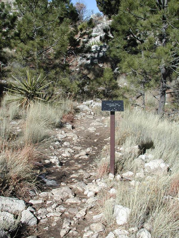
At three and one quarter miles up the trail hikers will pass a sign indicating the Guadalupe Peak backcountry campsite. A short trail leads north to the campsite, where there are five individual tent sites. Backpackers wishing to hike the peak for sunrise and sunset can camp here if they obtain a Wilderness Use Permit in advance of their hike.
El Capitan Trail Junction
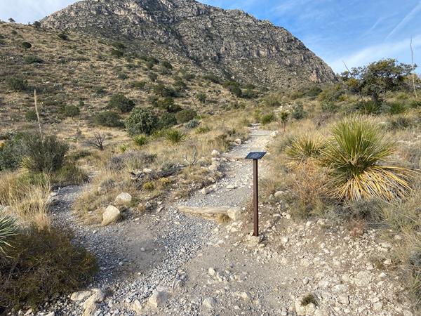
Less than a quarter mile from the trail is the junction of three trails. Stay straight to continue toward the summit of Guadalupe Peak. A right turn directs hikers toward Devil's Hall and the Guadalupe Peak "stock trail". A left turn here begins the El Capitan Trail.
Frijole Horse Corral Trailhead

The Frijole Horse trailhead is located at the Frijole Horse Campsites and a short distance from the historic ranch.
Frijole Ranch Museum
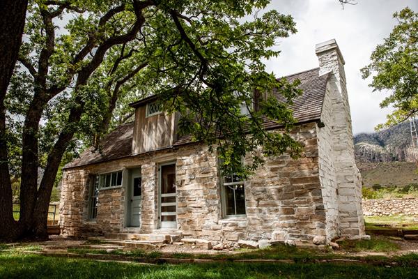
Frijole Ranch is a delightful oasis on the edge of the dry, lower slopes of the Guadalupe escarpment which truly captures the rugged sprit of the American West. Today the Frijole Ranch History Museum occupies the old ranch headquarters, and displays the sequential human history of the Guadalupes from Native Americans and the early ranching community to the establishment of a national park. Imagine what life may have been like in this remote West Texas location 100 years ago.
Frijole Ranch Trailhead
The Frijole Ranch trailhead is located at the end of the Frijole Ranch Road and a short distance from the historic ranch. The popular Smith Springs loop trail begins here. A picnic area is immediately adjacent the trailhead.
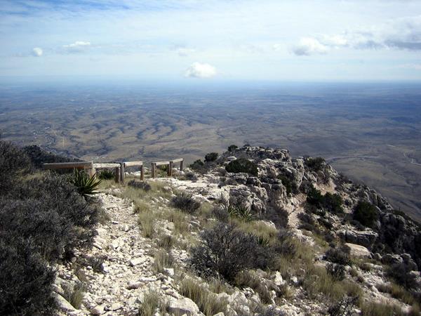
Guadalupe Peak
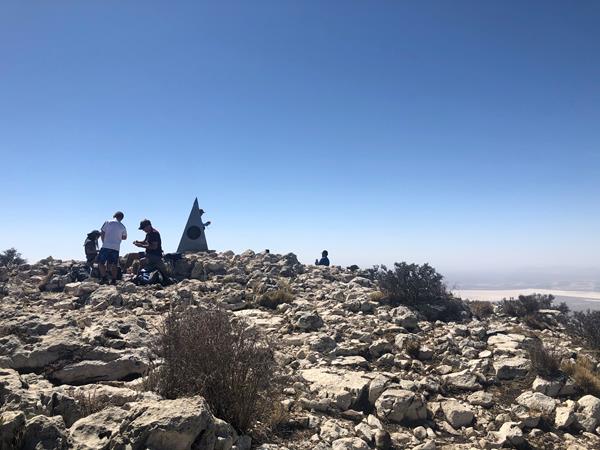
Guadalupe Peak is the highest natural point in Texas, with an elevation of 8,751 feet above sea level. The peak can be climbed by a maintained strenuous day hike via the Guadalupe Peak Trail with a 3,000 feet elevation gain at any time of the year.
Hueco Tanks State Park & Historic Site
A unique geology and a relative abundance of water made the Hueco Tanks site a refuge for nature and humans for over ten thousand years. This park offers guided & self-led tours of ancient rock imagery, plus picnic spots & 20 campsites.
McKittrick Canyon Trailhead
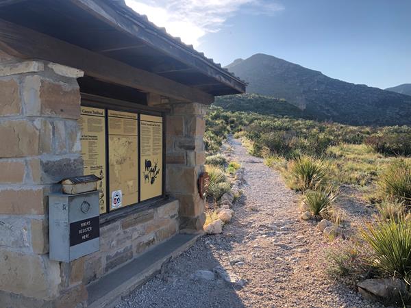
The McKittrick Canyon trailhead is the starting point for trails for destinations in McKittrick Canyon as well as above and beyond the canyon. Trail destinations inside the canyon make excellent day hikes. The trailhead is located on the other side of the visitor center from the parking lot. This is a day use area and visitors must exit before the gate closing time each evening.
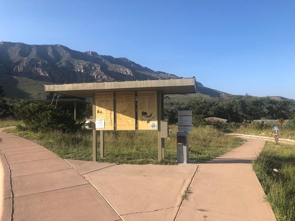
Pine Springs Trailhead
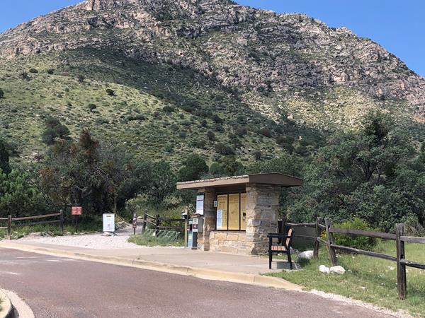
The Pine Springs trailhead is the starting point for many park trails, and is located near the campground. Except for the Pinery Trail near the visitor center, most of the trails starting here are rated strenuous with significant elevation gains. On busy weekends this trailhead area often fills first.
Salt Basin Dunes Trailhead
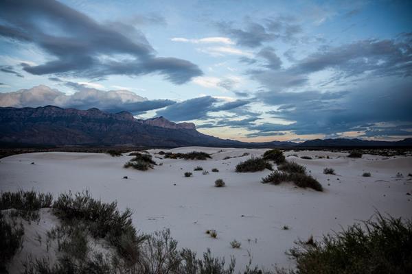
The white gypsum sands of the Salt Basin Dunes rise 100 feet from the desert floor and provide a brilliant contrast to the dark, towering cliffs of the Guadalupe Mountains. This is the only trailhead on the remote western side of the park.
Stock Trail Junction
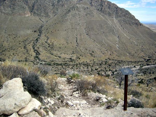
The stock trail junction marks almost a mile up the trail to the Guadalupe Peak summit. The so-called "Stock Trail" is the original trail section and offers a significantly less steep ascent and descent with the trade-off of an additional mile hiked. This junction provides excellent views of Guadalupe Pass, Pine Spring Canyon, the Pine Springs Visitor Center, and Pine Springs Campground.
Tejas Trail Junction
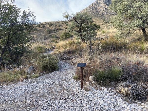
The junction with the Tejas Trail is a short distance up the trail from the Pine Springs Trailhead. The Tejas Trail is the gateway to the high elevation Wilderness in the park.
The Bridge
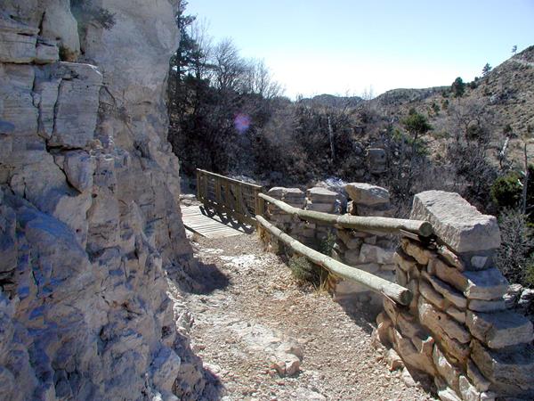
Nearly a mile below the summit of Guadalupe Peak, the trail crosses a small chasm by a wooden bridge. This bridge is a well photographed landmark on the trail.
The Dog Canyon Trailhead
The Dog Canyon trailhead is located in the remote northern district of the park. The higher elevation makes for faster access to the wilderness and high country.
The Grotto
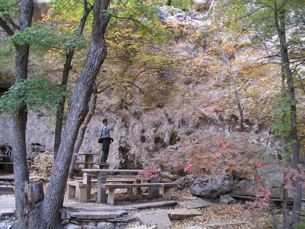
The open face of a small cave and rock benches and tables await you in the deep shade in McKittrick Canyon, a tempting location for a picnic.
The Hitching Posts
The hitching posts below the summit of Guadalupe Peak mark the end of the portion of the trail that stock are allowed to travel. The trail continues to the left of the hitching posts on slick rock surfaces. You are nearly to the summit!
The Notch
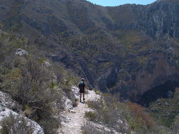
Located where the McKittrick Canyon Trail first breaks through the ridge, "The Notch" is a strenuous hike and the last traditional day hike destination within South McKittrick Canyon.
The Pinery
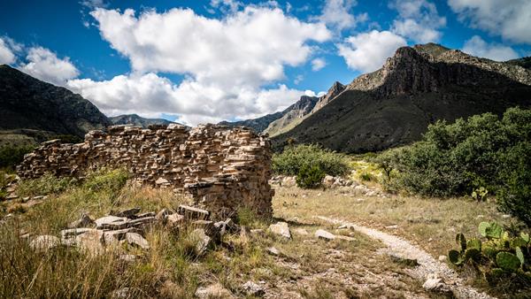
Visit the ruins of the Pinery Station and get a sense of the isolation and rugged beauty that travelers experienced here in 1858. The old stone walls stand today as a testament to the spirit of change that early travelers, station keepers, and stage drivers carried as they passed this way over a century and a half ago.
Williams Ranch
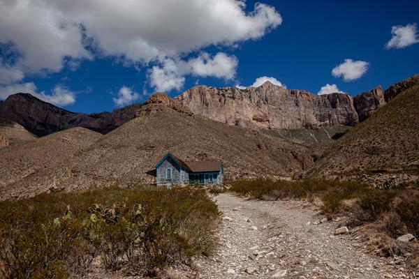
A key remnant of the early Twentieth Century ranching era, the Williams ranch house lies approximately one mile northeast of the original Butterfield Overland Stage Route, which moved further south in 1859. The house is situated in a narrow valley between the Guadalupe Mountains to the east and the Patterson Hills to the west. The ranch sits at the mouth of Bone Canyon, placing it close to the perennial water source of Bone Spring.