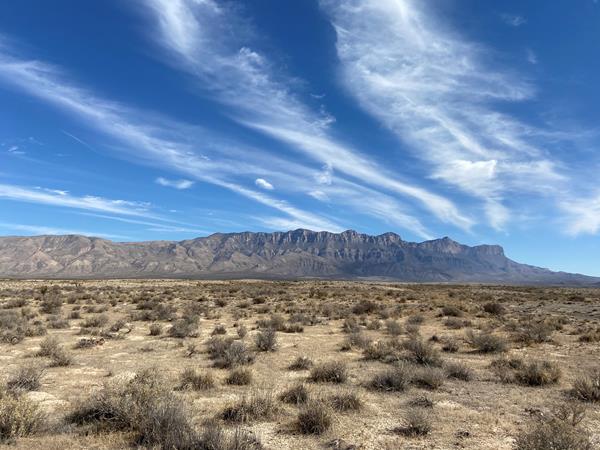
Guadalupe Mountains
Salt Flat, TX
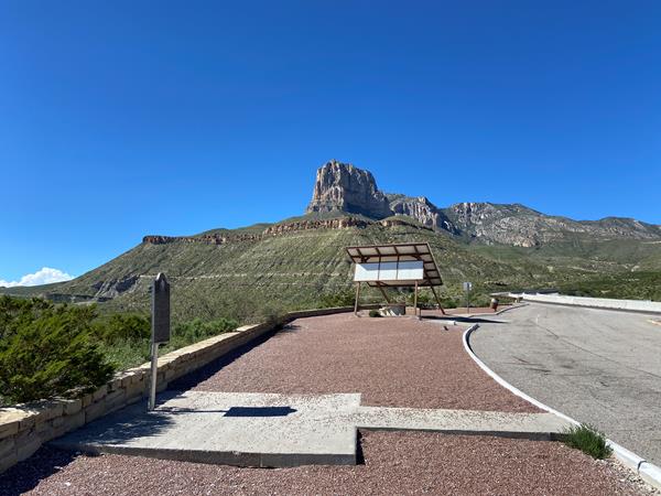
Guadalupe Peak Viewpoint
This viewpoint, located just to the southeast of the park boundary alongside U.S. Highway 62/180 provides an excellent view to the summit of Guadalupe Peak.
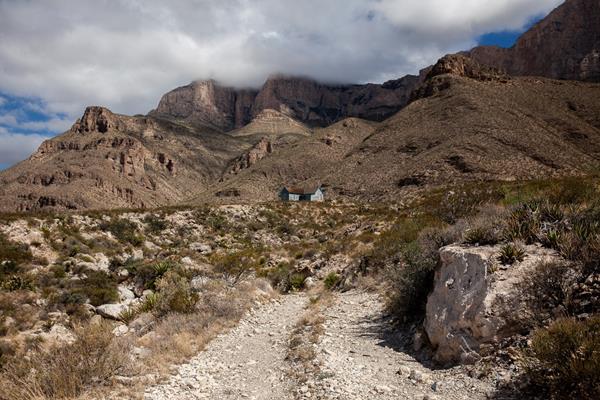
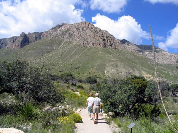
Visit the historic Frijole Ranch
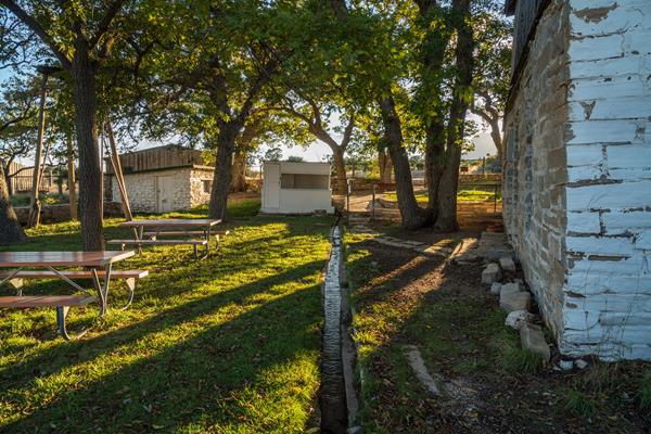
Frijole Ranch is a delightful oasis on the edge of the dry, lower slopes of the Guadalupe escarpment which truly captures the rugged sprit of the American West. Today the Frijole Ranch History Museum occupies the old ranch headquarters and displays the human history of the Guadalupes. The grounds are open from dusk to dawn, with picnic tables at the parking area and under the large shade trees in the courtyard. Bring your binoculars; this is an excellent location for birding!
Overnight on Wilderness Ridge
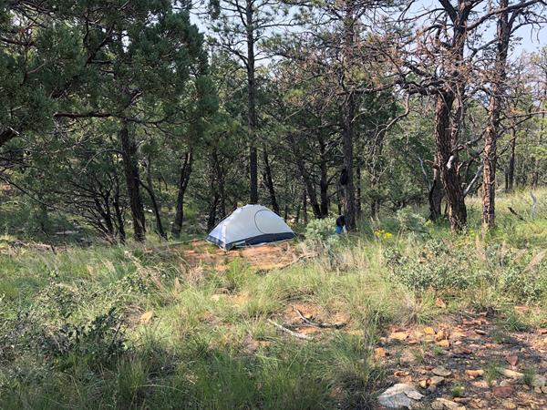
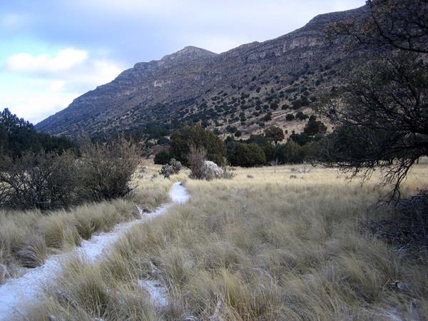
The lesser used Permian Reef Trail leads to sheltered campsites and spectacular views into McKittrick Canyon, making a great destination of a one night, two day backpacking trip into the Wilderness.
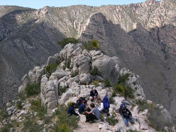
The Notch
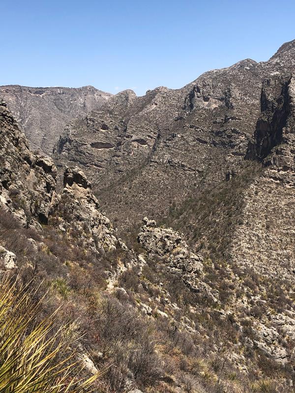
The hike to "the Notch" is a challenging day hike that proceeds through McKittrick Canyon to a dramatic viewpoint about half way up toward McKittrick Ridge.
Drive to Williams Ranch
If you have a high-clearance, four wheel drive vehicle, the primitive dirt road to Williams Ranch provides a unique opportunity to get off the beaten path and get close to the remote and imposing western escarpment of the Guadalupe Mountains. The Williams Ranch Road is currently CLOSED.
McKittrick Canyon to Dog Canyon
The McKittrick Canyon Trail follows the floor of South McKittrick Canyon for four miles before climbing steeply to gain the ridge on the north side of the canyon. This is an arduous climb provides spectacular views into the canyon and to the ridges that border it. This is an extremely rewarding trail, offering both the variety of McKittrick Canyon and the grandeur of the high ridges that surround it.
McKittrick Ridge
The journey to the top of McKittrick Ridge is "the toughest hike in Texas." This arduous hike is best enjoyed as an overnight hike allowing for rest, recovery, and fabulous night skies at the McKittrick Ridge Wilderness Campground. An overnight Wilderness Use Permit is required for camping.
Trail Rides
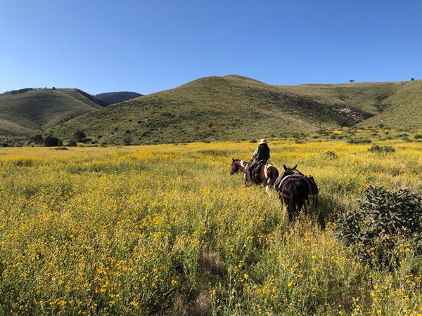
For those bringing horses and other stock to the Guadalupe Mountains, the park offers diverse riding opportunities. Sixty percent of the trails are open to stock use.
Hiking off-trail
A new kind of experience in the Guadalupe Mountains starts where the maintained trail ends. However, off-trail hiking requires planning and preparation and carries a great deal of risk. Any person or persons planning to hike off trail in the park must obtain a Special Use Permit before they attempt the hike.
Day Hike Preparation
As with most activities, hikers face potential risks. Knowledge and preparation can increase your comfort level and reduce your chances of injury. Remember, you are ultimately responsible for your own safety.
Guadalupe Ridge Trail (GRT)
This trail covers 100 miles (161 km) through Carlsbad Caverns National Park, Lincoln National Forest, Bureau of Land Management, and Guadalupe Mountains National Park. Over 20 miles (32 km) of this trail is within Carlsbad Caverns National Park.
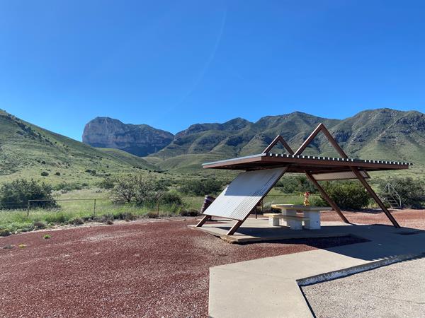
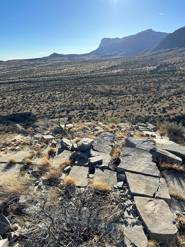
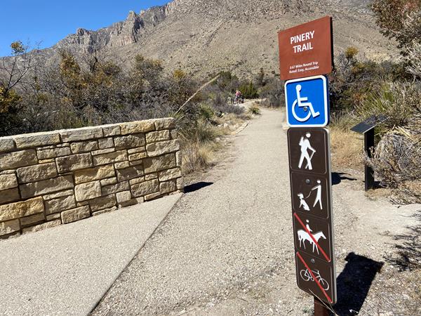
Pinery Trail
The Pinery Trail offers visitors an opportunity to take a quick walk on a paved trail. The trail also features ruins of the Old Butterfield Stagecoach Route Pinery Station built in 1858.
Bringing Horses
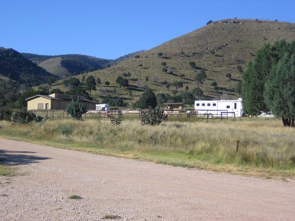
Camping is authorized for overnight horse users only at the visitor horse corrals, with a permit. The visitor horse corrals and campsites at Frijole Horse Corral Campground and Dog Canyon Campground can be reserved in advance of the visit.
Dealing with Human Waste
Nothing can spoil a trip in the Guadalupe Mountains Wilderness as quickly as the discovery of human waste or toilet paper at a prime camping spot or along the trail. Always use the restroom before hiking. If you are on the trail for the day or an extended trip, be prepared to pack out human waste, toilet paper, diapers, and hygiene products. Human waste disposal bags are highly recommended to transport solid waste.
Hike to Fall Colors
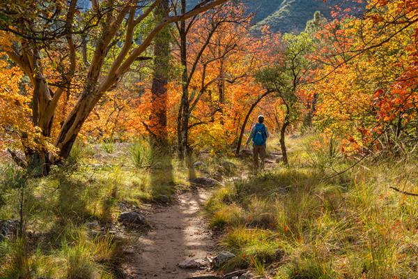
Bright fall colors of deciduous trees are not common in the southwest, but elevation and environment combine in the Guadalupe Mountains for a seasonally striking display usually from mid-October to Mid-November. A series of short and long hikes of varying degrees of difficulty will bring you to glimpse of this annual splendor.
Know the Rules
There are a variety of rules and regulations that dictate how the parks must be managed. These laws and regulations help us protect park resources while also providing visitors with a safe and enjoyable experience.
Campground Connector Trail
This short trail connects the visitor center to the campground and the trailhead area at Pine Springs.
Overnight on McKittrick Ridge
The journey to the top of McKittrick Ridge is "the toughest hike in Texas." This arduous hike is best enjoyed as an overnight hike allowing for rest, recovery, and fabulous night skies at the McKittrick Ridge Wilderness Campground. An overnight Wilderness Use Permit is required for camping.
Tejas Thru Hike
The Tejas Trail is the primary north/south through trail within the park, connecting the Pine Springs Trailhead with the Dog Canyon Trailhead at the park's northern boundary. This major artery can be used to connect to numerous other trails to make a variety of loops. The central portion of the trail from Pine Top until the McKittrick Canyon Trail junction is forested, passing through the Bowl and numerous drainages.
Pine Springs to McKittrick Canyon
The Tejas Trail is the primary north/south through trail within the park, connecting the Pine Springs Trailhead with the Dog Canyon Trailhead at the park's northern boundary. The central portion of the trail from Pine Top until the McKittrick Canyon Trail junction is forested, passing through the Bowl and numerous drainages. As the trail descends from McKittrick Ridge, visitors are provided with a panoramic experience of the canyon.
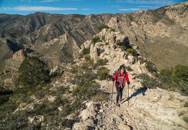
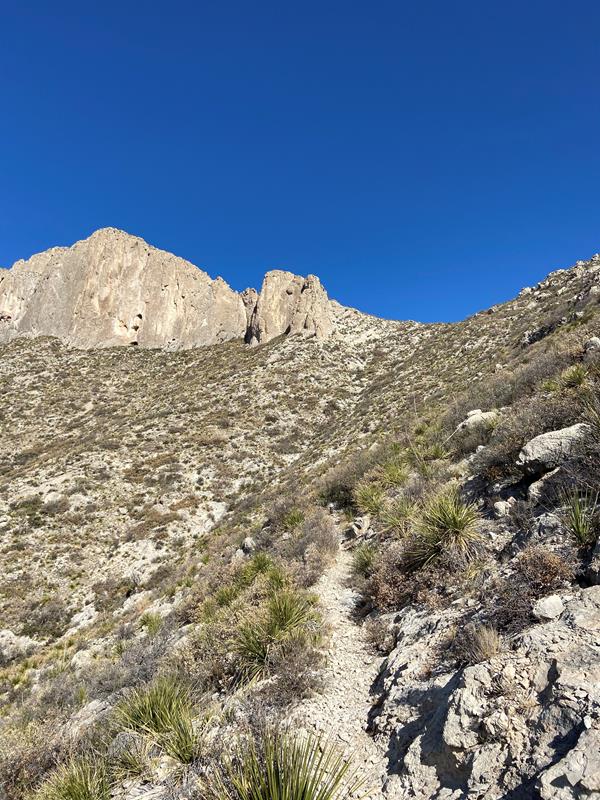
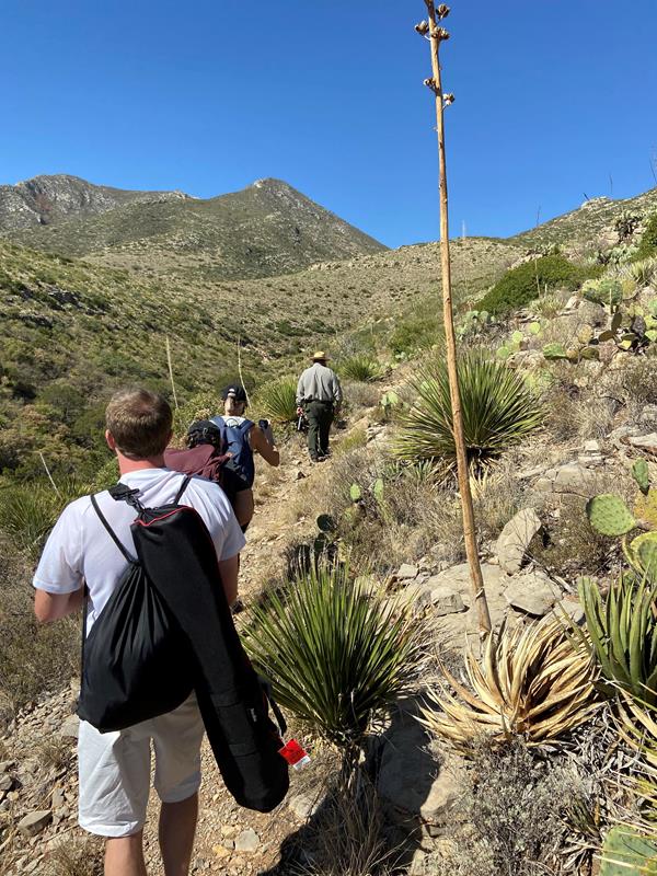
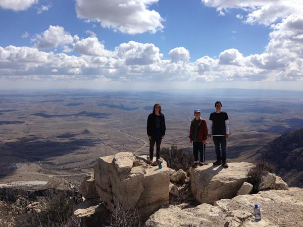
Guadalupe Peak
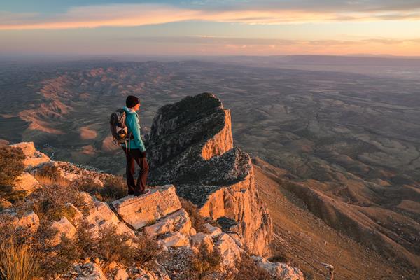
Climb to the "Top of Texas" with a hike up Guadalupe Peak. Guadalupe Peak is a rewarding, although very strenuous, 8.4 mile round trip hike with a 3,000 foot elevation gain. It will take from six to eight hours to complete the hike. The peak provides fantastic views from the highest point in the state of Texas (8,751 feet / 2,667 meters). It also introduces hikers to several of the park’s ecosystems including the high desert and the high elevation forests.
Hiking with a Group
In order to protect sensitive ecosystems and limit the impacts on the natural landscape, day-use hiking groups may not be larger than twenty persons on any trails in the park. This page provides suggestions on how to split your group up in order to preserve Wilderness character, and limit adverse impacts on park resources.
Manzanita Spring
The Manzanita Spring Trail is a 0.5 mile (0.8 km) out and back trail that begins adjacent the Frijole Ranch. Manzanita Spring is a wide pool that provides excellent bird watching opportunities.
Indian Meadow Nature Trail
The Indian Meadow Nature Trail is an easy 0.6 mile loop that begins across the road from the ranger station and next to the group campsite, offering good views of the landscape. At a leisurely pace it takes 30-45 minutes. The trail is rated easy as it remains almost level after crossing an arroyo.
Smith Spring Trail Loop
Begin this hike at the trailhead sign. Look for birds, mule deer, and elk as you walk this loop trail to the shady oasis of Smith Spring. Take a break here and enjoy the gurgling sounds of the tiny waterfall before continuing around to sunny Manzanita Spring. Scars from wildland fires of 1990 and 1993 are evident along the trail. The trail is rated moderate, with a round-trip distance of 2.3 miles. Allow one to two hours.
Marcus Overlook
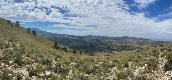
Hiking the Bush Mountain Trail from Dog Canyon out to the Marcus Overlook and back makes an excellent and usually solitary day hike in the Guadalupe Mountains. From the Marcus Overlook, there are commanding views south into the Guadalupe Mountains and westward.
Pratt Cabin
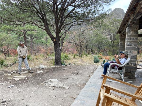
Enjoy the shortest distance into the heart of the canyon by hiking to Pratt Cabin and return (a distance of 4.8 miles). Along this walk you will cross the stream once before arriving at the historic structure. Enjoy a snack or lunch at the picnic tables near or at Pratt Cabin, or sit for a spell on the porch. Volunteers staff Pratt Cabin on occasion; take a look inside the stone structure.
Lost Peak Saddle
Hiking the Tejas Trail from Dog Canyon out to the Lost Peak Saddle and back makes an excellent day hike in the Guadalupe Mountains.
Foothills Loop
This moderate loop route uses the Frijole Trail and the Foothills Trail to make a loop below the eastern escarpment of the Guadalupe Mountains.
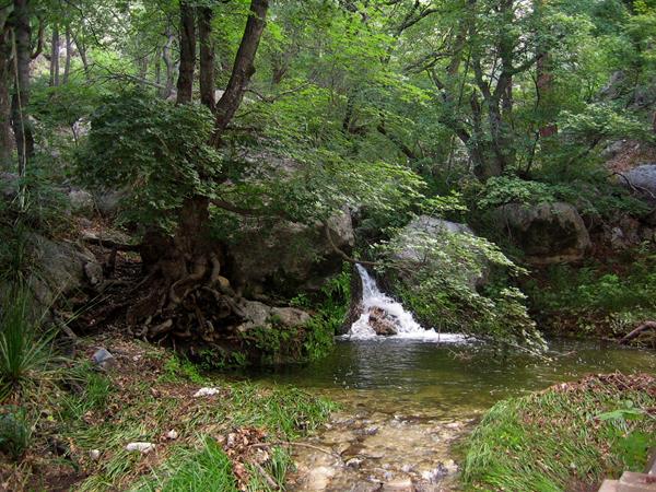
The Grotto and Hunter Line Shack
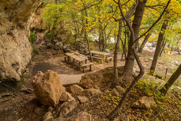
Stretch out your day hike into McKittrick Canyon by hiking to the Grotto. Elevation gain doubles as you travel further up canyon, but is still mild at less then 600 feet gained from the trailhead. Exposed cave features and stone picnic tables near the Hunter Line Shack make for a fabulous lunch destination.
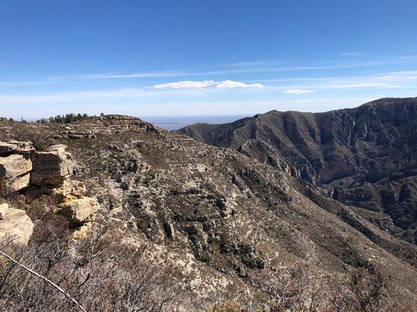
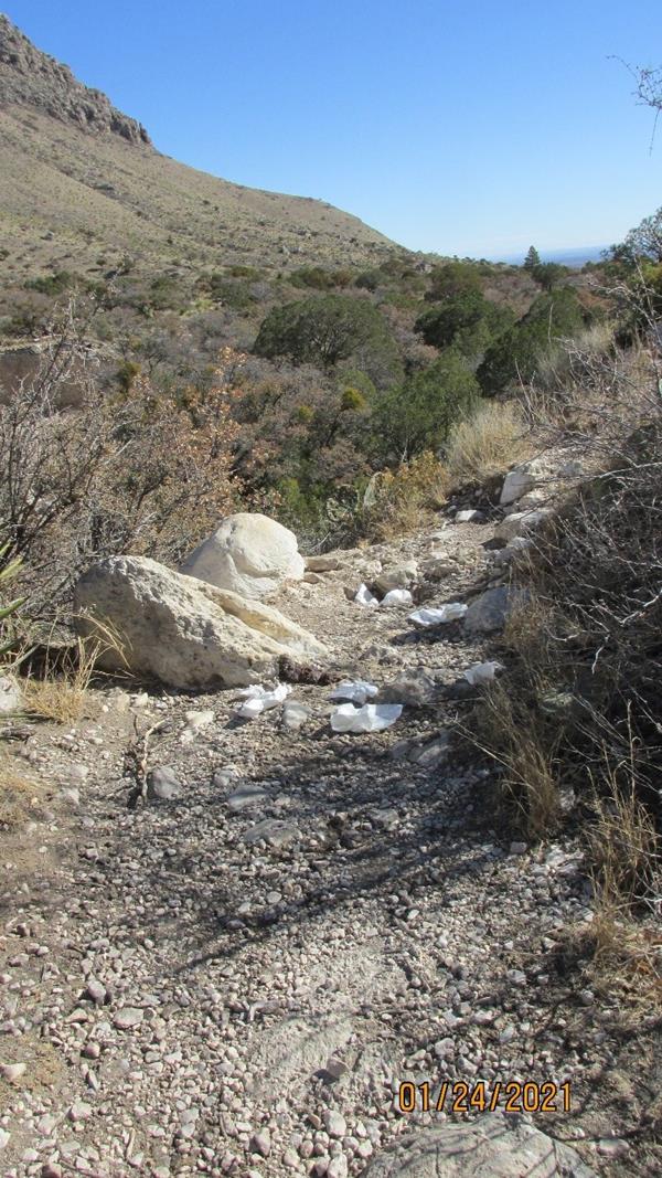
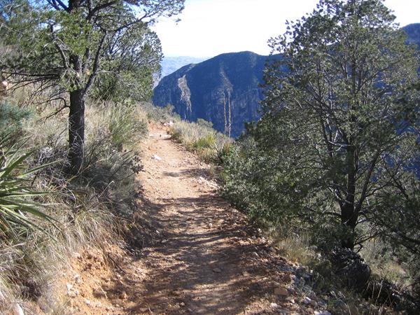
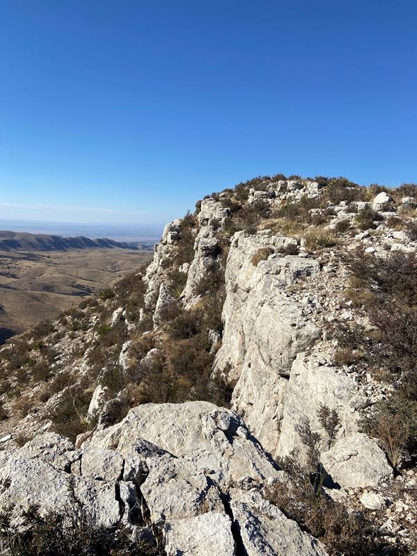
Permian Reef Trail
The Permian Reef Trail climbs the north side of McKittrick Canyon to the top of Wilderness Ridge, providing sweeping views into South McKittrick Canyon. Among the least used trails in the park, this long climb is rewarded with solitude and dramatic landscape views.
Hunter Peak
The hike to Hunter Peak is a challenging day hike done as a loop up the Bear Canyon Trail and down the Tejas Trail that provides solitude, stunning views, and opportunities for side trails into the Bowl area.
Devil's Hall
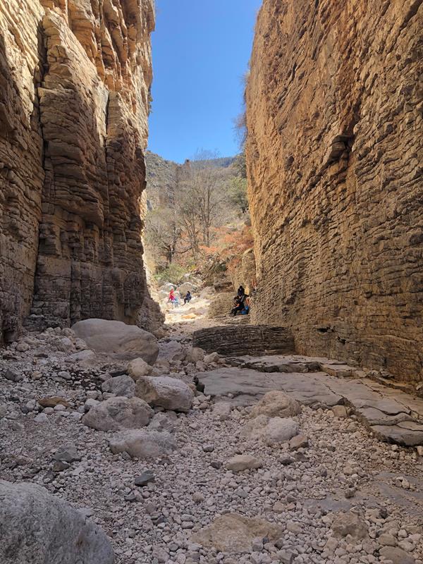
The strenuous route to Devil's Hall departs from the Pine Springs Trailhead and is 4.2 miles round-trip. After the first mile the trail enters a rocky wash which leads hikers to an impressive natural rock staircase that connects to a "hallway" formed by steep canyon walls. Rock surfaces in the wash can be slippery when dry and visitors should exercise caution on this hike.
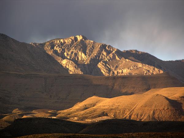
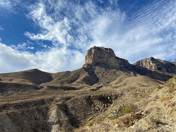
El Capitan Viewpoint
On the climb up Guadalupe Pass on U.S. Highway 62/180 just a few miles west of the Pine Springs area, this roadside pull-off provides an unparalleled view to the summit of El Capitan.
McKittrick Canyon Nature Trail
This fascinating, short trail passes an intermittent seep that lies hidden in junipers, then wanders up a southwest slope along an arroyo. Here, plants and animals tolerate true desert conditions. At the top of the trail you can look down at the mouth of McKittrick Canyon and read about Permian Reef geology.
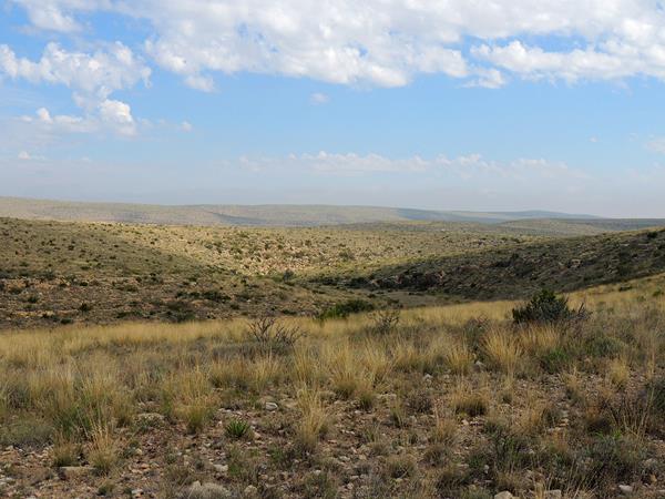
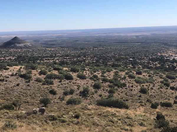
Salt Basin Dunes Trail
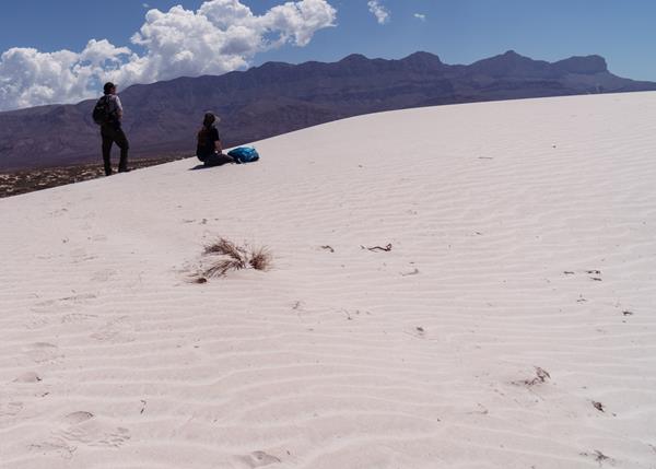
The white gypsum sands of the Salt Basin Dunes rise 100 feet from the desert floor and provide a brilliant contrast to the dark, towering cliffs of the Guadalupe Mountains. From the trailhead, follow the trail to the gypsum sand dune field with excellent views of the western escarpment of the Guadalupe Mountains. There is no shade along the trail, so carry plenty of water and avoid hiking in the midday heat.
What Time Is It?
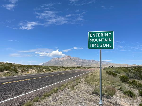
Guadalupe Mountains National Park is in the Mountain Time Zone. Visitors relying on electronic devices may be misled, as cell signal service for the park comes from towers located in the Central Time Zone. We strongly suggest that you set your phone or other device to Mountain time during your visit.
Drive to Dog Canyon
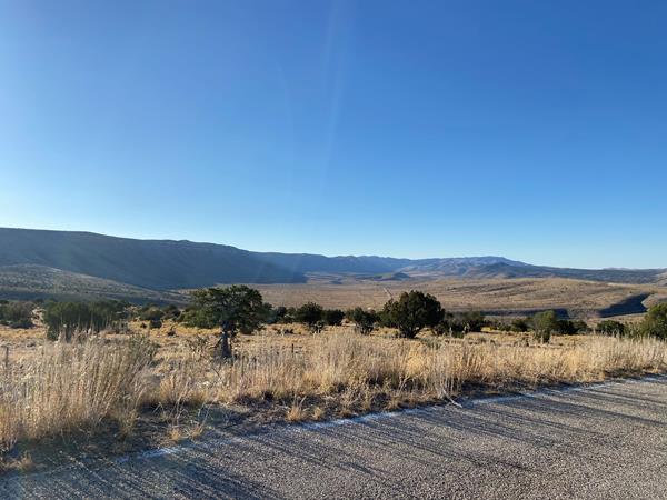
Dog Canyon, the park's remote north district, is only seven miles as the crow files, but a full two hour drive [one-way] from Pine Springs through a panoramic Chihuahuan Desert and mountain landscape.
Drive to the Five Points Vista
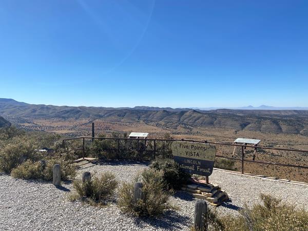
Located line of sight to Dog Canyon, the Five Points Vista is a scenic overlook near the end of the Guadalupe Rim Road in the Lincoln National Forest's Guadalupe Ranger District. This viewpoint offers spectacular views of the 'Rim' and the Guadalupe Mountains.
Highway 54 To The Guadalupes
From the south, Texas State Highway 54 leads directly to the Guadalupes from Van Horn, Texas. Running between the Delaware Mountains to the east and Sierra Diablo on the west, the highway provides a dramatic approach to the Guadalupe Mountains, and on a clear day, you can see the mountains ahead of you for forty miles.
Backpacking Preparation
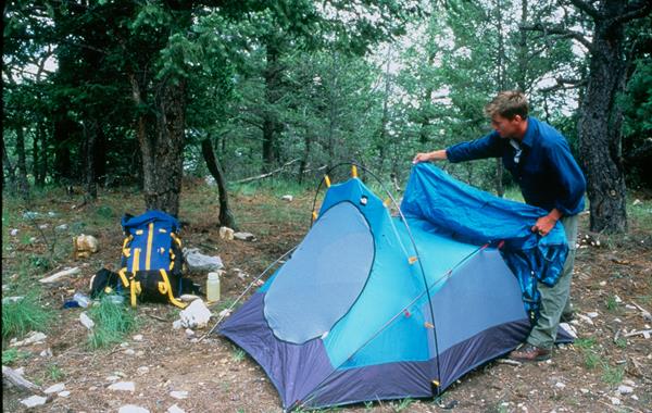
A backpacking trip in Guadalupe Mountains Wilderness requires some prior planning and decision-making to ensure the best experience.
Highway 62/180 to the Guadalupes
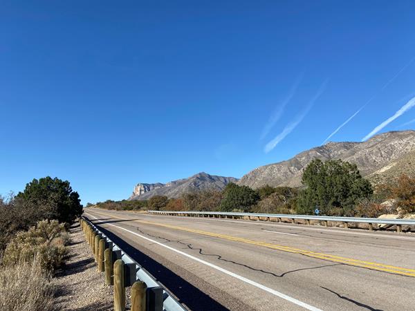
Every visitor to Guadalupe Mountains National Park travels U.S Highway 62/180. Connecting El Paso, Texas to Carlsbad, New Mexico, the highway provides breath-taking views of the park from the north, south, and west. The highway enters the park for five miles and a series of access roads provide access to park features.
Can I Take My Dog?
Opportunities for pets are limited. Leashed pets may walk on the short Pine Springs Campground connector trail or along the Pinery Trail from the visitor center to the Butterfield Stage Station.
Drive to the Salt Basin Dunes
The white gypsum sands of the Salt Basin Dunes rise 100 feet from the desert floor and provide a brilliant contrast to the dark, towering cliffs of the Guadalupe Mountains. This is a lesser used area of the park; a drive to the dunes provides excellent views of El Capitan and the western escarpment of the Guadalupe Mountains.
Search and Rescue Policy
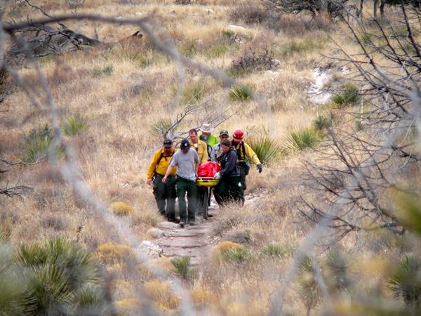
Search and rescue actions are conducted on a discretionary basis. The level and necessity of the response is determined through evaluation of the situation by field personnel. Rescuer safety is always our first priority. This park expects visitors to exhibit a high degree of self-reliance and responsibility for their own safety in line with the difficulty of their chosen activities. There is little to no cell reception in most areas of the park.
Leave No Trace
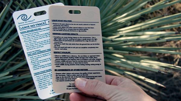
Each of us plays a vital role in protecting our national parks. As we spend time outdoors, in the natural world and in wilderness, it’s important to be conscious of the effects our actions may have on plants, animals, other people, and even entire ecosystems. Following the Leave No Trace Seven Principles, summarized below, can help us minimize those impacts.
Virtual Summit Log
When you reach a summit or other destination in the park, take a group photo or selfie in areas of the park and post to social media and include the hashtag #GuadalupeMountains #guadalupepeak #hunterpeak #lostpeak or others hashtags using your device and social media service.
Shop at the Park Store

The park store is operated by Western National Parks Association, an official non-profit partner of the National Park Service dedicated to supporting the educational mission of Guadalupe Mountains National Park. The park store has a wide range of books, maps, travel guides, and other items available for retail sale. These products complement the interpretive themes you experience when visiting the park. The park store is located in the Pine Springs Visitor Center.