Wrangell – St. Elias
Copper Center, AK
Amphitheater
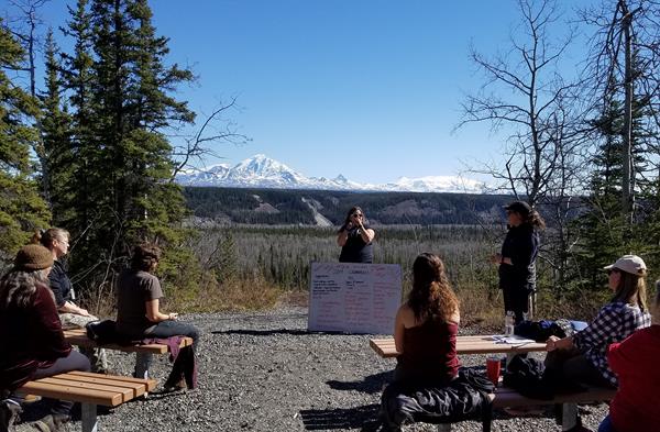
Rangers can present programs overlooking the bluff and view of the Wrangell Mountains (weather permitting) while the audience sits on benches arranged in a small outdoor amphitheater.
Boreal Forest Trail
The 1/2-mile loop Boreal Forest Trail follows even terrain, though wheelchair-users may need assistance. The trail passes along the river bluff, then cuts through the forest, connecting to a section of the historic Valdez Trail, the first all-American route into interior Alaska. View interpretive panels along the bluff overlooks and through the forest.
Bremner
Bremner is a glacier, river and mining camp within Wrangell-St Elias National Park. It is named after John Bremner, who in 1884-1885 was the first non-native person to live in the area and who prospected for gold along the Bremner River. Located just to the north of the Bremner River, it was the scene of an important placer gold discovery in 1902, and played a key role in the history of the Copper River Basin.
Bus Shelter waysides
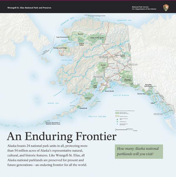
The Bus shelter is located in the parking area of the Wrangell-St. Elias Visitor Center in Copper Center. It has a picnic table and five interpretive wayside panels: An enduring frontier, Cant run never will - CRNW - Copper River Northwestern Railway, Intrepid travelers, Opening up the country, and Traversing the wilderness.
Chisana
Chisana (pronounced shoo-shana) is a small community inside Wrangell-St Elias National Park and Preserve, only accessible by plane or long snow machine ride in winter. It is located half-way between Nabesna and McCarthy, Alaska.
Chitina Ranger Station
Located at mile 33 Edgerton Hwy in Chitina, Alaska, about 1 hour southeast from the Wrangell-St. Elias Visitor Center complex. Call for season dates and hours of operation in Summer (907) 823-2205. Chitina Ranger Station is a must-stop for anyone visiting Chitina or venturing down the McCarthy Road to Kennecott. Hikers can obtain park information, backcountry trip-planning, and obtain bear and moose safety info. Federal subsistence fishing permits available.
Crystalline Hills Trail
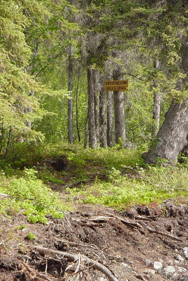
The Crystalline Hills north of McCarthy Road are composed mostly of gneiss and gabbro, but some of the lower slopes are made up of a light colored marble. These hills are an excellent place to see Dall Sheep up on the hills and hike up to nice scenic views.
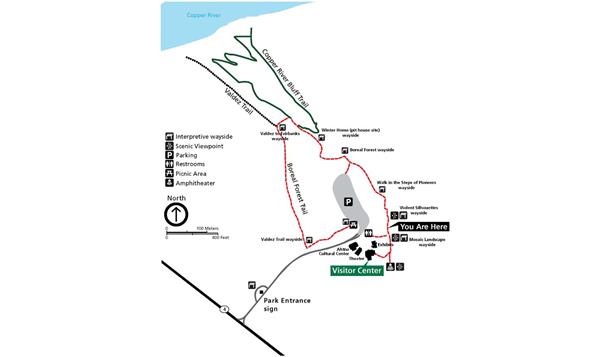
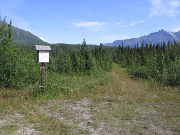
Entrance Loop Information Sign
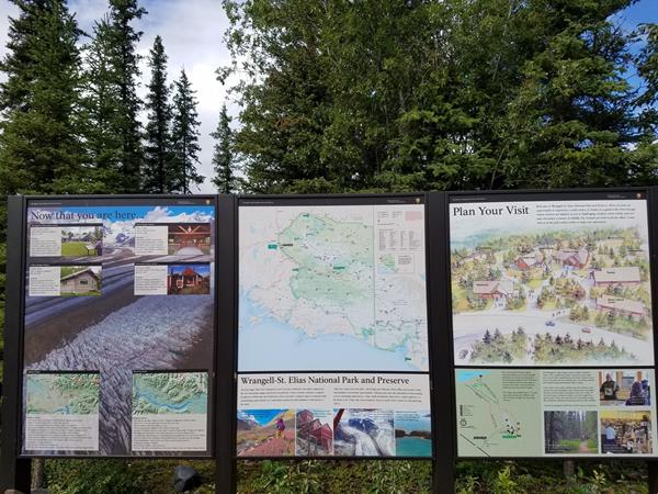
The Wrangell-St. Elias Entrance Loop Information Sign is located at the north end of the Headquarters driveway entrance loop, off the Richardson Hwy at mile 106.8 near Copper Center. There are three panels which include the park map, visitor center and ranger station locations, scenic images, map of the visitor center complex and map of the Bluff Overlook - Boreal Forest Trail.
Gilahina Trestle
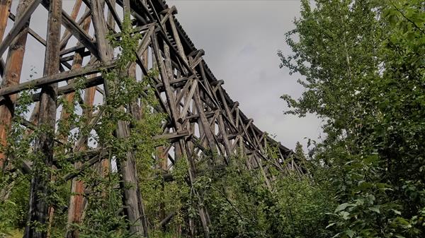
This wooden structure was originally 890 feet long and 90 feet high, required one-half million board feet of timber, and was completed in eight days in January of 1911. There are vault toilets and a 1/2 mile trail here that leads south from the toilets.<br />
Kendesnii Campground
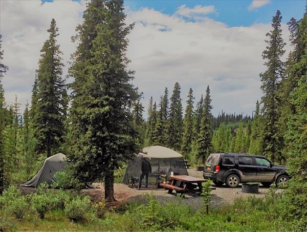
These ten campsites with picnic tables, fire rings, and toilets are on a first-come, first-serve basis. Enjoy the lakes, short hiking trails, interpretive waysides, canoeing, grayling fishing and waterfowl viewing. Parking will accommodate regular vehicles and small recreational camping vehicles (RV's). It is free and open year-round, but access is limited in winter since it is not snow plowed. There are no reservations required. Be bear aware. Pets on leash at all times.
Kendesnii Campground Interpretive Wayside
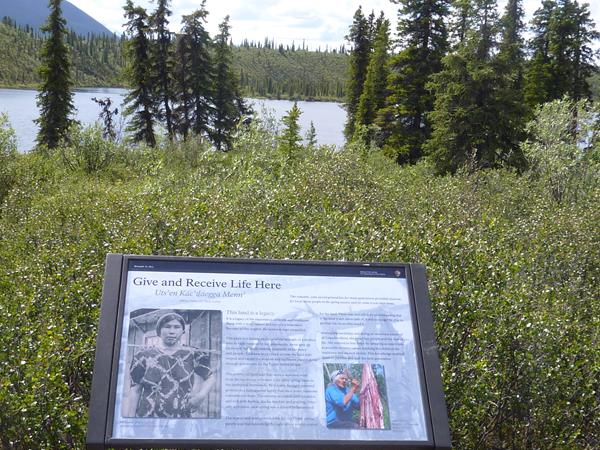
Called "Give and Receive Life Here" this cultural interpretive panel recognizes and pays tribute to Daisy Nicolai (Kendesnii is her Ahtna name) and her family’s connection to the site.
Kennecott Mines National Historic Landmark
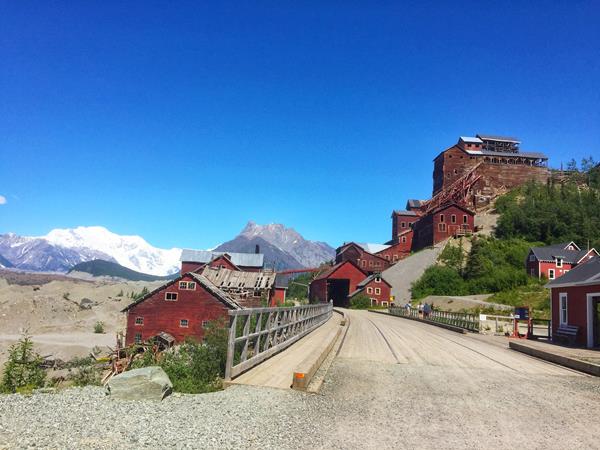
A vestige of an early 20th-century copper mining camp, Kennecott represents the mining techniques of the era. The mines here were among the nation's largest and contained the last of the great high-grade copper ore deposits of the American West.
McCarthy Road
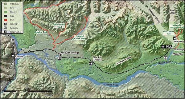
Containing the McCarthy Road and the towns of Chitina, McCarthy and Kennecott, this area is where history comes alive. The road follows the route of the previous CRNW Railroad, starting in the town of Chitina and ending a 1/2 mile before McCarthy at the Kennicott River footbridge. Walk, bike or shuttle 5 miles from the footbridge to Kennecott Mines National Historic Landmark. For more info, visit: www.nps.gov/wrst/planyourvisit/mccarthy-road-and-kennecott-area.htm
McCarthy Road Information Station
This wayside has posted information, restrooms, day-use only parking and a mile long trail to the west side of Kennicott Glacier.<br />
Nabesna Road
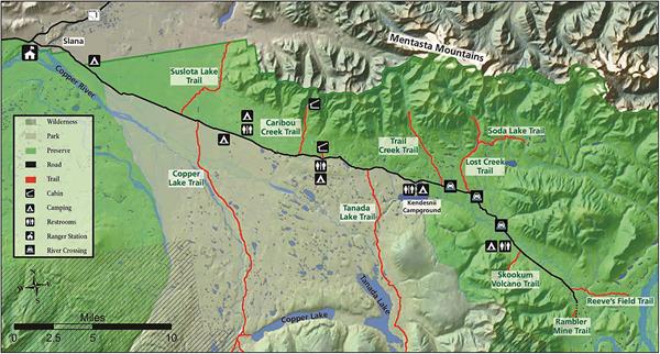
This area encompasses the Nabesna Road and nearby area. Starting at mile 60 of the Tok Cutoff Highway, the Nabesna Road starts at Slana and is nestled in a valley between two mountain ranges, the Alaska Range and the Wrangell Mountain Range. The scenic Mentasta Mountains are the foothills of the Alaska Range and there are several small lakes and rivers which offer endless opportunities for outdoor recreation. Drive, Hike, bike, picnic scenic views and wildlife viewing!
Public Use Cabins by reservation
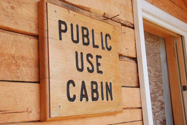
Public Use Cabins by reservation: https://www.nps.gov/wrst/planyourvisit/backcountry-cabins.htm Viking Lodge Cabin, access from Nabesna Road Caribou Creek Cabin, access from Nabesna Road Nugget Creek Cabin, access from McCarthy Road Esker Stream Cabin, access from Yakutat coastal area
Rambler Mine Trailhead
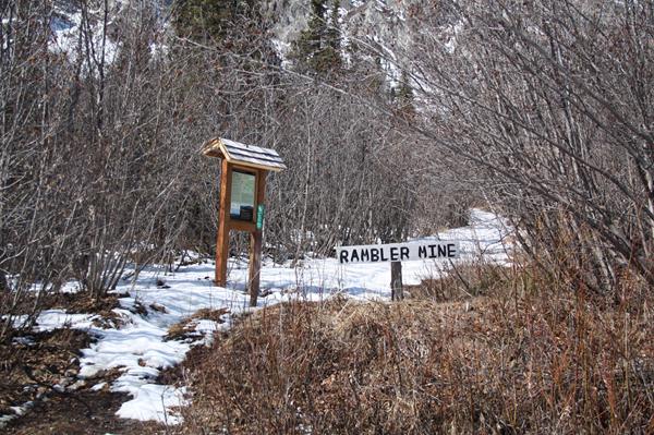
Mile 42.5 Nabesna Road. The maintained portion of the Nabesna Road ends at the Lodge, which is private property. Please respect this property and their privacy. Be careful not to park on the airstrip. Parking: Approximately a 1/4 mile beyond the lodge, there is a gravel parking area that is located on public land. Since the road is not maintained beyond this point, continue by foot to the Rambler Mine trailhead. The strenuous trail leads uphill (south) to the mine ruins.
Reeve's Field Trailhead
This 4.2 mile trail leads to the views of the Nabesna River. Though Reeve's Field airstrip is not longer here, this area is historically significant. During 1941, trucks hauled equipment from Valdez to a rustic airstrip along the river. Pilot Bob Reeve cut the equipment into pieces, loaded it into his Boeing Trimotor, flew them to Northway about 40 miles north and had them re-welded. This effort was to build the Northway Airport to defend Alaska during WWII.
Root Glacier
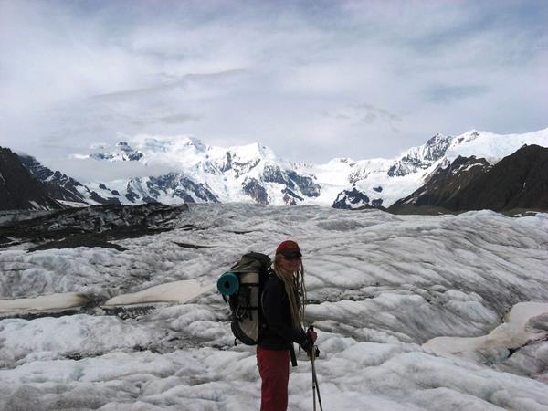
Of the 5,000 square miles of glacial ice in Wrangell-St. Elias, the Root Glacier is the most accessible. A moderate 1 ½ mile walk from the historic mining town of Kennecott along the Root Glacier Trail leads you onto the glacier. Be aware that glaciers can be dangerous. It is recommended to wear crampons or ice spikes on your shoes and go with an experienced guide.
Skookum Volcano
Mile 36.2 Nabesna Road. Skookum Volcano Trail is 2.5 miles one-way to a beautiful high pass. The trail leads through an extinct, deeply eroded volcanic system with fascinating geology two to four million years old. The elevation at the trailhead is 3,000' and rises to an elevation of 4,800' at the pass. Volcanic Ash and hot gasses formed a fiery cloud which flowed down the flanks of the volcano to produce the tan and light gray rocks. Lava formed the pink and rust colored roc
Slana Ranger Station
Located in the northern portion of the park, about two hours north of the Wrangell-St. Elias Visitor Center Complex. Slana is east of the Tok-Cutoff Hwy at mile 0.5 Nabesna Road. Call for season dates and hours of operation in Summer (907) 822-7401. The Slana Ranger Station provides information about the northern side of the park and the Nabesna Road as well as trip-planning, things to do, road conditions and subsistence ORV, fishing and hunting permits.
Valdez Trail wayside
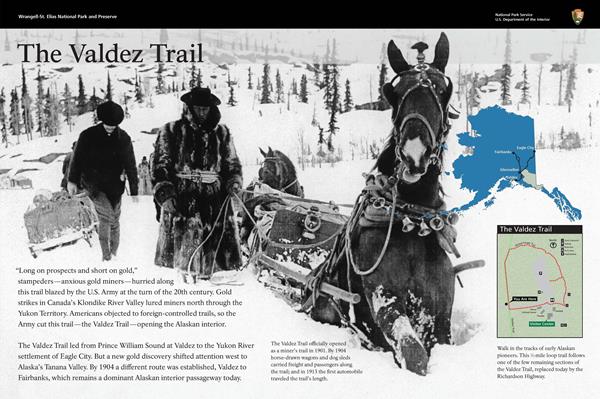
The historic Valdez Trail was used by stampeders from Valdez to the gold rush in the Yukon. A small section of the Valdez Trail is on the Boreal Forest Trail around the Copper Center Visitor Center.
Valdez to Fairbanks wayside
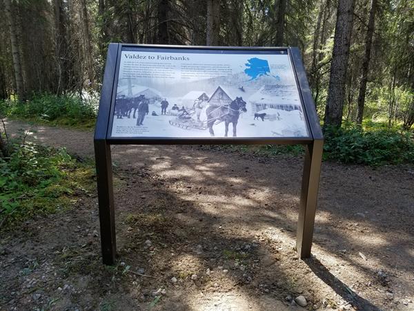
The historic Valdez Trail was used by stampeders from Valdez to the gold rush in the Yukon. A small section of the Valdez Trail is on the Boreal Forest Trail around the Copper Center Visitor Center.
Walk in the Steps of Pioneers wayside
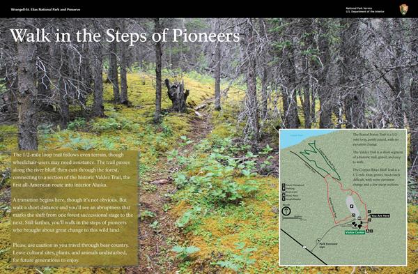
Walk in the Steps of Pioneers wayside overlook at the visitor center bluff and start of the 1/2 mile easy Boreal Forest Trail, with a small section of the historic Valdez Trail.
Winter Home (pit house site)
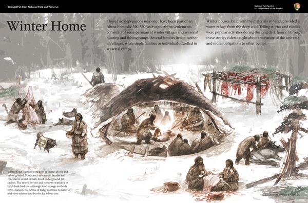
The two depressions on the west side of the trail may once have been part of an Ahtna homesite 300-500 years ago. Ahtna settlements consisted of semi-permanent winter villages and seasonal hunting and fishing camps. Several families lived together in villages, while single families or individuals dwelled in seasonal camps.
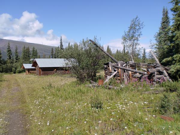
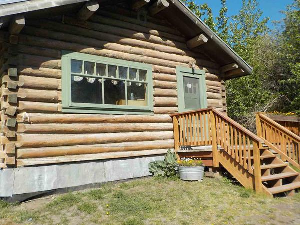
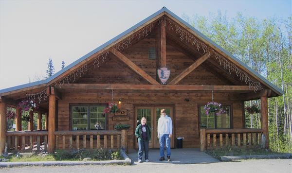
Wrangell-St Elias Visitor Center complex in Copper Center, Alaska
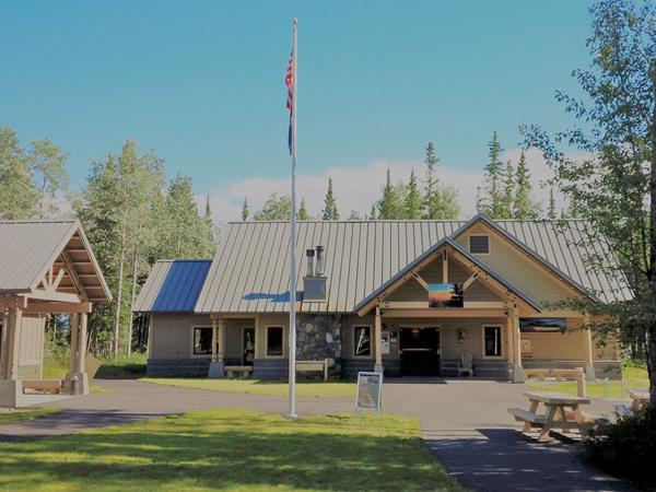
Located at mile 106.8 Richardson Highway, 10 miles south of Glennallen, Alaska. The campus-like setting includes: a visitor center, a park store, an exhibit hall, a theater, restrooms, picnic tables and a picnic shelter, an amphitheater, the Ahtna Cultural Center, scenic overlooks and short nature trails. Watch the park film, hike along the Copper River bluff, get park information and backcountry trip planning. Subsistence fishing and hunting permits are also available.