Shenandoah
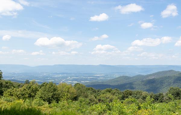
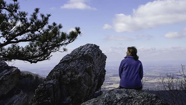
The Blue Ridge Mountains near Luray, VA
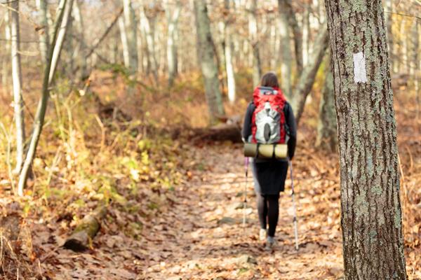
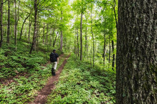
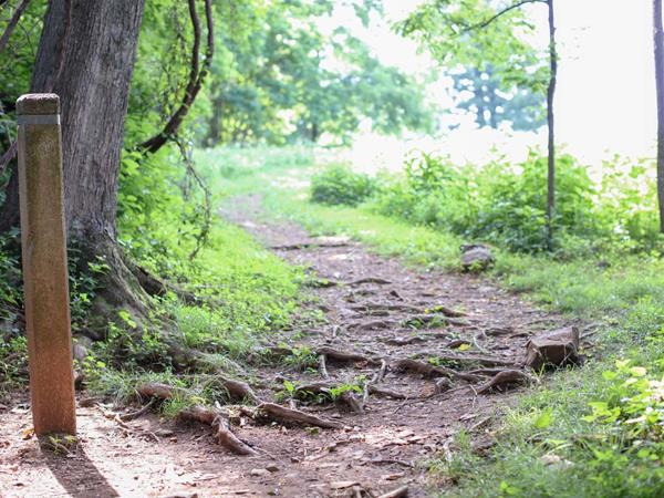
Appalachian Trail - Tanners Ridge Road Trailhead
Milam Gap Parking Area (Mile 52.8) | A fairly level hike that takes you through a former homestead on the famous Appalachian Trail.
Backcountry Registration: Appalachian Trail (North)
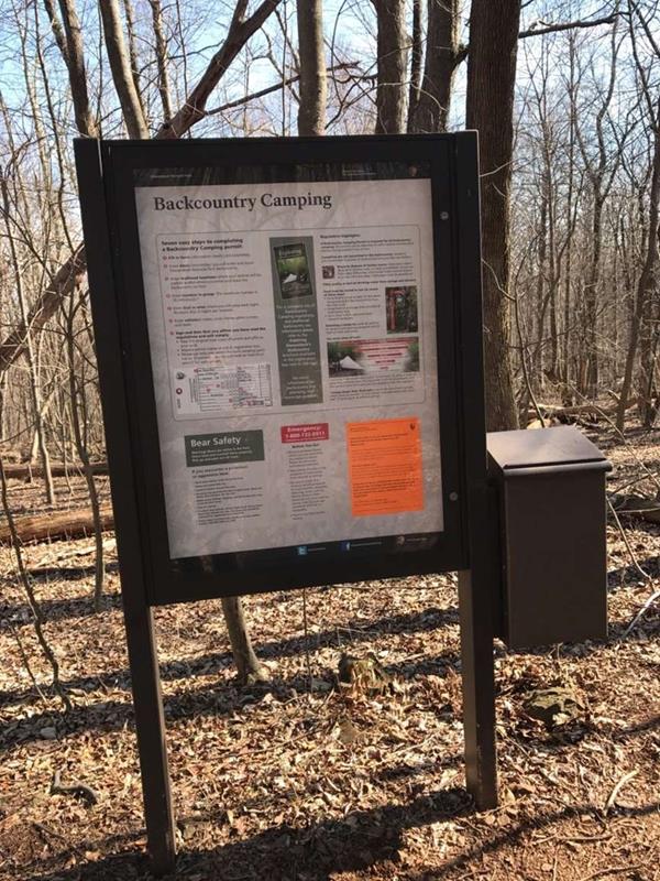
A free backcountry camping permit is required to camp in Shenandoah's backcountry. A permit can be filled out at this self-registration kiosk, located along the Appalachian Trail at the northern end of Shenandoah National Park. Note that this kiosk is not accessible by vehicle.
Beagle Gap
Beagle Gap contains a small parking lot with portable toilets and access to the Appalachian Trail.
Bearfence Rock Scramble Trailhead
Bearfence Parking Area (mile 56.4) | Pets are not allowed on this hike. An exhilarating rock scramble leads to a magnificent 360-degree view of the Virginia Piedmont and Shenandoah Valley.
Bearfence Viewpoint Trailhead
Bearfence Parking Area (mile 56.4) | Pets are not allowed on this hike. This route takes you to a 180-degree view of the Shenandoah Valley without a rock scramble.
Big Meadows
Skyline Drive (mile 51) | Perched on top of a mountain, this high-elevation meadow can come as a bit of a surprise after the miles of lush, green forests that make up most of Shenandoah National Park. A must-see for every visitor, stop by Big Meadows to explore the trails, grab a bite to eat, or talk to a Ranger at Byrd Visitor Center.
Blackrock Summit Trailhead
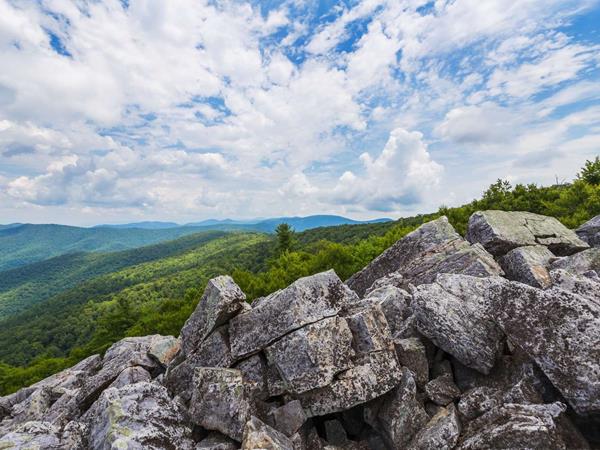
Blackrock Parking Area (mile 84.4) | A short hike to a viewpoint on top of a rocky talus slope with incredible views of the Shenandoah Valley, Massanutten Mountain, and beyond. This hike is also a designated TRACK Trail, featuring a self-guided brochure designed for kids.
Browns Gap Trailhead

Browns Gap Parking Area (mile 83) | This circuit hike leads you through designated Wilderness to Upper and Lower Doyles River Falls, as well as Jones Run Falls.
Cedar Run - Whiteoak Circuit Trailhead
Hawksbill Gap Parking Area (mile 45.6) | This hike is very challenging, although those who do it are rewarded with exceptional cascades and waterfalls.
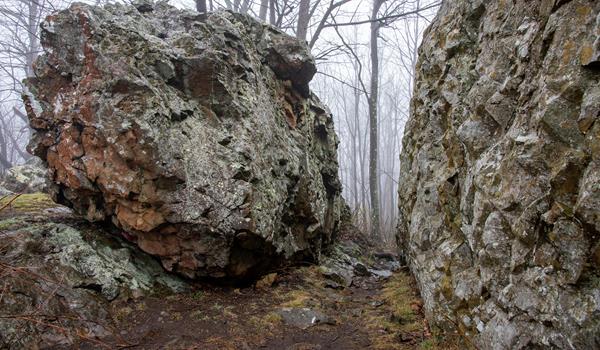
Chimney Rock Trailhead
Riprap Parking Area (mile 90) | An out-and-back hike to Chimney Rock, an excellent viewpoint with some very interesting geological features.
Compton Peak Trailhead
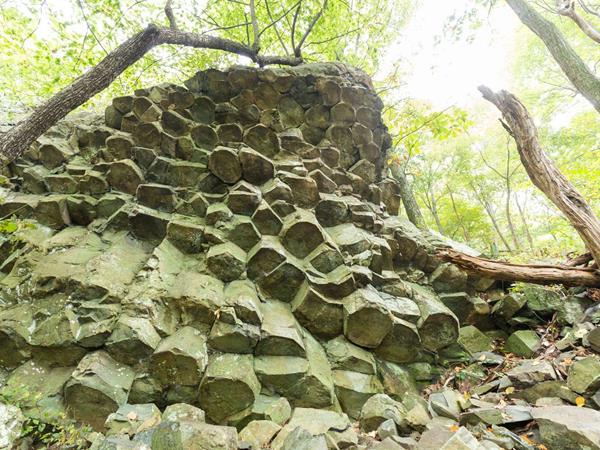
Compton Gap Parking Area (mile 10.4) | A hike through the forest along the Appalachian Trail to a western view and a great look at columnar jointing, an exciting geologic feature.
Dark Hollow Falls Trailhead
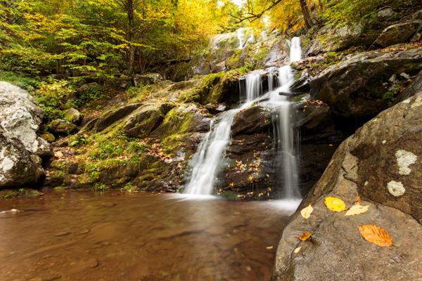
Dark Hollow Falls Parking Area (mile 50.7) | Pets are not allowed on this hike. This hike follows a stream to a beautiful waterfall, and is one of the Park’s most traveled trails. The trail is short, but very steep and rocky and the return hike is challenging!
Doyles River Falls Trailhead
Doyles River Parking Area (mile 81.1) | This beautiful trek through Wilderness takes you along cool, clear mountain streams to two unique waterfalls.
Fort Windham Rocks Trailhead
Compton Gap Parking Area (mile 10.4) | A short hike along the Appalachian Trail that leads to an interesting geologic feature.
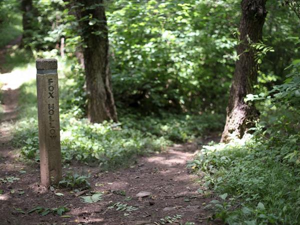
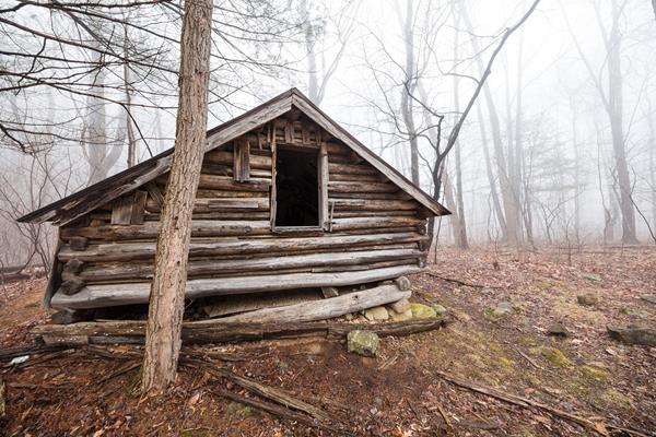
Fox Hollow First Trail Post: Tour Introduction
People once called this place home. Remnants of their lives and the impact they had on this land are still evident if you know where and how to look. In this hollow are the stories of people and a history obscured by the wild, rapid pace of natural flux.
Fox Hollow Right Turn: A Barn was Here
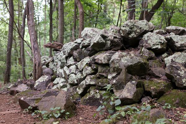
As the trail turns a sharp right, you are very near the location of a barn that belonged to a neighbor of the Foxes, Edgar Merchant. A short section of the trail here is on the Merchant property. Today, the rock foundation of Merchant's barn lies under thick spicebush and multiflora rose.After the turn, you will be walking along an old county road which once connected the Fox family to the town of Front Royal. To your left (and possibly not even visible through the dense fore
Fox Hollow Second Trail Post: The Fox Family
The family that chose this hollow as their home were named Fox. Thomas and Martha Fox started farming here - on this ground - in 1856. Their son Lemuel Franklin Fox and his wife, Lucy, planted bluegrass pastures, corn, and wheat after Lemuel returned from the Civil War. Lemuel's grandson Lemuel Fox Jr. courted his future wife, Maude Vaught on the family property. By the time of the establishment of Shenandoah National Park, the Foxes and extended family lived in several frame
Fox Hollow Third Trail Post: Out in the Clearing
As you approach the third trail post, take a second to look out at the clearing. As the forest opens up, imagine what the whole hollow would have looked like if it were cleared like this. When you think about living in the mountains, do you think of a hollow - low, narrow, enclosed on either side - or do you think of a home with a sweeping view? The cleared pastures and farmland certainly would have created some views for the Fox family, but the view was a secondary considera
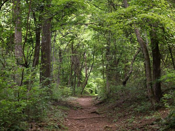
Fox Hollow Trailhead
Dickey Ridge Visitor Center (Mile 4.6) | Pets are not allowed on this hike. Discover the cultural history of Shenandoah National Park as you pass by historic rock walls, a cemetery, and periwinkles planted by former residents. This hike is also a designated TRACK Trail, featuring a self-guided brochure designed for kids.
Frazier Discovery Trailhead
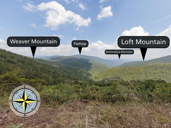
Loft Mountain Wayside (mile 79.5) | Pets are not allowed on this hike. This hike features several picturesque overlooks as it passes through woodlands of varying ages on Loft Mountain.
Front Royal Entrance
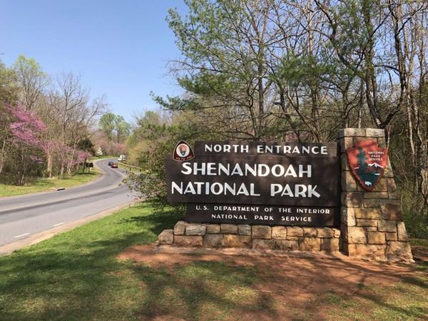
Entering the park here at its northern entrance gives you an opportunity to travel south along Skyline Drive's entire length and experience the beauty of Shenandoah National Park. You'll notice mile posts on your right as you travel. Use these as references to find everything from dining and lodging to trails and visitor centers. Be sure to stop at beautiful, historic Dickey Ridge Visitor Center at mile 4.6 for information, an orientation movie, guides and books, and more! Yo
Hawksbill Loop Trailhead
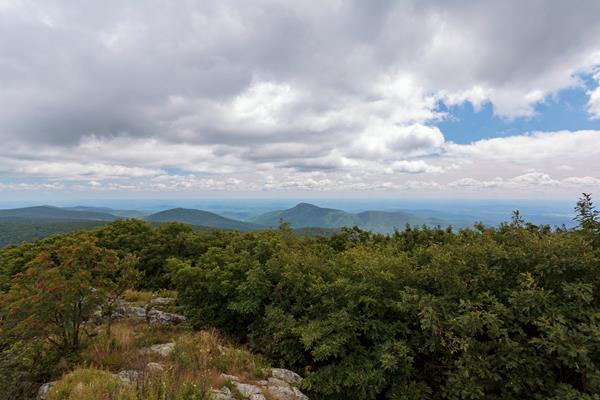
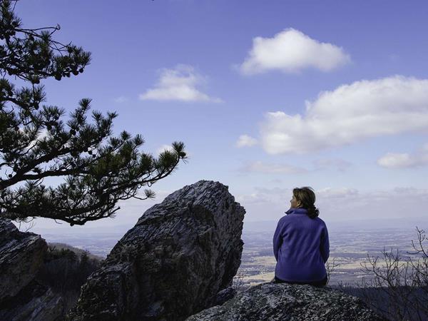
Hawksbill Gap Parking Area (mile 45.5) | A circuit hike to Shenandoah’s highest peak. The viewing platform on top of Hawksbill offers a magnificent 360-degree view of the Shenandoah Valley, the Blue Ridge Mountains, and the Virginia Piedmont.
Hawksbill Summit Trailhead
Hawksbill Gap Parking Area (mile 45.5) | A shorter, yet steeper route to Shenandoah’s highest peak. The viewing platform on top of Hawksbill offers a magnificent 360-degree panoramic view of the Shenandoah Valley, the Blue Ridge Mountains, and the Virginia Piedmont.
Hawksbill Summit via Upper Hawksbill Trailhead
Upper Hawksbill Parking Area (mile 46.5) | A hike to the top of Shenandoah’s highest peak, offering 360-degree views of the Shenandoah Valley, the Blue Ridge Mountains, and the Virginia Piedmont.
Hazel River Falls Trailhead
Meadow Spring Parking Area (mile 33.5) | A trail that leads you through a rugged section of the Park to an exceptional waterfall.
Hightop Summit Trailhead
Hightop Mountain Parking Area (mile 66.7) | Wind your way up a ridge on this hike to a rocky viewpoint that stands at 3,296 feet.
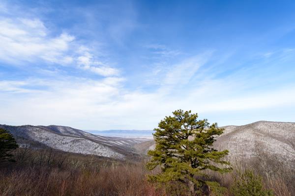
Ivy Creek Overlook
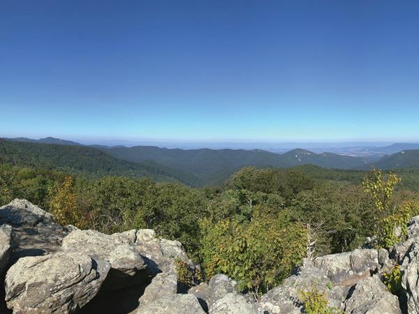
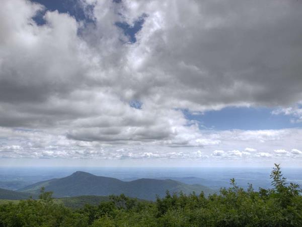
Facing east from an elevation of 2,890 ft (880 m), you will look out to the rolling ridges of Shenandoah National Park from Ivy Creek Overlook. The Appalachian Trail intersects with this overlook, as well.
Jones Run Falls Trailhead
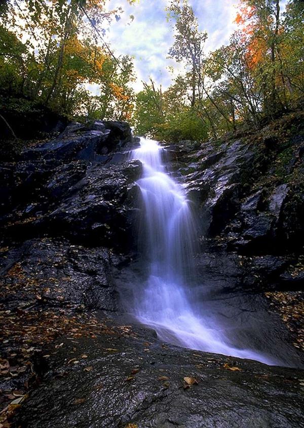
Jones Run Parking Area (mile 84.1) | This hike takes you over a mountain stream, through the forest, and beside a 42’ waterfall.
Knob Mountain - Jeremys Run Trailhead
Elkwallow Wayside (mile 24) | This hike goes around a beautiful area of the Park featuring one of the most picturesque streams in Shenandoah.
Lake Arrowhead
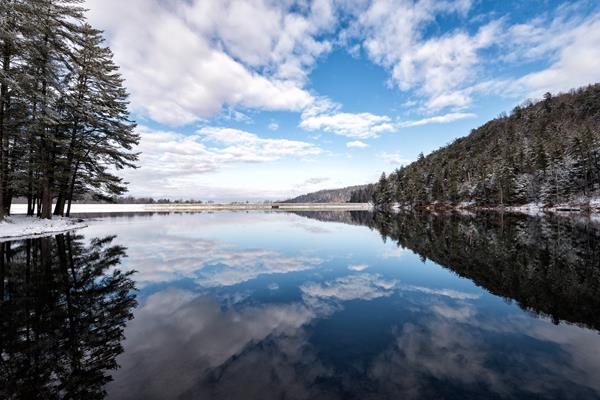
From many west-facing overlooks you can see a large lake in the valley. It is Lake Arrowhead and serves as a reservoir and a recreation area for the neighboring town of Luray. Lake Arrowhead features 6 picnic shelters for rent (Call 540-743-5511 for availability), fishing, white sand beach and swimming during the summer, ball field, volleyball nets, horseshoe pits, playground, 1 mile trail that circles the lake, and the Edwin Smith scout camping area. The physical address is
Lands Run Falls Trailhead
Lands Run Parking Area (mile 9.2) | A short hike down a fire road to a series of cascades that descend about 80 feet into a gorge. Note that it may not have water in dry seasons.
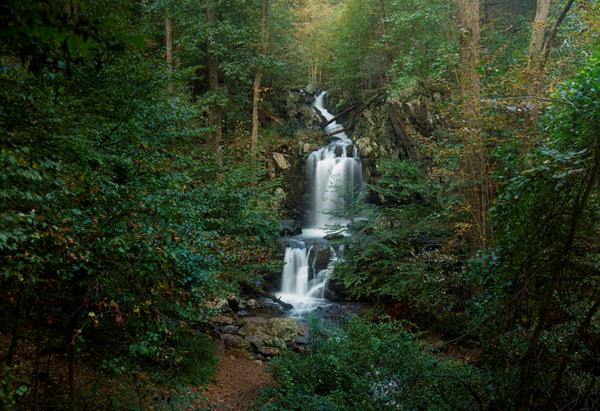
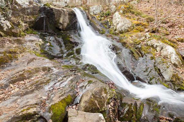
Lewis Falls Trailhead
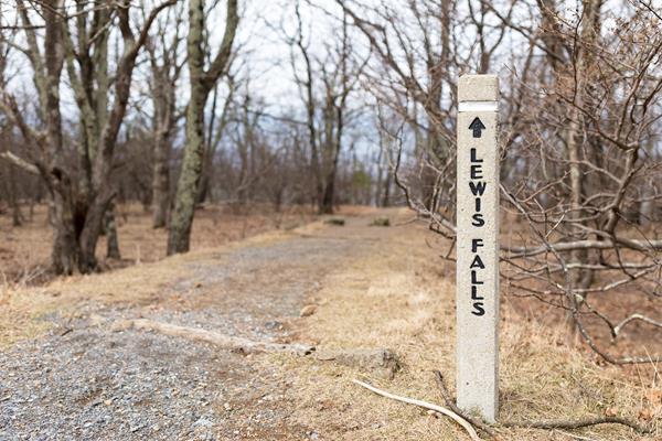
Big Meadows Amphitheater (mile 51.2) | This hike leads to an observation point over a beautiful 81’ waterfall.
Limberlost Trailhead
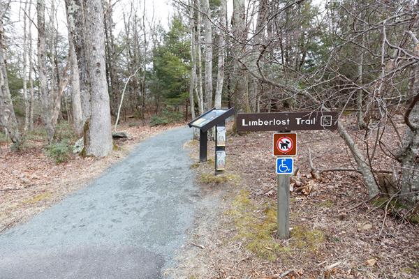
Limberlost Parking Area (mile 43) | An ADA accessible path through the forest with mountain laurel in the springtime and an example of a columnar jointing geological feature. This hike is also a designated TRACK Trail, featuring a self-guided brochure designed for kids.
Little Devils Stairs Loop Trailhead
Keyser Run Parking Area (mile 19.4) | A journey into a rocky gorge with some very rewarding, yet steep, sections along a stream.
Little Hogback Overlook
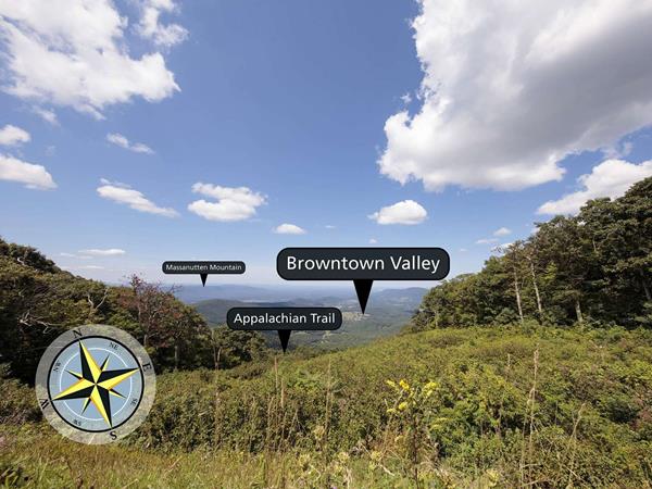
Looking north-northeast from an elevation of 3,035 ft (925 m), Little Hogback Overlook gives you a narrow window from which to view Browntown Valley. A section of the Appalachian Trail runs directly below this overlook.
Marys Rock Summit Trailhead
Panorama Parking Area (mile 31.5) | Many legends surround the name of this hike, but there is no denying the beautiful westward views that it provides of the Shenandoah Valley and Massanutten Mountain.
Mill Prong - Laurel Prong Loop Trailhead
Milam Gap Parking Area (mile 52.8) | A circuit hike to Camp Rapidan, the rustic getaway of President Herbert Hoover and First Lady Lou Henry Hoover. Today, this restful spot features exhibits on the First Couple and their perspectives.
Millers Head Trailhead
Skyland Amphitheater (mile 42.5) | Take this hike to a spectacular viewpoint at the site of a former fire tower.
Nicholson Hollow via Park Boundary Trailhead
Old Rag Parking Area (Park Boundary) | An alternate option for visitors with pets who still wish to hike from the Old Rag parking area. This hike takes you to Corbin Cabin, an old homesite built by a former resident, and features several stream crossings along the way.
Old Rag Circuit Trailhead
Old Rag Parking Area (Park Boundary) | Visitors must obtain an Old Rag day-use ticket in advance of this hike. Pets are not allowed. Old Rag is a popular, very strenuous hike with sweeping views and several scrambles across large rocks. This route starts from the Old Rag parking area on the boundary of the Park.
Old Rag Summit via Berry Hollow Trailhead
Berry Hollow Parking Area (Park Boundary) | Visitors must obtain an Old Rag day-use ticket in advance of this hike. Pets are not allowed. Old Rag is a popular, strenuous hike with sweeping views. This route starts from the Berry Hollow parking area and allows you to get to the summit without having to navigate the rock scramble.
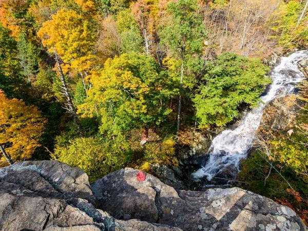
Overall Run Falls Trailhead
Mathews Arm Campground (mile 22.1) | A hike through federally designated Wilderness to a view of the highest waterfall in the Park at 93 feet. Unless rain is plentiful, Overall Run Falls may have minimal to no water flow.
Pass Mountain Loop Trailhead
Panorama Parking Area (mile 31.6) | A hike along the Appalachian Trail to a shelter. Be on the lookout for wildflowers and birds through the fairly open woods along the trail!
Pinnacles Overlook
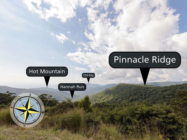
Looking south from an elevation of 3,320 ft (1011 m), Hannah Run and Old Rag Mountain can be seen from Pinnacles Overlook.
Rapidan Camp - Five Tents
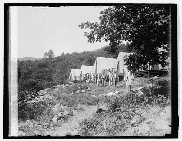
From here, you can take the trail to the site of the Hoovers' first night's stay at their new camp. Originally, "Five Tents" was just that: five army tents on wooden platforms. From this vantage point, the Hoovers planned their retreat. Despite eventually becoming a wood-sided much more permanent structure, the building retained its original name. "Five Tents" was one of the ten structures removed during the 1960s renovations. The fireplace remains mark the location of the fo
Rapidan Camp Road and Mill Prong Trail Intersection

Depending upon how you traveled to Rapidan Camp, you will be coming off the trail or arriving via the road. If you used Mill Prong Trail to hike in, go right and follow the road to the signs where the Camp tour begins. If you came via the road, continue straight.
Rapidan Camp Trailhead
Milam Gap Parking Area (mile 52.8) | A hike, featuring three stream crossings, to the rustic getaway of President Herbert Hoover and First Lady Lou Henry Hoover. Today, this restful spot features exhibits on the First Couple and their perspectives.
Riprap - Wildcat Ridge Trailhead
MILE 90 or 92.1 | This loop can be hiked from Riprap Parking or Wildcat Ridge Parking Areas. It takes you through pristine forest, over several stream crossings, and offers beautiful views of the hollows and valley to the west and north.
Robertson Mountain Trailhead
Old Rag Parking Area (Park Boundary) | Pets are not allowed on the Ridge or Saddle Trails, although an alternate route is available for pet owners who still wish to do this hike. This hike does not ascend to the summit of Old Rag, but does provide a great view of the mountain.
Rockfish Gap Entrance
Rockfish is the southern entrance to Shenandoah National Park. From here you can travel north through Shenandoah National Park. Be sure to notice the mile markers. Use those to find dining, lodging, visitor centers, trailheads, and more. You are starting at mile 105; numbers will descend as you travel north. The first 20 miles or so will be through the quietest part of the Park with beautiful vistas overlooking federally designated wilderness. The Loft Mountain area at mile 7