Sequoia & Kings Canyon
Three Rivers, CA
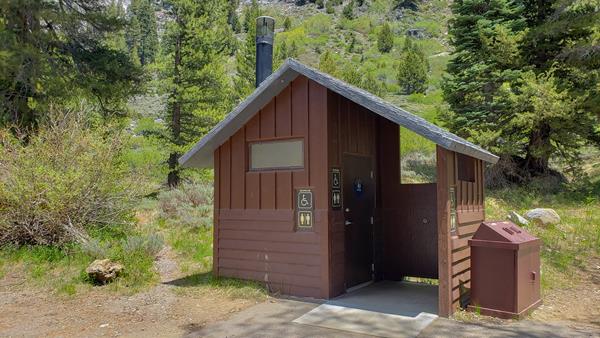
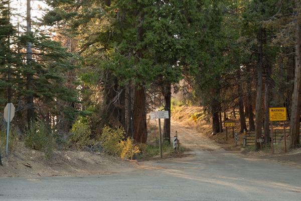
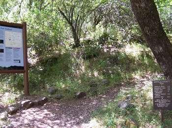
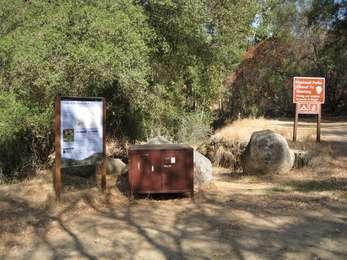
Atwell-Hockett Trailhead
Atwell-Hockett Trail leads 10 miles one-way (20 miles round-trip) at a moderate slope through sequoia trees and up to Hockett Meadow. The first campsite along the trail is at 6 miles at Clover Creek. Other wilderness destinations include Evelyn Lake, Cahoon Rock, and the Golden Trout Wilderness, which is outside national park boundaries in Golden Trout Wilderness.
Big Baldy Trailhead
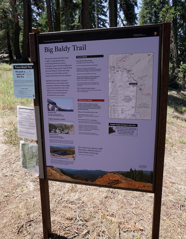
This trailhead orientation panel shows a map and images of the Big Baldy Trail area.<br /><br />The Big Baldy Trail leads 2.2 miles one-way (4.4 miles round-trip) at a gentle slope along a ridge toward panoramic views of Kings Canyon and the Great Western Divide. This trail is for day-use only; overnight camping is not allowed.
Big Meadows Road Access
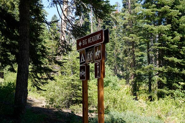
On Forest Service land between the park areas of Grant Grove and Lodgepole, this road accesses primitive campgrounds, the Big Meadows Pack Station, and Buck Rock Fire Lookout.<br /><br />This road can close, especially in the winter when conditions are snowy or muddy.
Big Stump Picnic Area and Snowplay Area
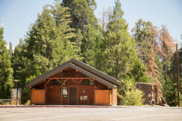
The first rest area after the park entrance station on Highway 180, makes this a perfect spot to get your bearings after the drive up from the San Joaquin Valley. It includes the trailhead for the Big Stump Trail, which leads to the Mark Twain Stump via a 1.5-mile (2.4 km) hike. A small staircase on the stump lets you climb onto it.
Big Trees Trailhead
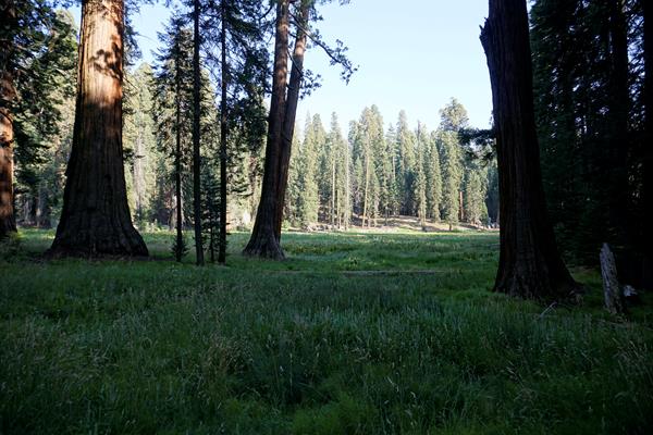
Big Trees Trail circles Round Meadow in a 0.7 mile loop. It is flat, paved, and has benches along the way. Informational displays offer insight into what you are experiencing. Watch for yellow-bellied marmots, bears, and other wildlife. After taking this trail, consider walking the Hazelwood Meadow Trail on the other side of the road; it leads through another part of the grove.
Boole Tree Access
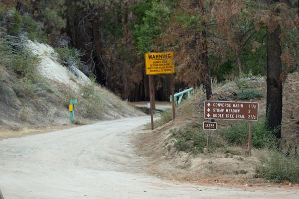
This 2.5-mile trail in the national forest outside the park leads to the magnificent Boole Tree, one of the few monarch sequoias spared by 19th-century logging. It also offers great views over and across the Kings River country. Take Highway 180 2.5 miles north of Grant Grove, and turn onto the dirt road. In about 2 miles, you pass through aptly named Stump Meadow, the remnants left by an 1800s logging operation.
Buena Vista Trailhead
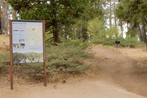
From here hike up to Buena Vista Peak and its 360-degree view of park, forest, and California's huge Central Valley. It's a two-mile round-trip hike, making it one of the most easily accessible peaks in the park. This uphill walk is fairly gentle.
Cherry Gap
This Forest Service area 3 miles (4.8 kilometer) north of Grant Grove is part of the Converse Basin sequoia grove. From Cherry Gap, you can take roads to the Chicago Stump.
Cold Springs Nature Trail - Western Trailhead
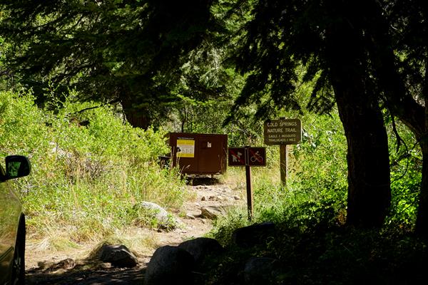
This trailhead orientation panel shows a map and images of Cold Springs Nature Trail.<br /><br />Cold Springs Nature Trail is 2.0 miles round-trip (3.2 kilometer) at an easy incline. It travels through meadows and aspen groves to the site of the former mining town of Beulah. The trail features interpretive panels, which give more information about your surroundings. This trail is for day-use only; overnight camping is available at the Cold Springs Campground.
Congress Trailhead
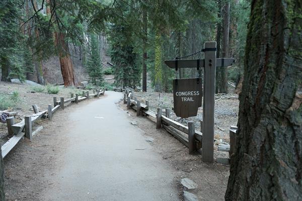
This trailhead orientation panel shows a map and images of the Congress Trail. Congress Trail is a 2.7 mile round-trip lollipop-shaped trail on a gentle, paved incline. It begins near the General Sherman Tree, the largest living tree on Earth. Along the path, you'll also see excellent examples of mature sequoias, including the House and Senate groups, and the President Tree.
Copper Creek
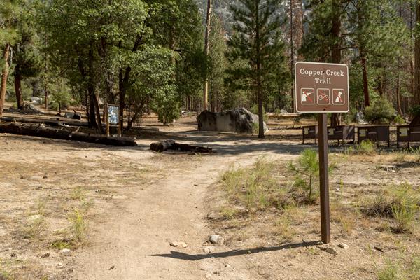
This trailhead orientation panel shows a map and images of the Copper Creek Trail area.Copper Creek Trail is 10 miles one-way (20 miles round-trip) at a difficult incline. The trail travels through several aspen forests and meadows, ending at Granite Lake, a stop that offers beautiful vistas of Mount Hutchings, Goat Mountain, and Comb Spur. The first campsite along the trail is at 4 miles at Lower Tent Meadow. This is a hot, steep climb, so you may want to plan your hiking fo
Crescent Meadow Picnic Area and Trailhead
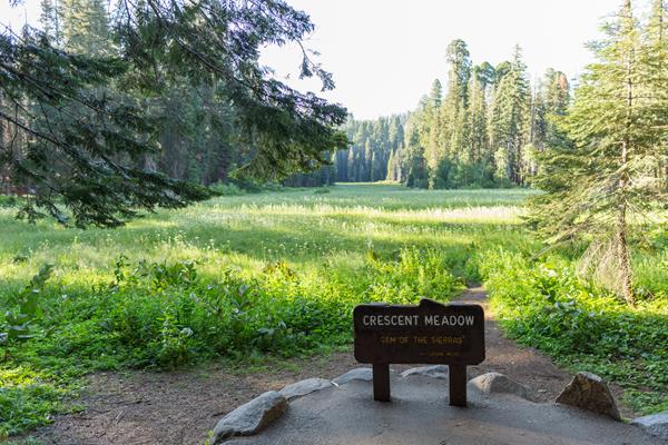
The Crescent Meadow Picnic Area is 2.6 miles from the Giant Forest Museum, near Moro Rock and several trailheads. The picnic area rests at the edge of a lush meadow.
Crescent Meadow Shuttle Stop
Due to COVID-19, the Sequoia Shuttle will not be operating for the 2020 summer season. This Sequoia Shuttle stop is located at Crescent Meadow, one of the larger meadows in these parks and the starting point for several hikes. Sequoia Shuttles run from late May until early September. Riding the shuttle helps you avoid having to find parking, which can be limited. It also reduces air pollution within our parks.Shuttles within the park are free; round-trip shuttles from Visali
Crystal Cave
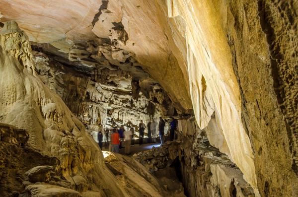
Crystal Cave is an excellent example of a marble cavern. There is a moderately steep (but paved) half-mile trail from the parking area to the cave entrance. The trail through the cave is also one half mile. Because of fragile formations, the only way to visit the cave is on a guided tour.
Crystal Cave Parking & Trailhead
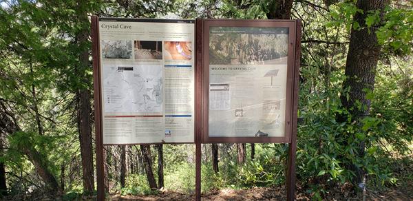
Here, you will find an expansive parking lot, restrooms, and an orientation panel that shows a map and images of Crystal Cave. The Crystal Cave Trail descends 0.5 miles at a moderately steep incline to Crystal Cave.
Don Cecil Trailhead
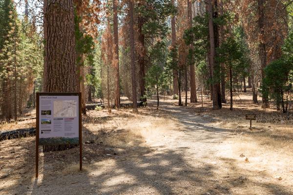
The 4.4 mile one-way (8.8 mile round-trip) Don Cecil Trail is a steep climb along the north-facing slope of Kings Canyon. If you're looking for a shorter hike, Sheep Creek Cascade is about a mile up the trail and offers a shady spot to sit and relax. This historic trail was the major access route to Cedar Grove prior to the completion of Highway 180 in 1939. This trail is for day-use only; overnight camping is not allowed.
Dorst Campground Shuttle Stop
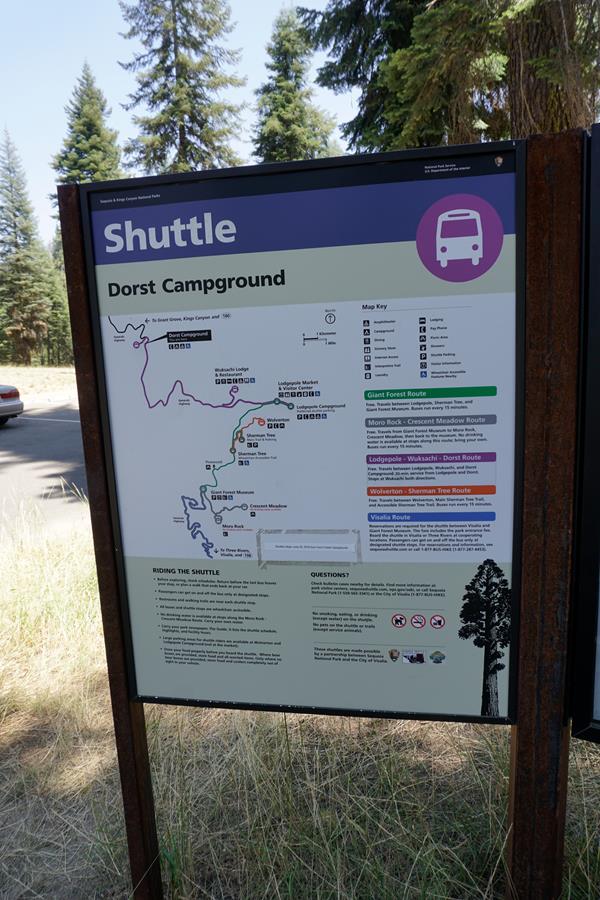
Shuttle info (seasonal): From here, the Purple Route of the free park shuttle travels to Lodgepole Visitor Center and Campground, and to Wuksachi Lodge and Restaurant. Transfer at Lodgepole to shuttles that travel to the Giant Forest and Moro Rock / Crescent Meadow Road.Sequoia Shuttles run from late May until early September. Riding the shuttle helps you avoid having to find parking, which can be limited. It also reduces air pollution within the parks. Shuttles within the pa
Eagle-Mosquito Trailhead
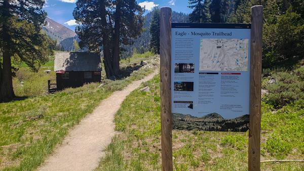
This trailhead orientation panel shows a map and images of the area around Eagle Trail and Mosquito Trail. Eagle and Mosquito Lakes trails share the same route for the first 2 miles. At Eagle Basin, Eagle Lake Trail travels to the left for 3.4 miles one way. Mosquito Lake Trail travels right 3.6 miles to Mosquito Lake #1. The first campsite along the trail is 4 miles from the junction (6 miles from the trailhead) at Mosquito Lake #2. Both trails are moderately strenuous and
Farewell Gap-Franklin Lakes Trailhead
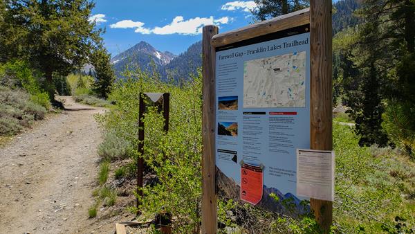
This trailhead orientation panel shows a map and images of the area around Farewell Gap Trail and Franklin Lakes Trail.
Garfield Grove Trailhead
If you'd like to experience a remote sequoia grove, consider the Garfield-Hockett Trail. It's a relatively steep 5-mile one-way climb to the Garfield Sequoia Grove, then levels out beyond the grove as it approaches the Hockett Plateau. The first campsite along the trail is 4 miles from the trailhead at Snowslide. <br /><br />As you hike, look for views of Homer's Nose, a prominent granite dome that can be seen from Visalia.
General Grant Tree Trailhead
You are about to travel among some of the giants of the world. The General Grant Trail is an easy, 0.5 mile loop through the Grant Grove of sequoias.The grove's namesake, the General Grant Tree, is the second-largest tree by volume in the world. (The largest is the General Sherman Tree, also in Sequoia Kings Canyon National Parks.) President Coolidge proclaimed the General Grant Tree as the Nation's Christmas tree in 1926. You can also visit the historic Gamlin Cabin here.
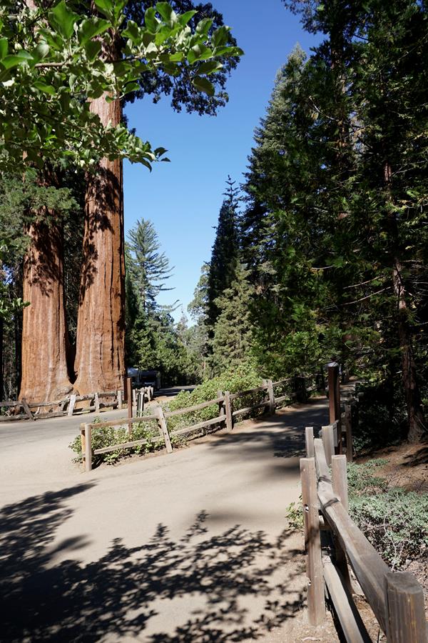
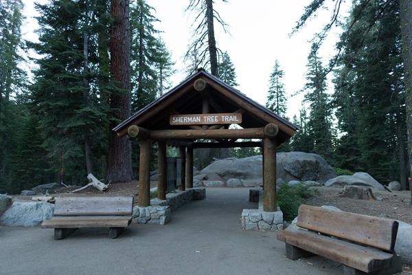
General Sherman Tree
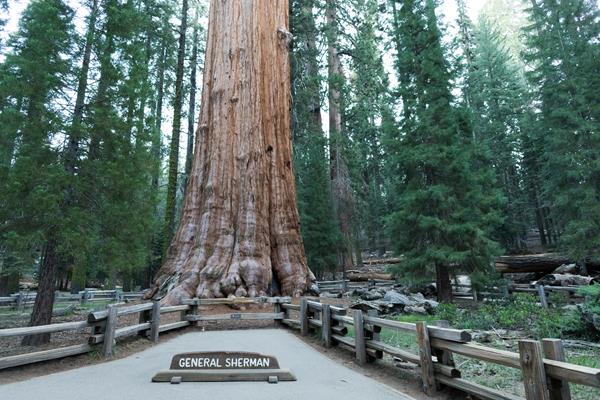
There are taller trees, and wider trees, but the General Sherman Tree contains more wood (volume) in its trunk than any other tree on Earth. Behind the Sherman Tree are the General Grant, President, Lincoln, and Stagg trees. Another measure of tree volume is the total biomass of the tree-trunk, branches, roots, and foliage. If we measure the biomass, the Sherman Tree still ranks at #1, but the General Grant Tree loses second place to the President Tree.
General Sherman Tree Accessible Trailhead
This trailhead orientation panel shows a map and images of the General Sherman Tree Accessible Trail area.<br /><br />You are getting close to the famous General Sherman Tree. The volume of wood in its trunk alone makes it the largest tree in the world. <br /><br />This trail runs from the accessible parking lot to the General Sherman Tree. If you do not have a disability plate or placard to park here, please park at the Main Sherman Tree Parking Lot and take the shuttle to this trailhead.
General Sherman Tree Main Trailhead
You are getting close to the famous General Sherman Tree. The volume of wood in its trunk alone makes it the largest tree in the world. As you walk the 0.8 miles to it, you'll pass many other spectacular giants as well. At the bottom of the trail, you can stand by a cross section of a sequoia trunk that was cut years ago. Because this trail goes downhill to where the giant grows, your walk offers the unique experience of seeing the Sherman Tree from top to bottom.
Giant Forest Museum Trail Center
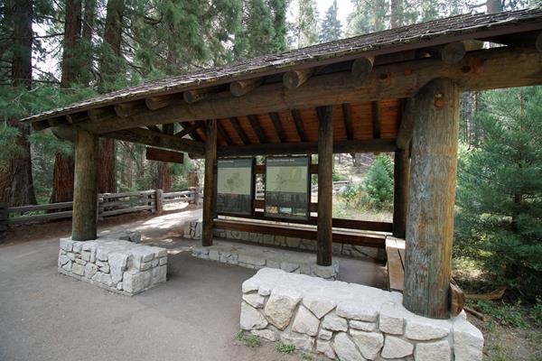
Trails from here can lead you past the giant trees and lush meadows in this sequoia grove, whether you are an experienced hiker who wants to see miles of the parks or you would just like a gentle half-hour walk. Trails in this area can be confusing. We recommend purchasing a trail map at the museum for all but the shortest hikes.
Hazelwood Nature Trail Trailhead
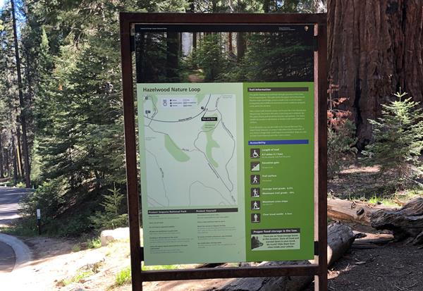
The Hazelwood Nature Trail features a 0.5-mile (0.8-km) loop trail. Along the Hazelwood Nature Trail you will walk through a mixed-fir forest with towering giant sequoias, and encounter a meadow. Along the trail, several exhibit signs provide information about the plants and and how they survive the seasons.
Hazelwood Nature Trail-Alta Trail Junction
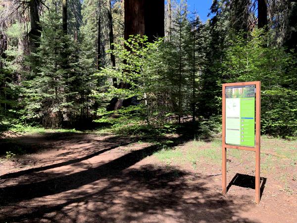
This trailhead sign includes a map indicating the junction of the Hazelwood Nature Trail Loop with the Alta Trail, which heads west towards the Giant Forest Museum.
High Sierra Trailhead
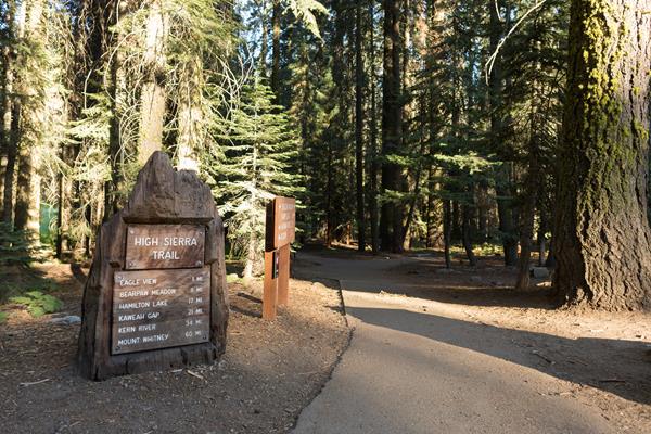
The historic High Sierra Trail is a marvel of engineering that stays relatively level for its first portion, offering views of wilderness without the steep climbs of other park trails. Hike 11 miles one-way (22 miles round-trip) to Bearpaw Meadow, where you can camp in designated sites or, with reservations, enjoy the luxury of Bearpaw High SIerra Camp. The trail travels through forests and oaks, along canyons, and reaches subalpine meadows.
Hospital Rock River Trailhead
A short steep downhill climb will lead you to the Kaweah River, which is one of the most scenic spots in all of the foothill region of the park.
Hotel Creek Trailhead
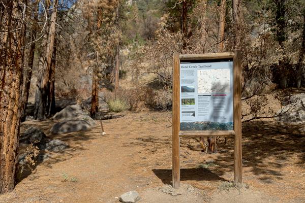
The 6.9 mile (11.1 KM) loop Hotel Creek Trail has a steep incline. The trail was iburned over during the 2015 Rough Fire but is recovering. It climbs through a ponderosa pine forest to views of Monarch Divide and other peaks. Parking is limited at the trailhead. Alternative parking is available at Cedar Grove Lodge, which adds 0.5 miles (0.8 km) to the trip.
Ladybug Trailhead
This 4.2 mile (6.8 km) one-way trail, or 8.4 mile (13.5 km) out and back, is a moderate climb. After traveling through forests and passing over creeks, the path reaches Ladybug Camp, where ladybugs can be found during cooler months. The route then narrows and heads uphill to giant sequoias and Whiskey Log Camp.
Lakes Trailhead
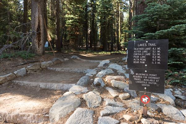
This trailhead orientation panel shows a map and images of the Lakes Trail area. The 6 mile one-way Lakes Trail is a moderately strenuous climb up through meadows and forests, along granite cliff overlooks, and to several lakes. Heather and Aster lakes are closed to overnight use. Camping is available five miles from the trailhead at Emerald Lake and at the end of the trail, six miles from the trailhead, at Pear Lake.
Lewis Creek Trailhead
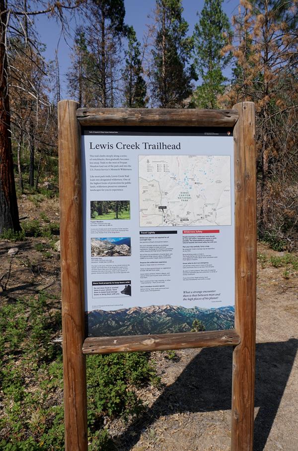
This trailhead orientation panel shows a map and images of the Lewis Creek Trail area.
Little Baldy Trailhead
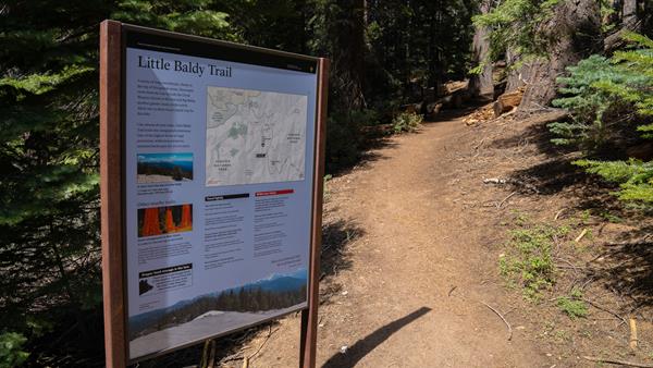
This trailhead orientation panel shows a map and images of the Little Baldy Trail area. Little Baldy Trail travels 1.7 miles (2.7 km) at an easy incline to the granite dome of Little Baldy, which features views of the lower portion of the Great Western Divide, Kaweah Peaks, and Sillman Crest.
Lodgepole Campground
This large, popular campground is on the Marble Fork of the Kaweah River within easy walking distance of Lodgepole Village. Many campsites are surrounded by lodgepole pine forest. In summer, this campground has 214 sites for tents, RVs, and trailers. In fall and spring, there are 16 walk-in tent sites and a limited number of RV sites, and
Lodgepole-to-Sherman-Tree Trailhead
The trail from the Lodgepole Campground to the General Sherman Tree is 2.8 miles one way (9 kilometers) with a mild incline.
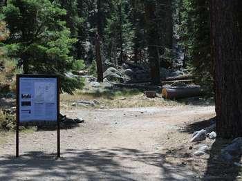
Marble Falls Trailhead
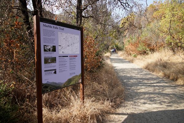
This trailhead orientation panel shows a map and images of the Marble Falls Trail area.<br /><br />This trail climbs 3.1 miles one-way at a moderate incline through the chaparral scrubland, ending at a waterfall cascade. <br /><br />Park near site #14 at Potwisha Campground and follow the dirt road across the concrete ditch. The trail starts along the steep bank to the right. Additional parking available across the Generals Highway in the Potwisha Overflow Parking Lot.
Middle Fork Trailhead
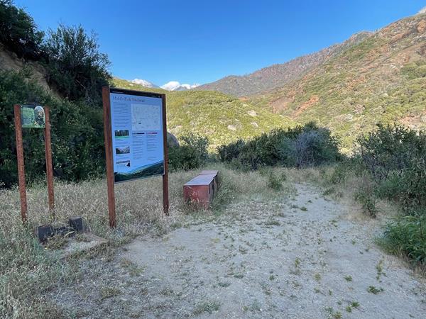
This trailhead orientation panel shows a map and photos of the Middle Fork trailhead.
Mist Falls
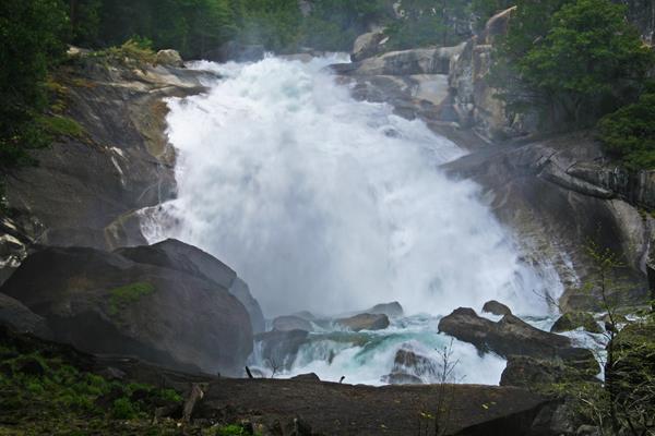
The 8-mile round-trip walk to this spectacular cascade makes a great all-day walk. The first miles are relatively flat and open; in the last mile the wooded trail gains 600' in elevation. Be careful once there: Mist and spray make the surrounding rocks slippery and treacherous. Too often people have slipped and fallen in here.
Moro Rock
Climb to the top of this immense granite dome for views of the park that extend deep into wilderness. Along the way, stop to catch your breath at exhibits that offer details about the surrounding landscape. At the top, a railing encloses a flat portion of the rock to protect viewers from steep dropoffs.
Moro Rock History and Geology
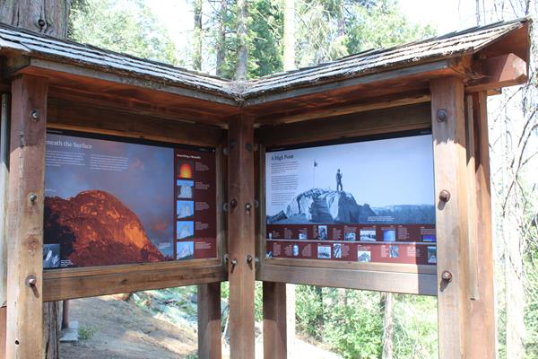
These wayside exhibits show a timeline of historic events related to Moro Rock, and describe the forces that created the granite dome, and provide an introduction to hiking the stairway to the top.
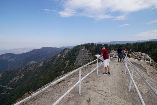
Moro Rock Trailhead
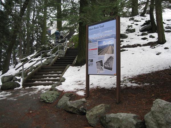
Welcome to one of the most popular and spectacular hikes in these parks. To reach the top of this granite dome, take the stairway that climbs up 300 feet (.09 km) to the 6,275 ft (2,050 km) summit. This parking area is two miles (3.2 km) from the Generals Highway. In summer, free park shuttles at the Giant Forest Museum will drop you off at this parking area. At the top is a spectacular 360° view from the Great Western Divide to the east around to the western half of Sequoia
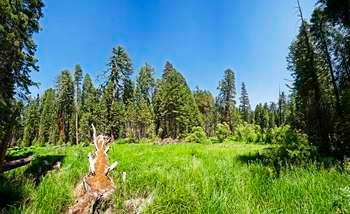
Muir Grove Trailhead
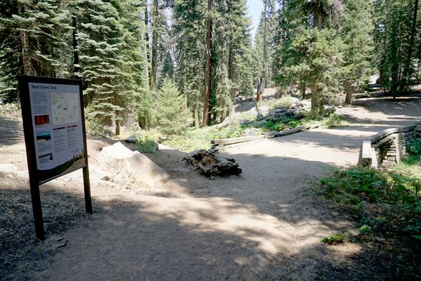
Muir Grove offers an opportunity to hike into a sequoia grove that's off the beaten path. The gently sloping trail follows a ridgeline that offers distant views of the sequoias as you hike. Once you reach them, enjoy the quiet and calm of the area.
North Fork Trailhead
The trails that start here are lightly maintained. Be prepared for more rugged conditions than you would see on trails that get heavier use. Maps can be useful in this area. Poison oak is common here, especially on the Colony Mill Trail.
North Grove Loop and Dead Giant Loop Trailhead
The North Grove Trail is an initial loop through sequoias and meadows. After the North Grove Trail, you can continue to the Dead Giant Trail loop. These trails offers views of Sequoia Lake and the Dead Giant, a huge sequoia that stayed standing even after it died.
Panoramic Point Picnic Area and Trailhead
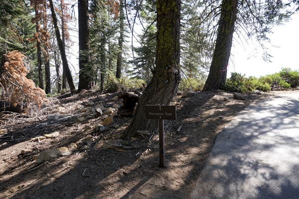
Take this fairly easy half-mile hike to Panoramic Point and a great view of the Kings Canyon, Hume Lake, and the mountains beyond. It offers one of the best places to get a view of the effects that millions of years of erosion, and especially the Ice Age, have had on Kings Canyon. The trail to Panoramic Point is paved, with gentle slopes. You can continue past there to the Park Ridge Fire Lookout, another 2.5 miles of unpaved trail.
Paradise Creek Trailhead
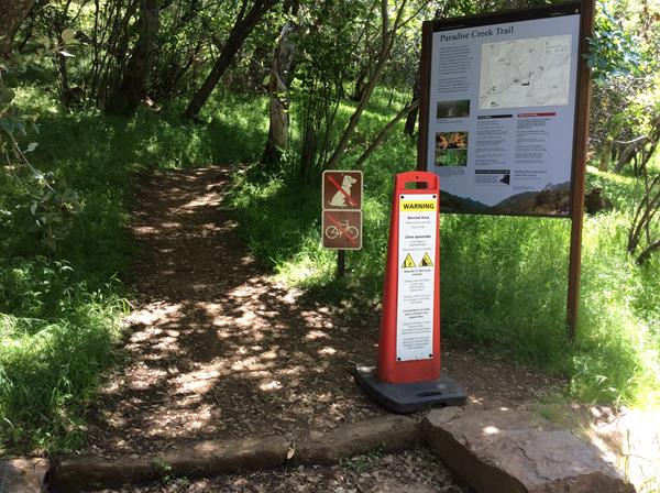
This trailhead orientation panel shows a map and photos of the Paradise Creek trailhead.
Paradise Ridge Trailhead
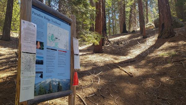
This 5.5 mile loop (8.85 kilometers) is a moderate climb, with frequent ups and downs. Starting with views at Panoramic Point, the trail visits a fire lookout, dense forest, and logged and fire-scarred areas.<br /> <br />This trailhead orientation panel shows a map and images of the Paradise Ridge area.
Park Ridge Service Road
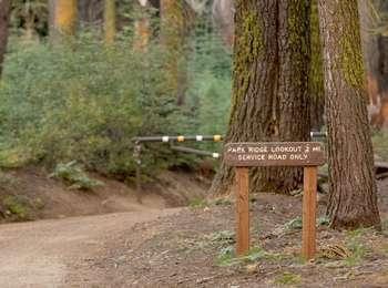
This service road provides access to park vehicles for maintenance of the Park Ridge Fire Lookout. It's more commonly used for hiking, though. Because of it's status as a road, it's the only trail in Kings Canyon National Park that allows biking.