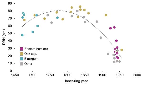
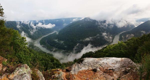
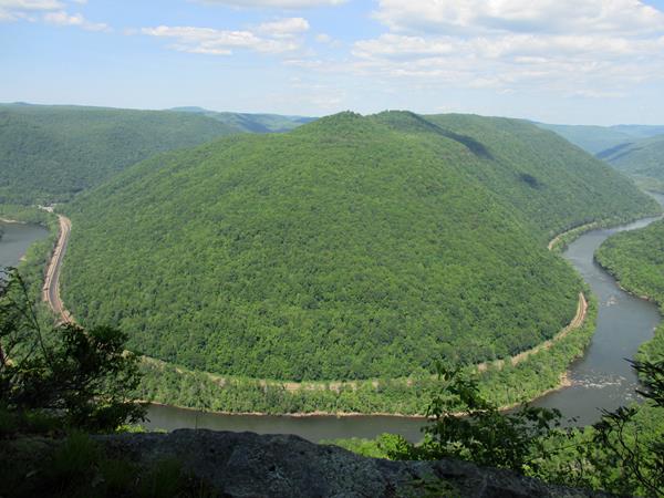
New River Gorge
Hinton, Beckley, Glen Jean, and Fayetteville, WV
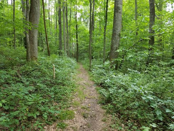
Adena Trail
Labeled (2) on the Arrowhead Bike Trails map; LENGTH: 3.1 miles/4.99km (One-Way). DIFFICULTY: Easy to Intermediate. TRAIL TYPE: Hiking and Biking. DESCRIPTION: This trail loops through the forest on low-grade swooping dips along light uphill and downhill sections. This trail is 30" to 36" wide with a few rock-surfaced sections, wide turns and switchbacks, offering safe and exciting learning opportunities for beginning mountain bikers.
Arbuckle Connector Trail
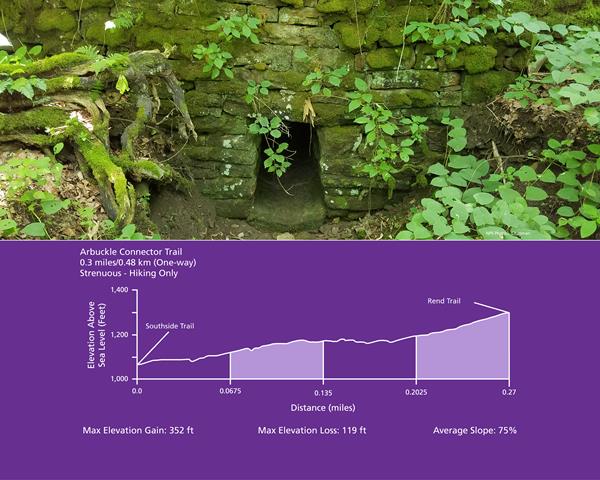
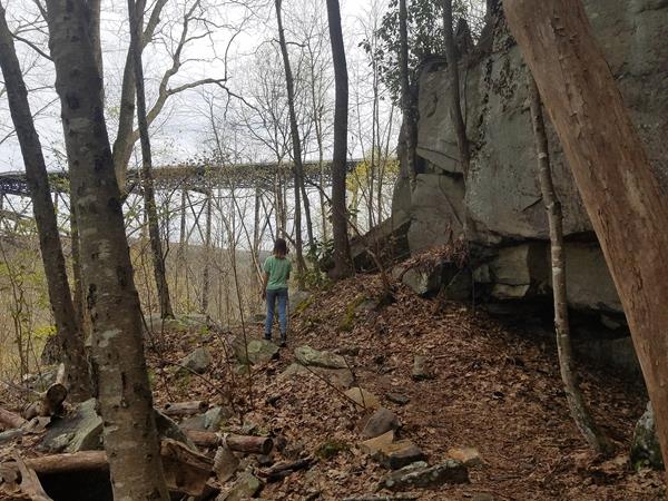
Labeled (4) on the Cunard, Thurmond and Stone Cliff Area Trails map LENGTH: 0.3 miles/0.48 km (One-way). DIFFICULTY: Strenuous. TRAIL TYPE: Hiking only. This steep and rocky trail connects the Rend and Southside Trails. Located 1.2 miles from the Thurmond end of the Rend Trail, just past the third trestle, this 0.3 mile connector trail drops off to the right. This trail also provides glimpses of the stonework and coke ovens of the former mining town of Wee Win.
Big Branch Trail
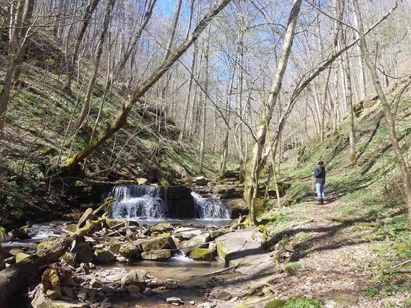
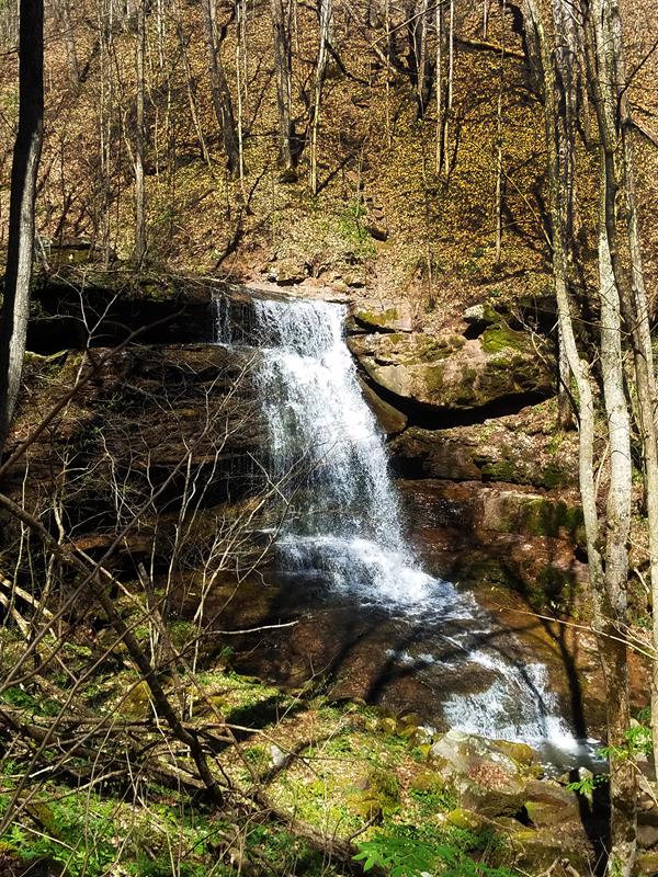
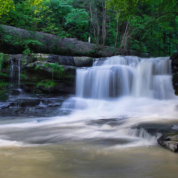
Labeled (5) on the Sandstone Brooks Area Trails map; LENGTH: 2.0 miles/2.74 km (Round-trip). DIFFICULTY: Strenuous. TRAIL TYPE Hiking only. On the west side of the river at Brooks Falls is the Big Branch Trail. This strenuous trail creates a 2 mile loop that is especially scenic in the early spring when wildflowers are in bloom. It can be a great place to see the early bloomers like trout lilies, spring beauties, toothwort, and bloodroot.
Big Buck Trail
Labeled (2) on the Grandview Area Trails map; LENGTH: 0.9 miles/1.45 km (round trip). DIFFICULTY: Easy. TRAIL TYPE: Hiking only. This easy 0.9 mile trail loops through a rolling section of forest. Tree identification signs along the way celebrate the great diversity of flora found in the Appalachian forest.
Bridge Trail
Labeled (4) on the Fayetteville - Lansing Area Trails map LENGTH: 0.86 miles/1.38 km (one way). DIFFICULTY: Strenuous. TRAIL TYPE: Hiking only. This occasionally steep and rocky trail offers views of the gorge and the New River Gorge Bridge. The trail passes under the bridge and connects to the Fayetteville Trail.
Brooklyn Coke Ovens
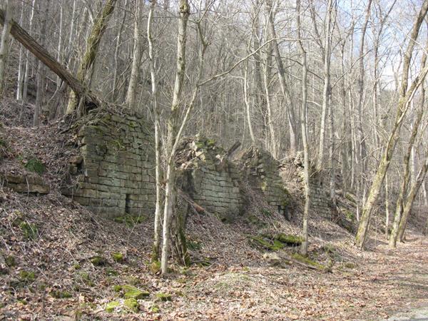
The beehive-style coke ovens of the Brooklyn Coal Company stand on the opposite side of the Southside trail, closer to the bank of the river.
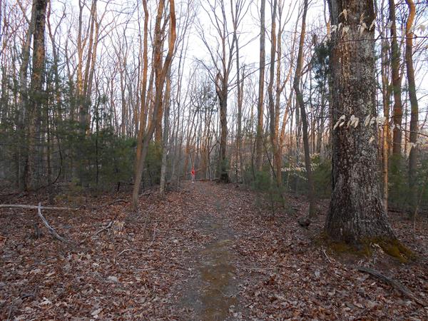
Brooklyn Mine Trail
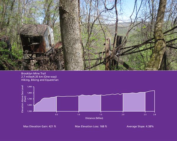
Labeled (1) on the Cunard, Thurmond and Stone Cliff Area Trails map LENGTH: 2.7 miles/4.35 km (One-way). DIFFICULTY: Moderate. TRAIL TYPE: Hiking, biking and equestrian. This 2.7 mile hiking and equestrian Trail follows an old road through the forest to the Brooklyn coal mine site. Scenic views of the river through the trees can be found along the trail.
Burnwood Trail
Labeled (1) on the Fayetteville - Lansing Trails map LENGTH: 1.2 miles/1.93 km (Round-trip). DIFFICULTY: Easy. TRAIL TYPE: Hiking only. This enjoyable 1.2 mile loop trail leads through old-growth forest and rhododendron thickets. The trail then follows the edge of an open field, loops back through the forest, and returns to the field. This area was a former home site of the Laing family.
Butcher Branch Trail
Labeled (11) on the Fayetteville - Lansing Area Trails map LENGTH: 0.8 miles/1.29 km (One-way). DIFFICULTY: Moderate. TRAIL TYPE: Hiking only. This wooded trail connects the Kaymoor Top area to the Long Point Trail, with a spur to the popular Butcher Branch climbing area. There are steep sections and a small stream crossing on this trail.
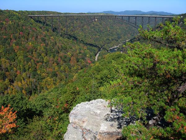
Canyon Rim Boardwalk
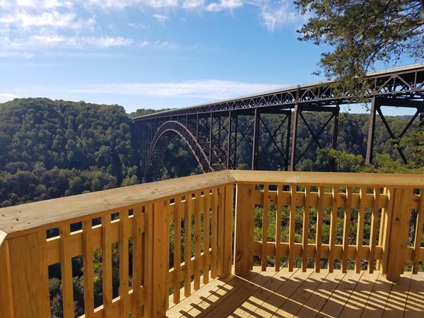
Labeled (2) on the Fayetteville - Lansing Trails map LENGTH: 0.1 miles/0.16 km (One-way). DIFFICULTY: Easy/strenuous. TRAIL TYPE: Hiking and accessible to the top overlook This boardwalk offers scenic views of the gorge and New River Gorge Bridge. An easy walk on a fully accessible ramp leads to the first viewing point, while 178 steps descend to the lower overlook.
Castle Rock Trail
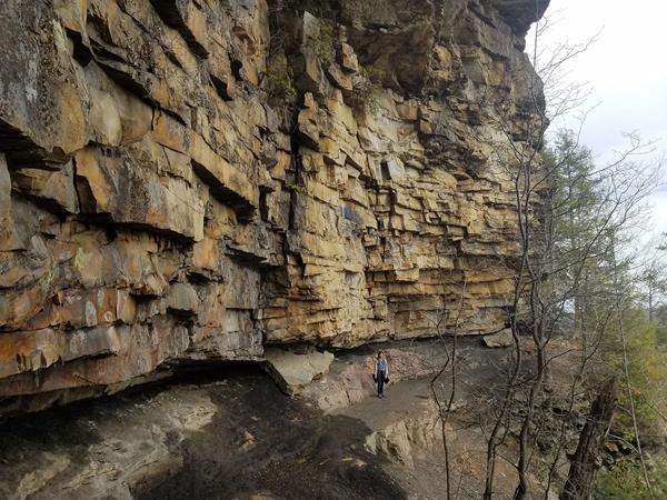
Labeled (4) on the Grandview Area Trails map; LENGTH: 0.6 miles/0.97 km (One-way). DIFFICULTY: Strenuous. TRAIL TYPE: Hiking only. This strenuous 0.6 mile trail begins near Main Overlook and ends where it intersects the Grandview Rim Trail, approximately ½ mile from Main Overlook. Hikers will find close-up views of towering fortress-like rock walls and exposed coal seams. The Castle Rock Trail and Grandview Rim Trail can make a great one mile loop.
Church Loop Trail
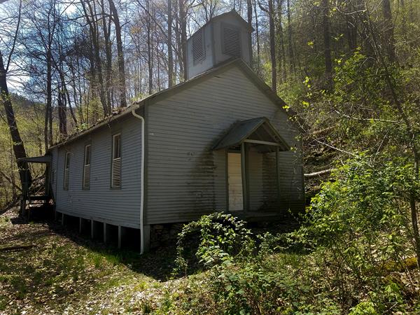
Labeled (5) on the Cunard, Thurmond and Stone Cliff Area Trails map LENGTH: 0.1 miles/0.16 km (One-way). DIFFICULTY: Moderate to Strenuous. TRAIL TYPE: Hiking only. This 0.1 mile trail loops past the First Baptist Church of Thurmond.
Clovis Trail
Labeled (1) on the Arrowhead Bike Trails map. LENGTH: 1.1 miles/1.77 km (Loop Trail). DIFFICULTY: Easy to Intermediate. TRAIL TYPE: Hiking and biking. DESCRIPTION: This compact loop trail offers lightly rolling, forested terrain on a tread that is 30" to 36" wide. There are a couple of short, even rocky sections that are simple to navigate on bike or foot. For runners and bikers, this trail offers a nice sense of flow.
Conveyor Trail
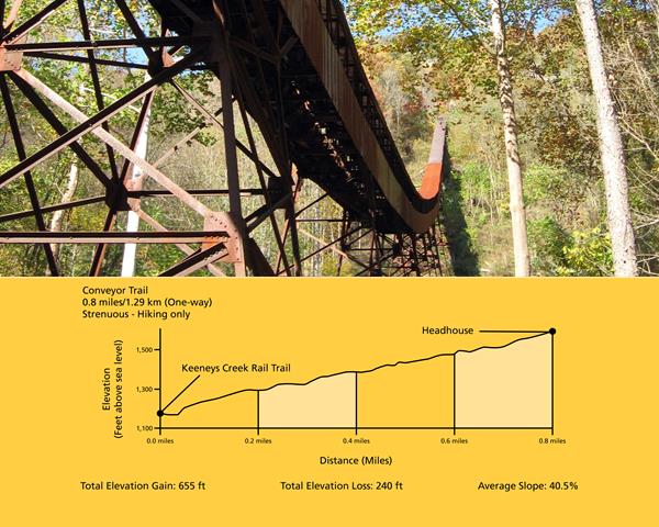
Labeled (2) on the Nuttallburg Area Trails map; LENGTH: 0.8 miles/1.29 km (One-way). DIFFICULTY: Strenuous. TRAIL TYPE: Hiking only. This steep, rugged trail zigzags from the mid-bench level, not far from the mine entrance, to the old Keeneys Creek railroad line (trail). Views of the conveyor and gorge is visible from time to time, but be sure to watch your footing, for the trail surface is loose and slaggy (old coal debris from the conveyor) in many places.
Craig Branch Trail
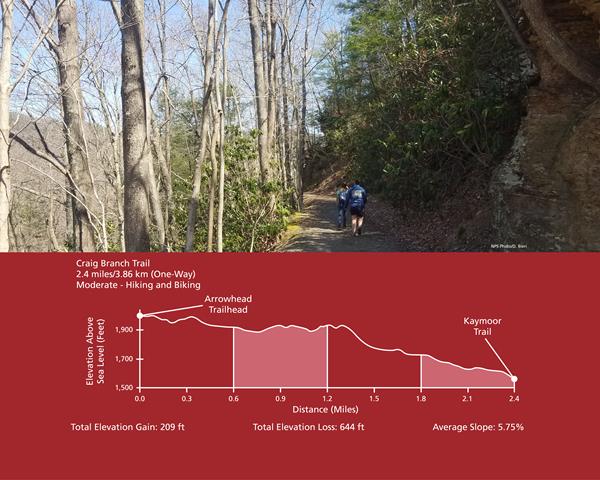
Labeled (10) on the Fayetteville - Lansing Area Trails map LENGTH: 2.4 miles/3.86 km (One-way). DIFFICULTY: Moderate. TRAIL TYPE: Hiking and biking. This forest trail offers views of the river and gorge, plus it connects to the Kaymoor Trail, offering access to the historic Kaymoor coal mine site. There are several steep sections on this gravel trail (administrative road).
Dalton Trail
Labeled (3) on the Arrowhead Bike Trails map; LENGTH: 6.4 miles/10.3 (One-Way); DIFFICULTY: Intermediate: TRAIL TYPE: Hiking and biking; DESCRIPTION: This trail is more narrow than the easy (green) loops in the Arrowhead Trail system. Trail tread width is 20" to 24" with tight turns and mildly steep hills. From Point N, ride towards Point M along a ridge line, then drop down through a cool rhododendron tunnel.
Endless Wall Trail
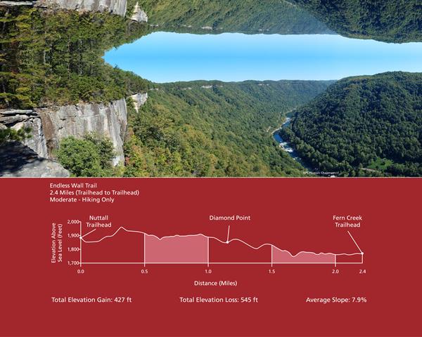
Labeled (3) on the Fayetteville - Lansing Area Trails map; LENGTH: 2.4 miles/3.86 km (One-way). DIFFICULTY: Moderate. TRAIL TYPE: Hiking only. The Endless Wall Trail is a 2.4 mile moderate walk that passes through rich forest, crosses Fern Creek, then zig-zags along the cliff edge. Many vistas can be seen along the trail.
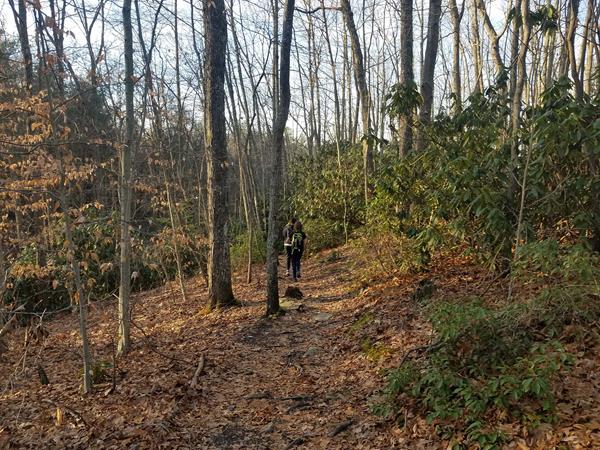
Fayetteville Trail
Labeled (5) on the Fayetteville - Lansing Area Trails map; LENGTH: 3.96 miles/6.37 km (One-way). DIFFICULTY: Strenuous. TRAIL TYPE: Hiking and biking. This trail connects Fayette Station Road, the town of Fayetteville, and Kaymoor Top with hiking access to Long Point. Be prepared for a creek crossing and up and down terrain. Connections can be made to the following trails: Kaymoor, Bridge, Park Loop, Timber Ridge, Long Point, Butcher Branch, Kaymoor Miners, and Craig Branch
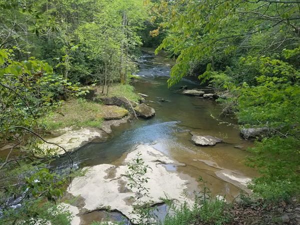
Glade Creek Trail
Labeled (1) on the Glade Creek Trails map; LENGTH: 5.6 miles/9.01 km (One-way). DIFFICULTY: Moderate. TRAIL TYPE: Hiking and biking. This 5.6 mile trail follows an abandoned narrow-gauge railroad along Glade Creek. The trail offers an enjoyable stroll at a very moderate grade, and is popular with hikers of all ages and abilities, as well as being a favorite destination for those in search of swimming holes.
Grandview Rim Trail
Labeled (5) on the Grandview Area Trails map; LENGTH: 1.6 miles/2.57 km (One-way). DIFFICULTY: Moderate. TRAIL TYPE: Hiking only. This is the longest trail at Grandview, connecting Main Overlook with Turkey Spur. From Main Overlook to Turkey Spur is a moderate 1.6 mile hike (3.2 miles round trip). Along the way hikers will enjoy many breathtaking views of the gorge and river far below.
Gwinn Ridge Trail
Labeled (2) on the Sandstone Brooks Area Trails map; LENGTH: 3.0 miles/4.83 km (Round-trip). DIFFICULTY: Strenuous. TRAIL TYPE: Hiking only. South of Sandstone Visitor Center on the east side of the New River off Brooks Mountain Road is the Gwinn Ridge Trail, a three mile loop through a ridge top forest. The south branch of the moderately strenuous trail follows the edge of the ridge where hikers can sometimes (in winter) get views through the trees.
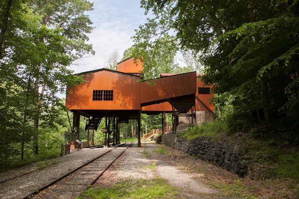
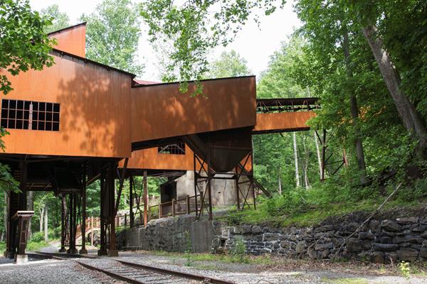
Headhouse Trail
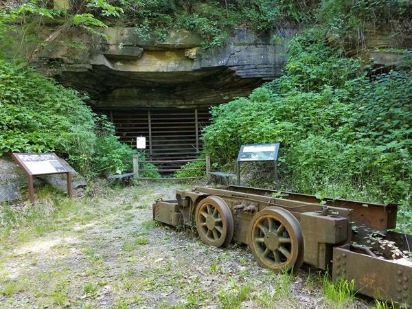
Labeled (1) on the Nuttallburg Area Trails map; LENGTH: 0.7 miles/1.13 km (One-way). DIFFICULTY: Moderate. TRAIL TYPE: Hiking and biking. This gravel trail (administrative road) leads to the entrance of the Nuttall coal mine and top of the coal conveyor which was used to transport coal from the mine to the processing area at river level. Learn more about this mine operation from exhibits at this site. Stairs next to the conveyor allow a closer look at the conveyor structure
Island Loop Trail
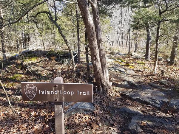
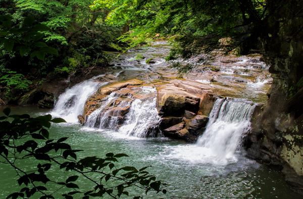
Labeled (4) on the Sandstone Brooks Area Trails map; LENGTH: 0.5 miles/0.8 km (Round-trip). DIFFICULTY: Easy. TRAIL TYPE: Hiking only. The Island Loop Trail is an easy ½ mile trail that loops around the largest island below Sandstone Falls. The island was once farmed, grazed, and timbered, and a grist mill once operated here. Today, hikers can observe the natural succession as the old fields transition back to forest.
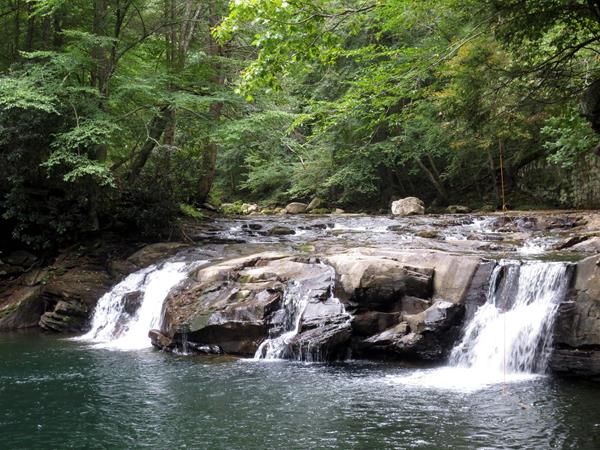
Kates Falls Trail
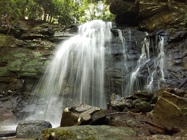
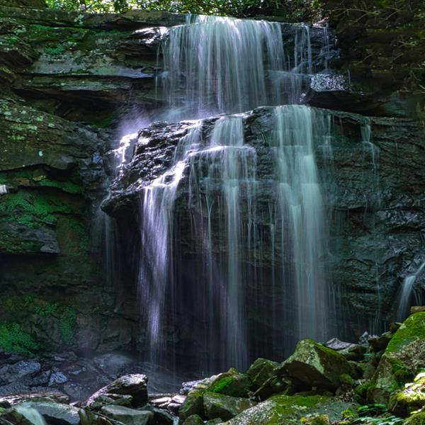
Labeled (2) on the Glade Creek Trails map; LENGTH: 0.2 miles/0.32 km (One-way). DIFFICULTY: Strenuous. TRAIL TYPE: Hiking only. This is a very short 2/10 mile, steep spur trail leading from the Glade Creek Trail to Kates Falls.
Kates Plateau Trail
Labeled (3) on the Glade Creek Trails map; LENGTH: 5.1 miles/8.21 km (Round-trip). DIFFICULTY: Strenuous. TRAIL TYPE: Hiking only. Look for signs of beaver, deer, and turkey as you follow old logging roads. The 5.1 mile trail passes through fields, forests, and near wetlands. Initially the trail passes under Interstate 64, then crosses Kates Branch. The creek crossing of Kates Branch can be challenging and involves some steep terrain.
Kaymoor Miners Trail
Labeled (9) on the Fayetteville - Lansing Area Trails map; LENGTH: 1.0 miles/1.6 km (One-way). DIFFICULTY: Strenuous. TRAIL TYPE: Hiking only. This forest trail descends steeply 0.5 miles from the top of the gorge with stairs and switchbacks to the Kaymoor coal mine site, where it crosses the Kaymoor Trail.
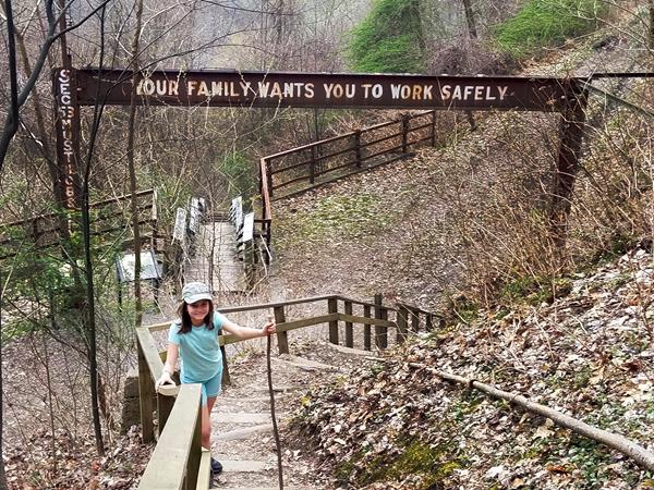
Kaymoor Trail
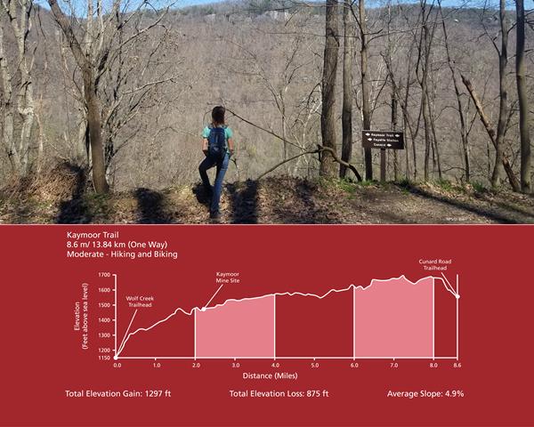
Labeled (8) on the Fayetteville - Lansing Area Trails map; LENGTH: 8.6 miles/13.84 km (One-way). DIFFICULTY: Moderate. TRAIL TYPE: Hiking and biking. The Kaymoor Trail runs parallel with the middle of the gorge, passing the historic coal mine site at Kaymoor. The northern two miles of the trail, from Wolf Creek trailhead to the old mine site, follows an old road. Wayside exhibits interpret the Kaymoor mine operation and community along the way.
Keeneys Creek Rail Trail
Labeled (3) on the Nuttallburg Area Trails map; LENGTH: 3.3 miles/5.31 km (One-way). DIFFICULTY: Easy. TRAIL TYPE: Hiking and biking. Enjoy a leisurely stroll or bike ride on this wide trail that criss-crosses the rugged mountain landscape at a 4% grade. Here it is easy to see how the rugged terrain was a great challenge to those who constructed this railroad line over 100 years ago.
LeCroy Trail
Labeled (4) on the Arrowhead Bike Trails map; LENGTH: 1.8 miles/2.9 km (One-way); DIFFICULTY: Intermediate; TRAIL TYPE: Hiking and biking; DESCRIPTION: The LeCroy Trail is narrow, with a tread width of 20" to 24". Enjoy a few stretches of rolling and sweeping turns, and cross a challenging rock bridge over a small drainage then be enchanted by a tunnel of rhododendron.
Little Laurel Trail
Labeled (1) on the Grandview Area Trails map; LENGTH: 2.6 miles/4.18 km (One-way). DIFFICULTY: Strenuous. TRAIL TYPE: Hiking and biking. This strenuous trail connects Grandview with the New River 1,400 feet below. The trail follows an old road for two miles as it descends to the river, passing by the site of an old coal mine at Royal.
Long Point Trail
Labeled (12) on the Fayetteville - Lansing Area Trails map; LENGTH: 1.6 miles/1.29 km (One-way). DIFFICULTY: Moderate. TRAIL TYPE: Hiking and biking . This trail traverses field and forest on the way to a rock outcrop (Long Point) with panoramic views of the gorge and New River Gorge Bridge. Most of this trail lazily descends through the forest, but it does include one steep section just before you arrive at the point.
Park Loop Trail
Labeled (6) on the Fayetteville - Lansing Area Trails map; LENGTH: 1.1 miles/1.7 km (Round-trip). DIFFICULTY: Easy. TRAIL TYPE: Hiking and biking. The Park Loop is an enjoyable loop trail that begins at the Town Park in Fayetteville, with a connection to the Fayetteville Trail.