Indiana Dunes
Porter, IN
Bailly Homestead, Chellberg Farm, Little Calumet River, Mnoké Prairie Trails
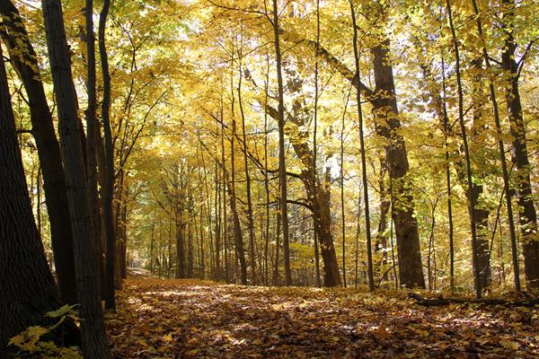
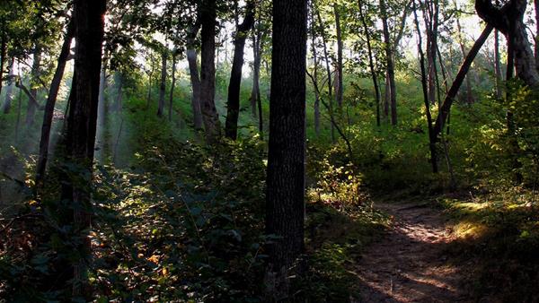
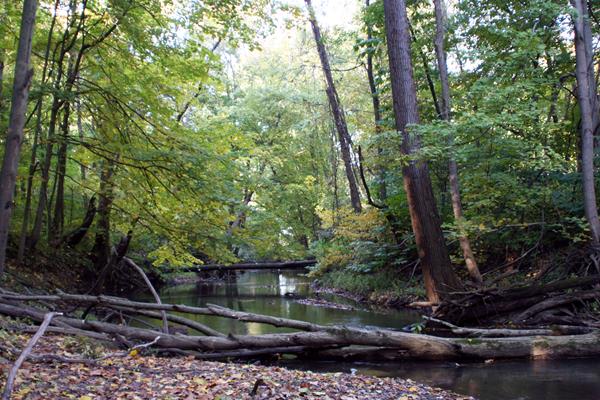
The Little Calumet River, Mnoké Prairie, Bailly Homestead, Chellberg Farm and Bailly Cemetery trail system reveals the rich natural diversity that has drawn people to this area for over 10,000 years. Hike through a forest dominated by maple, beech, basswood and oak trees. Follow a stretch of the Little Calumet River, once a critical transportation route for early regional travelers and explore the recently restored Mnoké Prairie.
Calumet Dunes Trail
Built as a Church in 1959, the last service in the building was held on August 30, 1970 and the National Park Service purchased the land and building shortly afterwards. The building became the park's headquarters and visitor center in 1971. The headquarters moved out of the building to the abandoned Nike missile base in 1977. The visitor center stayed in the building until 2006, when the current Visitor Center on State Road 49 was opened.
Chellberg Farm
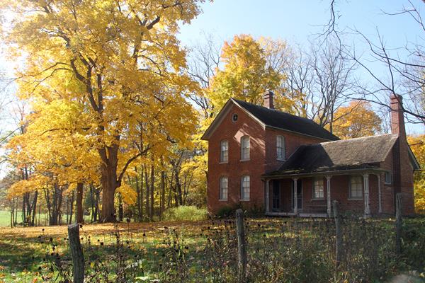
During the early 20th century, a hardworking Swedish immigrant family, lived and worked here for three generations. The Chellberg's gave other immigrants a place to stay and helped them find work.
Cowles Bog Trail (North)
The Cowles Bog Trail highlights an area of such outstanding plant diversity that it was designated as a National Natural Landmark in 1965. This location, where Dr. Henry Cowles conducted much of his early work in plant ecology and succession in the early 1900s, remains an important focus for scientific study today. Explore several distinct habitats along this 4.7-mile trail including ponds, marshes, swamps, black oak savannas and beaches.
Cowles Bog Trail (South)
The Cowles Bog Trail highlights an area of such outstanding plant diversity that it was designated as a National Natural Landmark in 1965. This location, where Dr. Henry Cowles conducted much of his early work in plant ecology and succession in the early 1900s, remains an important focus for scientific study today. Explore several distinct habitats along this 4.7-mile trail including ponds, marshes, swamps, black oak savannas and beaches.
Dune Ridge Trail
The Dune Ridge Trail offers great views of the extensive wetlands and forests south of this tall, forested dune. The different habitats you'll see along the trail help make Indiana Dunes National Park one of the top most biologically diverse of all the national parks.
Glenwood Dunes Trail (Alternate)
This extensive trail system features interconnected loops ranging from less than a mile to nearly 15 miles and is popular with hikers, runners, horseback riders and cross-country skiers.
Glenwood Dunes Trail (Main)
This extensive trail system features interconnected loops ranging from less than a mile to nearly 15 miles and is popular with hikers, runners, horseback riders and cross-country skiers.
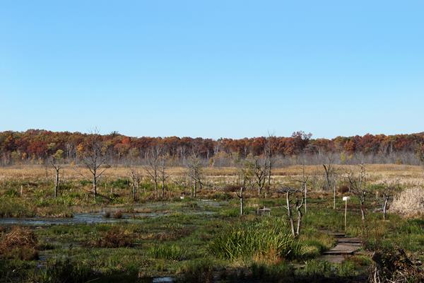
Great Marsh Trail (North)
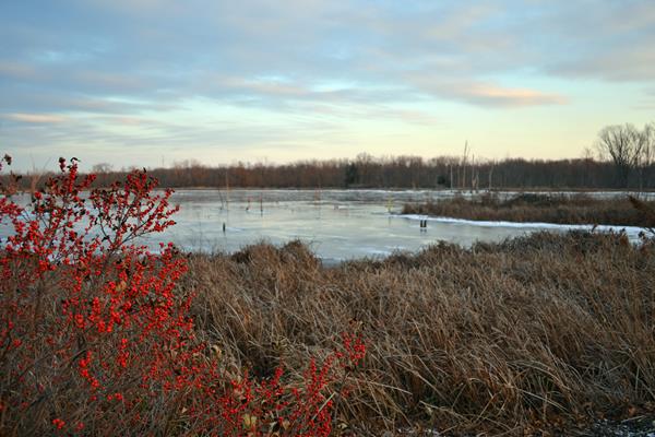
The Great Marsh is the largest interdunal wetland in the Lake Michigan watershed. It serves as a critical habitat for breeding and migratory birds. This popular trail features an overlook of the marsh where you can spot a wide variety of birds ranging from Great Blue Herons to Sandhill Cranes. While much of the marsh was drained in the early 1900's for residential and agricultural use, the National Park Service began restoration of this portion in 1998.
Great Marsh Trail (South)
The Great Marsh is the largest interdunal wetland in the Lake Michigan watershed. It serves as a critical habitat for breeding and migratory birds. This popular trail features an overlook of the marsh where you can spot a wide variety of birds ranging from Great Blue Herons to Sandhill Cranes. While much of the marsh was drained in the early 1900's for residential and agricultural use, the National Park Service began restoration of this portion in 1998.
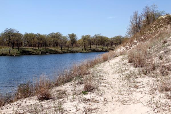
Heron Rookery (East)
The Heron Rookery Trail follows along a portion of the Little Calumet River that once featured over 100 Great Blue Heron nests. After 60 years of nesting here, the herons have moved on to new nesting grounds. These woods remain alive with dozens of birds including kingfishers, woodpeckers and a wide variety of migrating and nesting warblers.
Heron Rookery (West)
The Heron Rookery Trail follows along a portion of the Little Calumet River that once featured over 100 Great Blue Heron nests. After 60 years of nesting here, the herons have moved on to new nesting grounds. These woods remain alive with dozens of birds including kingfishers, woodpeckers and a wide variety of migrating and nesting warblers.
Hobart Prairie Grove Trail (East)
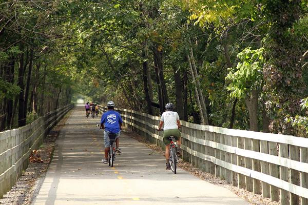
Hobart Prairie Grove consists of forested ravines and a portion of scenic Lake George, which is part of the Deep River. The Hobart Woodland trail offers views of forest ravines and has an overlook of Lake George. The Oak Savannah rail trail runs through the Hobart Prairie Grove and is a great place for biking, pushing a stroller or just hiking to relax and improve your health.
Hobart Prairie Grove Trail (West)
Hobart Prairie Grove consists of forested ravines and a portion of scenic Lake George, which is part of the Deep River. The Hobart Woodland trail offers views of forest ravines and has an overlook of Lake George. The Oak Savannah rail trail runs through the Hobart Prairie Grove and is a great place for biking, pushing a stroller or just hiking to relax and improve your health.
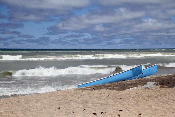
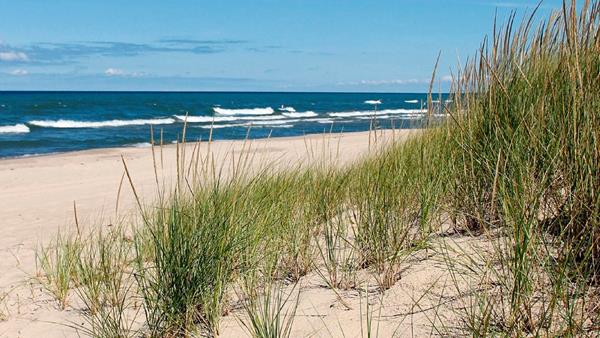
Kemil Beach
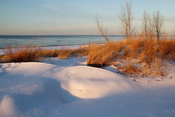
Kemil Beach is an excellent destination to swim, soak up the sun, or watch the stars at night. Facilities and a paved parking lot are located just a block away from the shoreline.
Mt. Baldy Beach
Mt. Baldy is the tallest moving sand dune in the National Park. The dune itself is closed, but the beaches are open. Facilities and parking are located less than 0.5 miles from the beach. Walk along the shoreline, enjoy breathtaking views of the Lake, dunes, and Michigan City Harbor.
Mt. Baldy Beach Trail
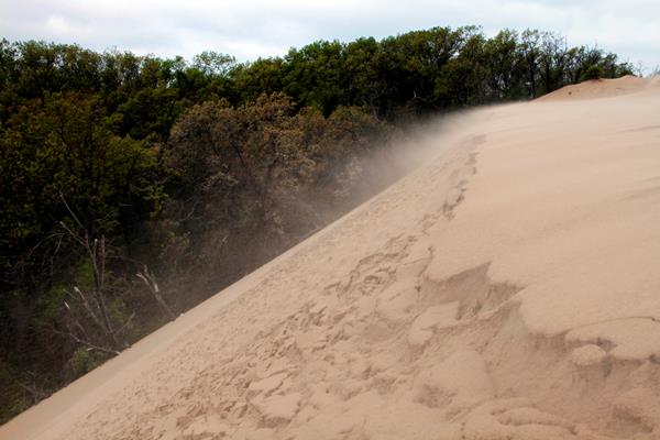
Mount Baldy is 126 feet above the water level of Lake Michigan and is moving inland at about 4 feet per year. Beach sand on the dune moves when the prevailing northwest wind exceeds 7 mph. The movement of Mount Baldy is made worse because there is no longer sand collecting at the water's edge to bolster the dune. Beach erosion is taking away more sand from Mount Baldy than the waves are bringing in due to the breakwall that was built for the Michigan City Harbor.
Paul H. Douglas Center
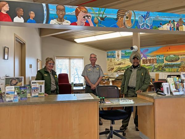
The Paul H. Douglas Center for Environmental Education provides programming for school-aged children and adults through ranger-led talks, hikes, and activities.
Paul H. Douglas Trail through Miller Woods
The Paul H. Douglas Trail in Miller Woods winds through several habitats including wetlands, globally rare black oak savanna, open dunes and beach. The views of the lake and the dunes are incredible. The oak savanna's native grasses and wildflowers, including lupine, thrive in the sunlight and open forest floor.
Portage Lakefront and Riverwalk Beach
Portage Lakefront and Riverwalk was opened in October 2008. The redevelopment of the site, formerly used by a steel corporation as settling ponds for industrial byproduct and a sewage treatment facility, is a successful model of brownfield reclamation.The land, buildings, and facilities at the site are owned by the National Park Service and operated in partnership with the City of Portage.
Portage Lakefront and Riverwalk Pavilion
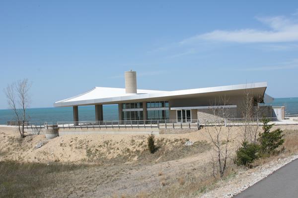
This 3,500 square foot public pavilion includes restrooms, a seasonal snack bar, and a glass walled classroom/meeting space.
Portage Lakefront and Riverwalk Trail
This popular location is a great place to view the ever-changing seasons along Lake Michigan and watch dramatic weather and clouds build over the lake. It's an easy location to watch for migrating birds in the spring and summer, and observe shelf ice that forms along the beach edge in the winter. Visitors can enjoy easy access to the lakefront and trails that highlight dune succession.
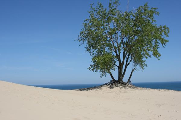
Tolleston Dunes Overlook
This overlook provides a scenic view of the Tolleston Dunes Trail, which winds amid 4,700 year-old sand dunes that were formed when Lake Michigan's water level was 25 feet higher than today. Tolleston is the second youngest of four distinct dune systems found within the national park. Together these dune ridges provide a glimpse into the changing shoreline of Lake Michigan.
Tolleston Dunes Trail

The Tolleston Dunes Trail winds amid 4,700 year-old sand dunes that were formed when Lake Michigan's water level was 25 feet higher than today. Tolleston is the second youngest of four distinct dune systems found within the national park. Together these dune ridges provide a glimpse into the changing shoreline of Lake Michigan.
Upland Trail
The Pinhook Bog Trail System features two very different habitats. The Upland Trail highlights a rich beech and maple forest growing on top of a glacial moraine formed about 15,000 years ago. The Bog Trail leads to a bog in a depression in the moraine created when a large piece of ice broke off the melting glacier. The bog features an incredible habitat with unique plants.
West Beach
West Beach is the most popular destination in the National Park each summer. Lifeguards, a bathhouse, hiking trails, picnic shelters, and a large parking lot make this the idea destination on those hot summer days.
West Beach Trails
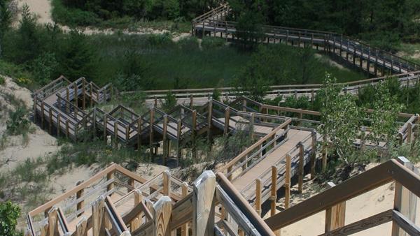
West Beach offers a great combination of hiking and relaxing at the beach. The trails are varied and encompass many habitats. There are great views from the top of the Dune Succession Trail stairs, a beautiful pinery of jack pines, birding opportunities along Long Lake and secluded sections of forest. After hiking, relax and swim at the beach.