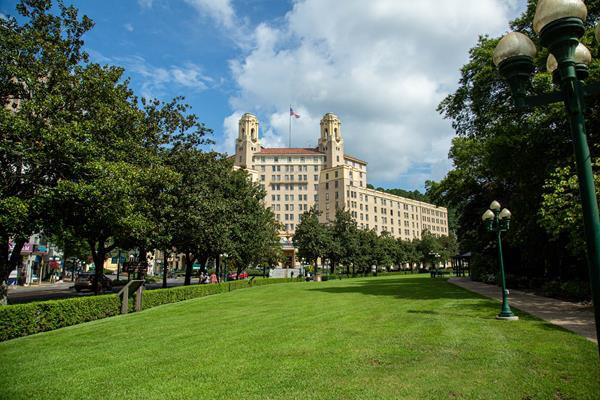
Hot Springs
Hot Springs, AR
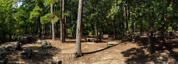
Camp at the Gulpha Gorge Campground
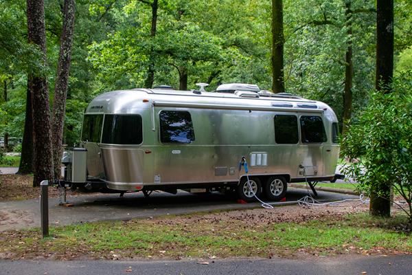
BASIC INFORMATION Camping at Gulpha Gorge Campground costs $34 per night for all sites. All sites have full hookups: 30 and 50 amp electric, water and sewer connections. Sites are not pull-through. Each campsite has a picnic table, pedestal grill, and water.
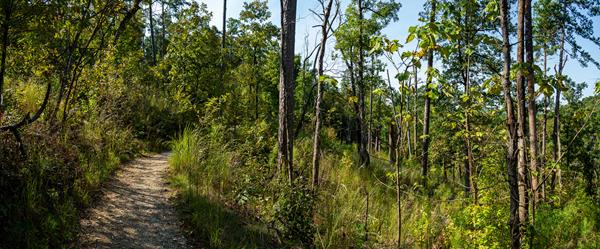
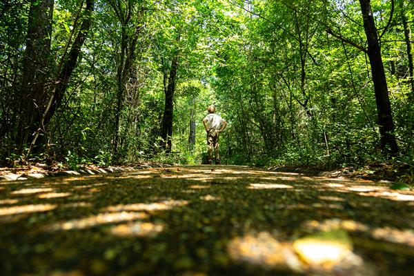
Oak Trail
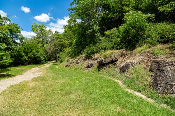
The northeastern end of Oak Trail is mostly flat. The trail is fairly steep for a short distance between West Mountain Trail and West Mountain Drive.
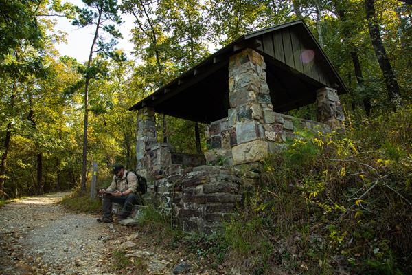
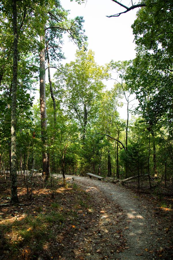
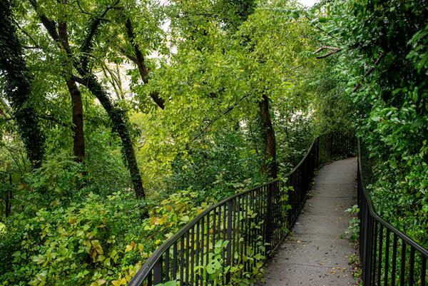
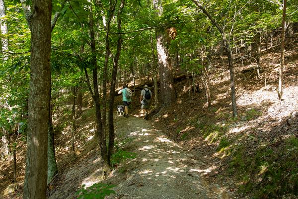
An Overview: Hot Springs and North Mountain Trails
The Hot Springs and North Mountain trails are popular since they are easy to reach and provide scenic views. You can get to these trails via Stephen’s Balustrade (grand staircase) behind the Fordyce Bathhouse, Hot Springs Mountain Drive, and the Gulpha Gorge Campground. See the Hot Springs and North Mountain trail map for more information.
Honeysuckle Trail
Honeysuckle Trail connects Peak Trail with Hot Springs Mountain Trail.
Short Cut Trail
Short Cut Trail connects Oertel Trail with Hot Springs Mountain Trail near the picnic area atop Hot Springs Mountain.
West Mountain Trail
Both sections of West Mountain Trail have gradual change in elevation. Note: West Mountain Trail can be made into a loop by using Mountain Top Trail (elevation change: 400 feet in this section).
Whittington Trail
The flat, gravel trail is popular with joggers and walkers. Whittington Trail loops around Whittington Park.
Mountain Top Trail
Mountaintop trail can be linked with Canyon Trail and West Mountain trail to complete a loop around West Mountain. If hiking southward, the trail is strenuous, as it gains elevation quickly. If hiking northward, there is a steady rise in elevation until you cross Sunset Trail; the trail descends steeply to the trailhead at Whittington Park.
Canyon Trail
The West Mountain trails can be reached from downtown via Canyon Trail. The trailhead is behind the Mountain Valley Water building. The section between West Mountain Drive and West Mountain Trail is very steep.
Pullman Trail
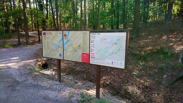
The Pullman Trail is the only trail in the park that allows bicycles. This moderate trail passes an archeological site and connects with the city's Northwoods Trails.
Upper Dogwood Trail

Upper Dogwood trail has short rises and long stretches of flat trail. It can be combined with the Lower Dogwood Trail or the Goat Rock Trail to create a longer hike.
Lower Dogwood Trail
Lower Dogwood Trail climbs North Mountain. Near the top, boulders mark the westernmost tip of the trail. From there, the trail drops downhill.
Arlington Trail
Ask for directions to the trailhead from staff at the Arlington Hotel lobby. Arlington Trail will connect with Lower Dogwood Trail.
Floral Trail
Floral Trail connects Lower Dogwood Trail and Honeysuckle Trail. From either trailhead you will descend into a valley and climb the other side.
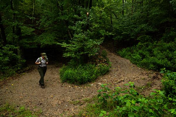
Gulpha Gorge Trail
Gulpha Gorge Trail connects the Gulpha Gorge Campground to many of the park's trails. The trail going west from the campground is steep.
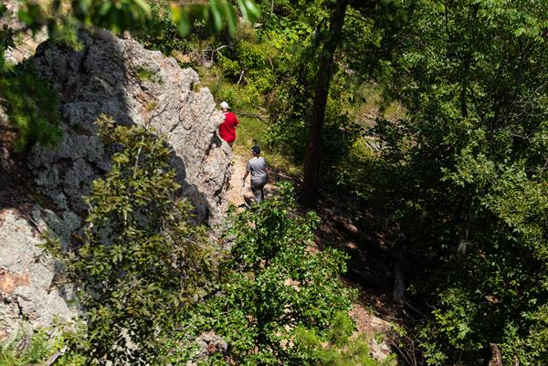
Goat Rock Trail
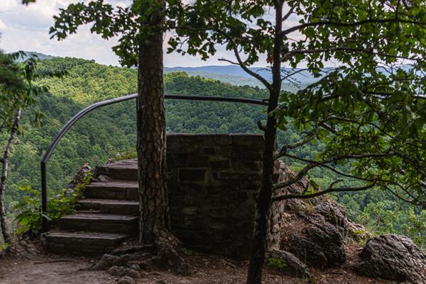
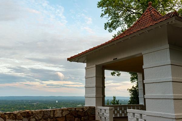
The Goat Rock trail offers stunning views of the Ouachita Mountains and the recharge zone for the thermal springs. Limited parking is available at the overlook on North Mountain. The trailhead starts south of the parking area.
Tufa Terrace Trail
This paved trail can be reached from the Grand Promenade or Arlington Lawn. The lower portion of the Tufa Terrace Trail is near the Hot Water Cascade.
Grand Avenue Trail
Grand Avenue Trail connects Oertel Trail with Grand Avenue. A local motel lies just south of the trailhead.
Fountain Trail
This short trail begins on Fountain Street below the entrance to Hot Springs Mountain Drive. Use it to reach Honeysuckle Trail by crossing the road.
Reserve Trail
Reserve Trail connects Oertel Trail with Spring Street and Reserve Street at a "Y" intersection.
Hot Springs Mountain Trail
Hot Springs Mountain Trail is an easy stroll around the top of the mountain with several scenic overlooks.
Oertel Trail
From downtown, ascend the Stephen's Balustrade (grand staircase) behind the Fordyce Visitor Center to the Grand Promenade and climb the next two sets of steps until you reach the gravel road. Take the road right until you reach an iron gate; the trailhead begins here. Oertel Trail ranges from moderate to very steep grade.
Peak Trail
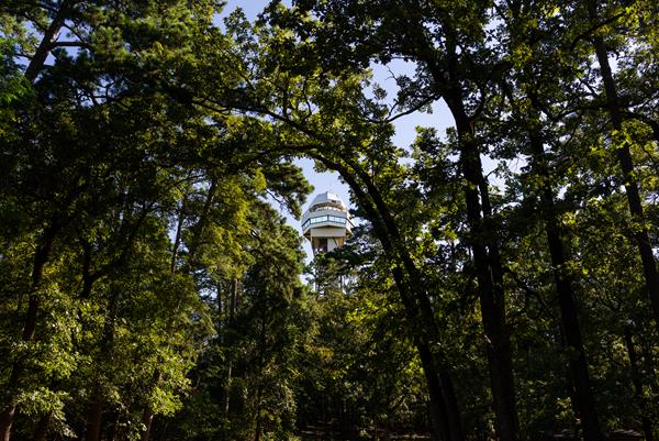
Peak Trail leads to the Hot Springs Mountain Tower. The Trail is 0.6 mi (1.0 km) long with an elevation gain of 644 - 1044 ft (196-318 m). It has a 12.6% grade. The trailhead is located near the center of the Grand Promenade. Peak Trail is paved then turns to gravel and connects to many other hiking trails around Hot Springs Mountain.
Grand Promenade National Recreation Trail
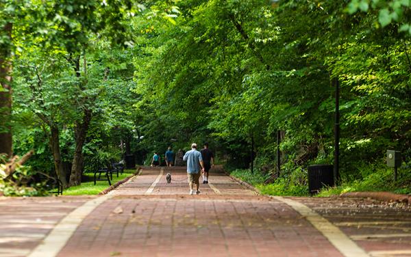
This National Recreation Trail is the entry point for many of the Hot Springs and North Mountain trails from downtown.
Bicycle Riding
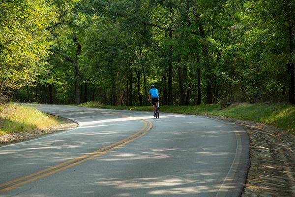
Biking through national parks is a great way to see beautiful scenery and discover new places. Cyclists are allowed and welcome to ride on any of the paved roads in the park. The roads up to North Mountain and West Mountain maintain a progressive incline with moderate traffic, so please use caution and plan accordingly. *Bicycles are not allowed on the Grand Promenade or on the sidewalk in front of Bathhouse Row.
Junior Ranger Fun

Kids visiting Hot Springs National Park may earn a Junior Ranger badge by completing a number of activities as they explore the park. The Junior Ranger booklet is available at the Fordyce Bathhouse Visitor Center.
Photography in the Park
Photography is an important part of national park history. Photographers took pictures to show why special places needed protection. People were able to see how beautiful and unique park landscapes were even if they could not visit them in person. Today, professional and amateur photographers alike travel from around the world to capture scenic and historic vistas.
Birdwatching in the Park
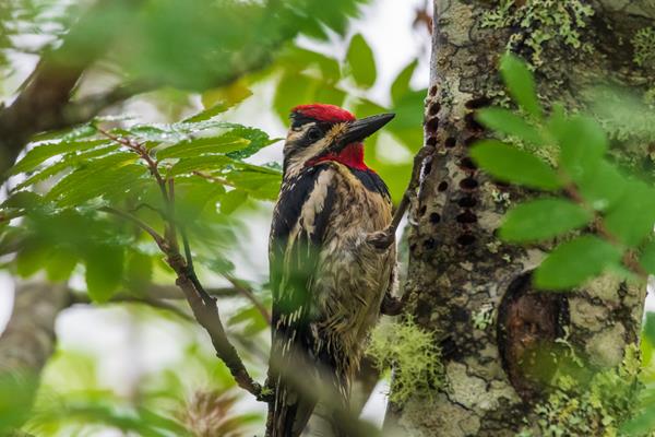
Birds are everywhere. They soar overhead, flit through branches, walk on the ground, and swim in the water. From the tiny calliope hummingbird to the gigantic California condor, a great diversity of birds finds a home in the national parks. Even more species pass through during migration. Casual observers and hardcore birders alike can experience the joy of birds and birding in a national park.
The Bathhouse Row Emporium
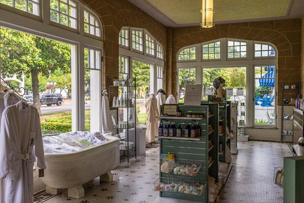
Visit the America’s National Parks™ Store at Hot Springs National Park to shop a curated selection of quality educational products and books that will help extend the park experience. Explore products in person or at the America’s National Parks™ Online Store. Your purchases in the park and online directly support educational programs at this park.
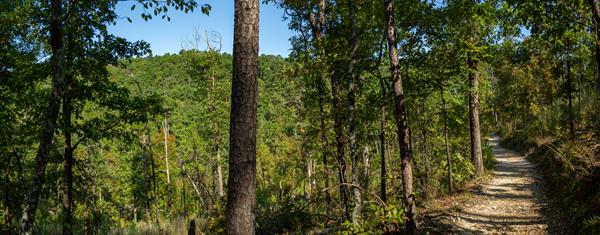
An Overview: West Mountain Trails
The West Mountain trails are less traveled, providing greater opportunities for wildlife sightings. You can get to these trails via Whittington Park and the Canyon Trailhead. See the West Mountain trail map for more information.
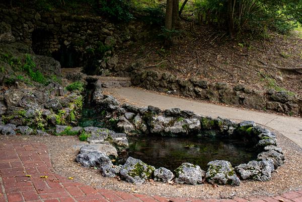
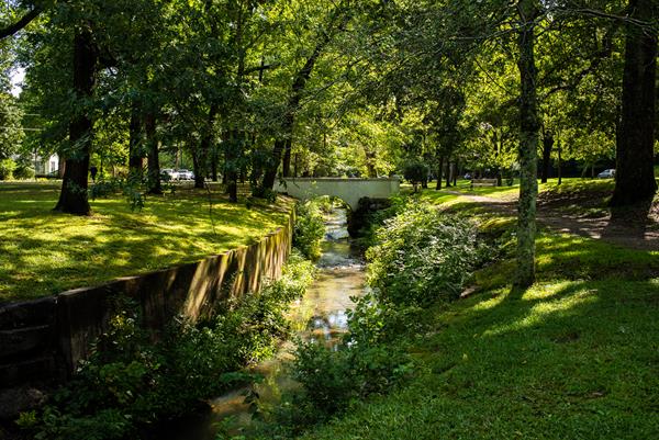
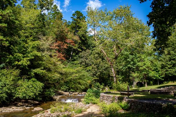
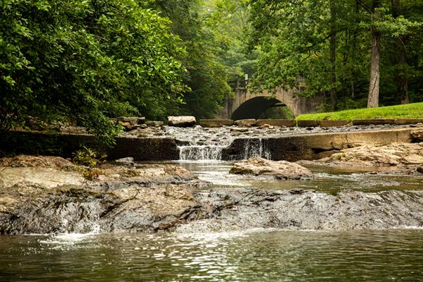
Visit the Hot Water Cascade
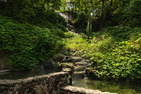
Located at Arlington Lawn, this is the largest visible spring in the Park. Hot water emanates from the hill side near the Grand Promenade and flows under the path, down a steep cliff into two pools.
Sunset Trail
Sunset Trail is the longest trail in Hot Springs National Park, covering approximately 10 miles one-way. Crossing all types of terrain, the trail makes its way through the most remote areas of the park. This trail is divided into three sections: West Mountain (2.8 miles), Sugarloaf Mountain (2.6 miles), and Stonebridge Road (3.8 miles). Sunset Trail can be combined with Hot Springs and North Mountain trails and West Mountain trails to complete a strenuous 15 mile loop hike.
Ride to the Top of Hot Springs Mountain Tower
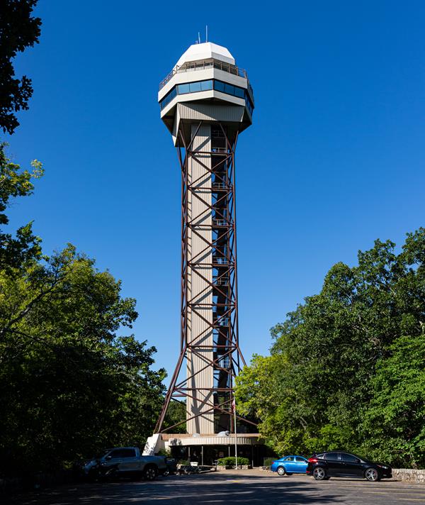
216 feet above Hot Springs Mountain and 1,256 feet above Sea level is the breathtaking panoramic view of the park and its surrounding countryside. Originally being made of wood in 1877, the tower was rebuilt with steel and an elevator in 1982 with both open and enclosed observation decks.
Drink the Water
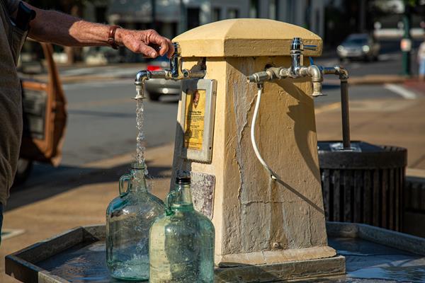
Thousands of visitors highly endorse the good quality of the hot springs water and fill bottles to take home.
Soak in the Springs
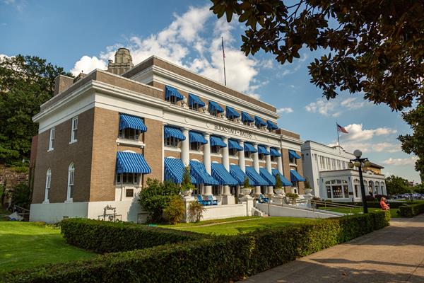
Even though there are no soaking opportunities outdoors, Bathhouse Row does have 2 available facilities that offer visitors the chance to fully submerge and relax in the thermal water. The thermal springs are piped directly into both of these bathhouses, offering users a true and authentic experience of the water.