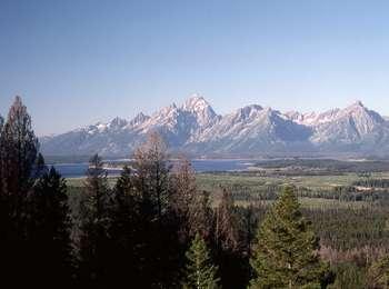
Grand Teton
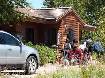
Moose, WY
Blacktail Butte Trailhead
Access the Blacktail Butte Trailhead from US 26/89/191. The parking lot is one mile north of Moose Junction on the east side of the highway. There are no facilities at this trailhead-remember to bring water and use a restroom before you arrive. Bears may be active any place and at any time-travel in groups, make noise and carry bear spray. Hikers cannot access backcountry camping from this trailhead.
Cascade Canyon Turnout
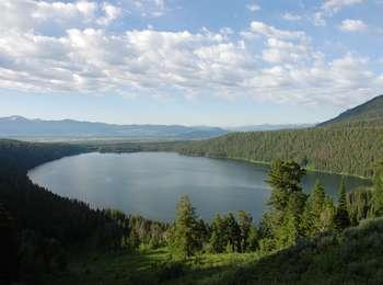
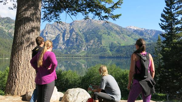
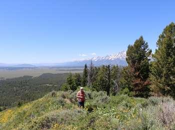
Most visitors find it challenging to reach the alpine community in the park, but the view from Cascade Canyon turnout provides a glimpse. The canyon climbs through the forest community where many conifers thrive-lodgepole pine, Engelmann spruce, Douglas fir and subalpine fir. Cascade Creek flows near the trail providing islands of wetland community. In the upper part of the canyon, the alpine community thrives-a harsh environment buried in snow most of the year.
Catholic Bay Picnic Area
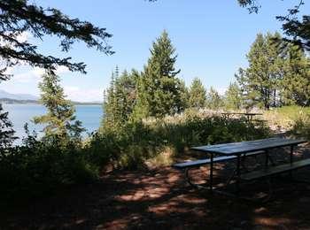
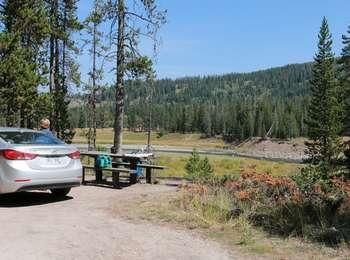
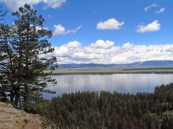
Catholic Bay picnic area sits above Jackson Lake with a trail that leads down to the shore. This is one of the few picnic areas with fire grates. There is also a vault toilet, trash and recycling available. A great place to stop for a snack along Jackson Lake! Adjacent to the picnic area is the Chapel of the Sacred Heart a historic chapel run by the Catholic Church. Mass is held on Sunday evenings during the summer.
Christian Pond Trailhead
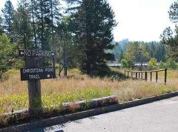
<b>Location</b> : Access the Christian Pond trail from the east edge of the parking lot next to the corrals at the Jackson Lake Lodge. <br /><br /> <b>Notes</b> : There are minimal facilities and limited parking at this trailhead-remember to bring water and use a restroom before you arrive. Bears may be active any place and at any time-travel in groups, make noise and carry bear spray. Hikers cannot access backcountry camping from this trailhead.
Colter Bay Corral
Enjoy a one or two hour horseback ride along the trails south of Colter Bay. The corrals also offer breakfast and dinner horseback or wagon rides. See and feel the park from a different perspective in truly western style! "http://www.gtlc.com/activities/horseback-riding" Visit the Grand Teton Lodge Co. website for more information.
Colter Bay Lakeshore Trail
Access the paved Colter Bay Lakeshore trail northwest of the visitor center. Visitor services include a visitor center, restrooms, water, stores, restaurants, laundromat, showers, cabins, corrals, campground and an RV park. Bears may be active any place and at any time-travel in groups, make noise and carry bear spray. Backcountry camping requires a permit-pick one up at a backcountry permits office.
Colter Bay Visitor Center
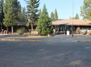
One of the surviving Mission 66 visitor centers, the Colter Bay Visitor Center sits above the shores of Jackson Lake. Enjoy a view of the lake and Teton Range from the back deck. Wander down to the lakeshore for a swim or picnic lunch, or hike to Swan Lake or Heron Pond from the Hermitage Point Trailhead.The visitor center exhibits 35 artifacts from the David T. Vernon Indian Arts Collection never before displayed .
Death Canyon Trailhead
Location: Access the Death Canyon trailhead from the Moose-Wilson Road. Travel three miles south from Moose and turn north on a spur road. The last mile leading to the trailhead is a narrow, rough dirt road recommended for high-clearance vehicles. Notes: Facilities include a small dirt parking lot, a vault toilet and a seasonally-occupied patrol cabin. Remember to bring water with you. Bears may be active any place and at any time-travel in groups, make noise and carry bear
Ditch Creek Pathway Access
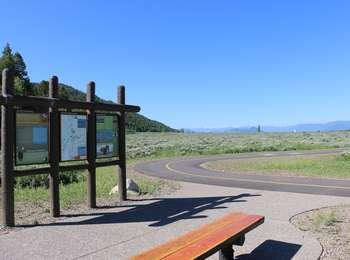
The pathway section from Moose Junction to the Antelope Flats Road is the most recent addition to the multi-use pathway system. This section allows bicyclists to complete a loop on the secondary roads from Antelope Flats to Kelly and return to Gros Ventre Junction without riding on the main highway. There is parking available at the small lot on the north end Blacktail Butte just south of Antelope Flats Road. ADA compliant.
Dornans Pathway Access
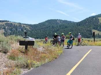
Leave from Dornans in Moose to access the multi-use pathway. A short spur connects to the main pathway allowing non-motorized users access to the paved trail system that extends from Jackson to Moose and on to Jenny Lake. Hop on your bike or pull on your shoes to enjoy the park at a slower pace. ADA compliant.
Flagg Canyon Launch
<b>Location:</b> Access from US 89/191/287 just south of the Yellowstone South Gate. A steep dirt road leads from the picnic area down to the boat ramp. The ramp is a log slide that provides access to the river bottom. Except during high water, visitors will need to carry their boat to the water.<br /><br /> <b>Notes:</b> There is a small picnic area above the launch with a vault toilet. The Flagg Canyon trail continues south from the boat launch along the rim of the canyon.
Flagg Canyon Picnic Area
Flagg Canyon picnic area is the first picnic area south of Yellowstone National Park. This location has only a few tables and a vault toilet, but it also provides access to the Flagg Canyon trail and a boat launch for the Snake River. Lodgepole pine trees provide shade, and even though the main highway is nearby the site feels secluded.
Flagg Canyon Trailhead
<b>Location</b> : Access the Flagg Canyon trail from the picnic area just south of the Yellowstone Entrance. Walk down a steep road from the picnic area to the boat launch and continue south.<br /><br /> <b>Notes</b> : Visitor services include a small picnic area, vault toilet, boat launch and limited parking-remember to bring water. Bears may be active any place and at any time-travel in groups, make noise and carry bear spray. Hikers cannot access backcountry camping from this trailhead.
Flagg Ranch Trailhead
Location: Access the Flagg Ranch trail from the Flagg Ranch Information Station. Head west from the information station cabin, through the parking lot, and look for a break in the trees. Notes: Visitor services include an information center, restrooms, water, stores, restaurants, showers, lodge, cabins, corrals, campground and RV park. Bears may be active any place and at any time-travel in groups, make noise and carry bear spray. Backcountry camping requires a permit-pick
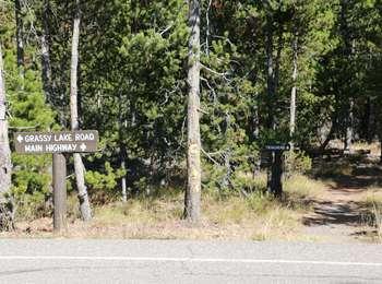
Glade Creek Trailhead
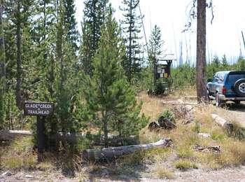
Location: Access the Glade Creek Trailhead from the Grassy Lake Road 4.5 miles west of Flagg Ranch about 3/4 of a mile after you enter the area burned during the 1988 Greater Yellowstone fires. Notes: There are no facilities at this trailhead-remember to bring water and use a restroom before you arrive. Bears may be active any place and at any time-travel in groups, make noise and carry bear spray. Backcountry camping requires a permit.
Grandview Point Trailhead
Location: Access the Grandview Point Trailhead from the main highway. Travel two miles north from Jackson Lake Junction, turn east on an unmarked dirt road and continue one mile to the end. Notes: These trails are lightly traveled and pass through prime bear habitat. There are no facilities at this trailhead-remember to bring water and use a restroom before you arrive. Bears may be active any place and at any time-travel in groups, make noise and carry bear spray.
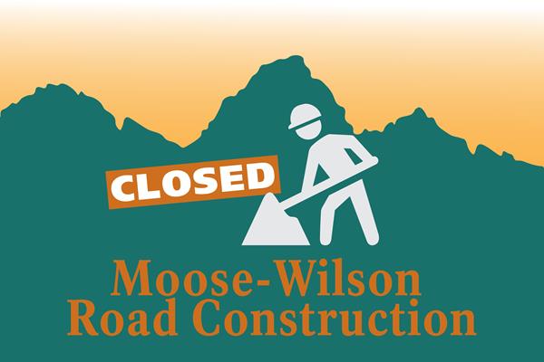
Granite Canyon Entrance Station
Travel 1.5 miles north of Teton Village on the Moose-Wilson Road to access the southern part of Grand Teton National Park. The road crosses through critical wildlife habitat as it winds through sagebrush, forest and wetland communities. Only stop in designated pullouts and maintain a safe distance from all animals. This road becomes congested during peak season.Special restrictions and considerations apply. The park prohibits RVs over 23.3 feet long and trailers. From Novem
Granite Canyon Trailhead
Location: Access the Granite Canyon Trailhead one mile north of the Granite Entrance Station on the Moose-Wilson Road. The road is not accessible to vehicles over 23.3 feet long or trailers. The dirt parking lot is small so arrive early in the day to secure your space. Notes: There are no facilities at this trailhead-remember to bring water and use the restroom before you arrive. Bears may be active any place and at any time-travel in groups, make noise and carry bear spra
Hermitage Point Trailhead
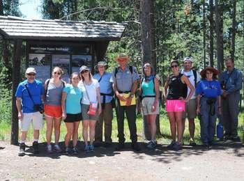
Location: Access the Hermitage Point Trailhead from Colter Bay Village. Continue ten miles northwest on the main highway from Moran Junction, and turn southwest at the Colter Bay Junction. The trailhead is at the southeast end of the parking lot next to the marina, and provides access to trails along the eastern edge of Jackson Lake. Destinations: Gently rolling trails lead out to Hermitage Point. Conifers shade the first part of the trail and give way to sagebrush meadow
Jackson Hole Mountain Resort Aerial Tram Trailhead
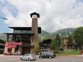
Location: Access the trailhead from the top of the aerial tram. Teton Village is about one mile south of Grand Teton National Park on the Moose-Wilson Road (WY 390). Notes: Visitor services are extensive in Teton Village including motels, restaurants, shops and activities. Bears may be active any place and at any time-travel in groups, make noise and carry bear spray. Backcountry camping requires a permit-pick one up at a backcountry permits office. For more information ab
Jackson Lake Lodge Corral
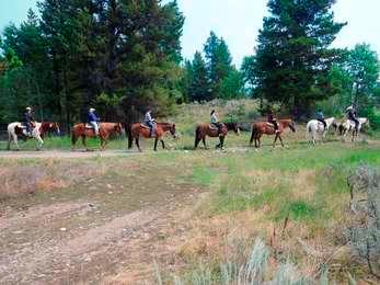
Enjoy a one or two hour horseback ride along the trails east of Jackson Lake Lodge. See and feel the park from a different perspective in truly western style! "http://www.gtlc.com/activities/horseback-riding" For more information visit the horseback activity page for the Grand Teton Lodge Co.
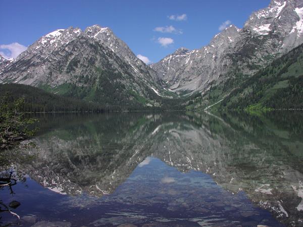
Jenny Lake Trailhead
Location: South Jenny Lake is eight miles north on the Teton Park Road from Moose Junction. The trailhead is located next to the east boat dock and provides access to the core of the Teton backcountry. Notes: Visitor services include a visitor center, restrooms, water, store, ranger station, shuttle boat, boat rentals and campground. The parking lot is often full from 10 am-4 pm. Arrive early to secure your space. Bears may be active any place and at any time-travel in gro
Jenny Lake Visitor Center
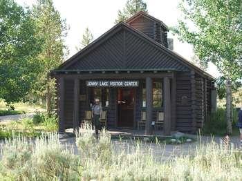
Harrison Crandall built this cabin in 1921 near the Cathedral Group Turnout to house his studio. He moved the cabin to the shores of Jenny Lake in 1929. Today, the rustic Jenny Lake Visitor Center hosts over 250,000 visitors annually. A new outdoor plaza provides interpretive and directional information. A fully accessible trail system leads visitors to the lakeshore and boat dock. Access the majestic Grand Teton backcountry from several nearby trailheads.
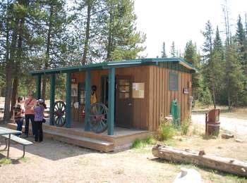
Laurance S. Rockefeller Preserve Trailhead
Location: Access the Laurance S. Rockefeller Preserve Trailhead from the Moose-Wilson Road. The Preserve provides access to the last piece of land donated by the Rockefeller family to Grand Teton National Park. This area is not accessible to vehicles over 23.3 feet long or trailers. The 50 vehicle parking lot is often full from 9 am-4 pm, and parking is prohibited along the Moose-Wilson Road. Arrive early to secure your space. Notes: The Preserve Center offers visitor info
Leigh Lake Trailhead
Location: Access the Leigh Lake Trailhead from the Jenny Lake scenic loop drive. Turn west at North Jenny Lake Junction, bend north where the road splits and choose from a series of parking lots. The first parking lot is the String Lake Trailhead. The second lot serves as a boat launch for String Lake. The third lot provides access to the Leigh Lake Trailhead and the String Lake Picnic Area. Notes: This area is popular for picnicking and water sports. Parking is often conge
Lupine Meadows Trailhead
Location: Access the Lupine Meadows Trailhead from the Teton Park Road one mile south of South Jenny Lake Junction. Turn west and follow a gravel road for about one and a half miles. Notes: Visitor services include gravel parking lot, a vault toilet, bear food storage boxes and a trailhead sign. Remember to bring water with you. Bears may be active any place and at any time-travel in groups, make noise and carry bear spray. Backcountry camping requires a permit-pick one up
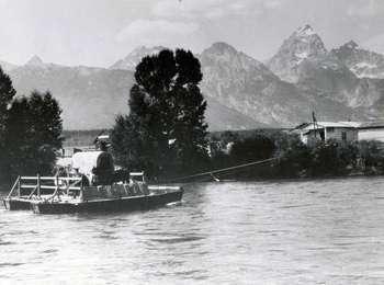
Menors Ferry District
This homestead once belonged to William D. (Bill) Menor. He moved from Montana to the valley in 1894 and took up this homestead on the banks of the Snake River. His ferry became a vital crossing point for the early Jackson Hole settlers. In addition to the whitewashed cabin, general store, storage shed and smokehouse, the Menor homestead once included barns, a blacksmith shop, a garden, and irrigated hayfields and pastures. Take a self-guided walk through the area to learn so
Saddle Up
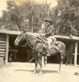
Trail rides were a popular pastime on the ranch, much as they still are in the park today. The tack room was a hub of activity. Wranglers would catch the horses each morning on their pasture and bring them down to the ranch. When guests were ready to go on a trail ride, the wranglers saddled up the horses and brought them out. Dudes often rode the same horse for years, developing a strong attachment. Look for the horses' names written on the wall, above where their saddles would have hung.
Signal Mountain Trailhead
<b>Location:</b> Access the Signal Mountain trail through the Signal Mountain campground or drive up the Signal Mountain Summit Road about one mile. Park near the pond and backtrack down the road to cut around the pond to the south.<br /><br /> <b>Notes:</b> This trail is lightly traveled. If you park near the Signal Mountain Lodge or Campground, you will have access to restrooms, water and a store. If you drive up the Signal Mountain Road to begin your hike, there are no facilities. Bears may be active any place and at any time-travel in groups, make noise and carry bear spray. This trail does not access backcountry camping areas.
String Lake Launch
Location: The String Lake Canoe launch is the middle of three parking lots in the String Lake area. Access String Lake from the Jenny Lake Scenic Drive. The farthest parking lot provides access to the String Lake picnic area and the Leigh Lake Trailhead. Notes: This area is very congested during summer especially from late morning through afternoon. Please obey all regulations. There is no boat ramp at this location. Visitors must carry their watercraft to the lake. No moto
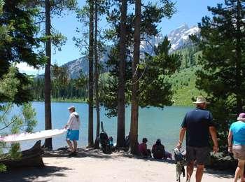
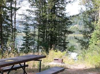
String Lake Picnic Area
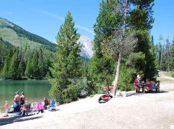
String Lake picnic area is one of the largest and most popular in the park! Tables are scattered along the lakeshore under a stand of lodgepole pines. The lake is the warmest in the park and is a popular place to swim, kayak, canoe or play on a standup paddleboard. Families often spend the afternoon picnicking and enjoying the lake. In addition to water activities, the picnic area is also located between the String and Leigh lake trailheads. Offering access to classic hikes i
String Lake Trailhead
Location: Access the String Lake Trailhead from the Jenny Lake scenic loop drive. Turn west at North Jenny Lake Junction, bend north where the road splits and choose from a series of parking lots. The first parking lot is the String Lake Trailhead. The second lot serves as a canoe launch for String Lake. The third lot provides access to the Leigh Lake Trailhead and the String Lake Picnic Area. Notes: This area is popular for picnicking and water sports. Parking is often con
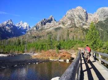
Taggart Lake Trailhead
<b>Location:</b> Access the Taggart Lake trailhead from the Teton Park Road three and a half miles northwest from Moose Junction.<br /><br /> <b>Notes:</b> Visitor services include a modest-sized parking lot, a vault toilet, map brochure box, bike rack and a trailhead sign. Remember to bring water with you. Bears may be active any place and at any time-travel in groups, make noise and carry bear spray. Backcountry camping requires a permit-pick one up at a backcountry permits office.
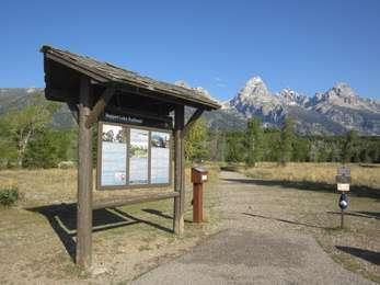
Taggart Pathway Access
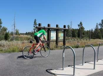
The Taggart Lake Trailhead provides a convenient access to the multi-use pathway for those looking for a short outing. With views of the Grand Teton to the west and Cottonwood Creek to the east, the scenery is spectacular. A four-mile trek north will take you to South Jenny Lake, or a three-mile trek south will take you to Moose. The parking lot provides visitors with access to hiking and the pathway and may become congested. ADA compliant.<br /><br />Facilities include a vault toilet and bike rack, but no water.
Two Ocean Lake Picnic Area
Two Ocean Lake picnic area is next to the parking lot and trailhead. The facilities include a few tables, vault toilet, a fire grate and trash. Conifer trees provide some shade and the lake is visible through them. Some visitors will carry their canoe or kayak through the shrubs to launch on the lake. Please remember to buy a boat permit if you do so.
Two Ocean Lake Trailhead
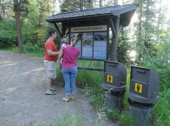
<b>Location:</b> Access the Two Ocean Lake Trailhead from the main highway. Travel one mile northwest from the Moran Entrance, turn northeast onto Pacific Creek Road for two miles, and then turn north onto the dirt Two Ocean Lake Road for two and a half miles. Park at the end of the road.<br /><br /> <b>Notes:</b> These trails are lightly traveled and pass through prime bear habitat. Facilities include a small, dirt parking lot, vault toilet and a few picnic tables. Remember to bring water with you. Bears may be active any place and at any time-travel in groups, make noise and carry bear spray. Hikers cannot access backcountry camping in the park from this trailhead.