Canyonlands
Moab, UT
Alcove Spring Trail
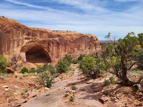
After descending 1,400 ft (4276 m) past a large alcove, the trail meanders in a wide canyon to the base of the notable Moses and Zeus towers.
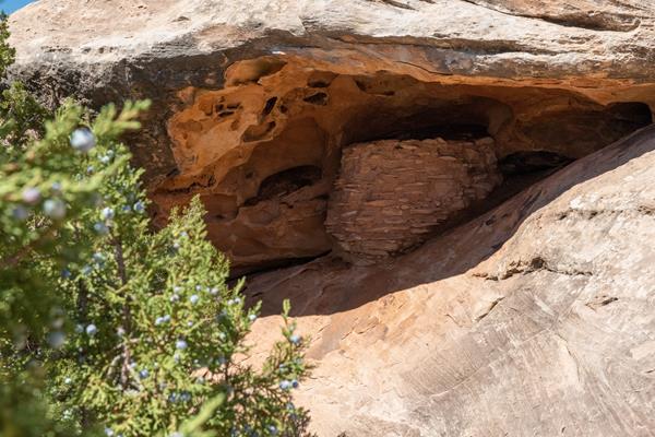
Aztec Butte Trail
This trail climbs two sandstone buttes to outstanding views and stone granaries built by Indigenous people centuries ago.
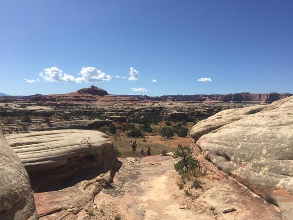
Big Spring Canyon Overlook and Trailhead
Big Spring rests at the end of the Needles Park Road. From the overlook, unique rock spires and multi-colored sandstone benches line the bend in the canyon. The presence of the spring allows trees and plants to flourish in the spring and summer months.
Big Spring Canyon to Elephant Canyon Loop Trail
This loop features extended hiking on slickrock benches and mesa tops overlooking canyons. Excellent views of sheer cliff walls and other rock formations. Must climb two ladders.
Big Spring Canyon to Wooden Shoe Canyon Loop Trail
A great introduction to the landscape of The Needles, this route connects two canyons for a loop across varied terrain.
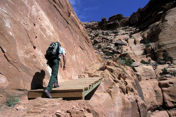
Canyonlands' Cave Spring Trail
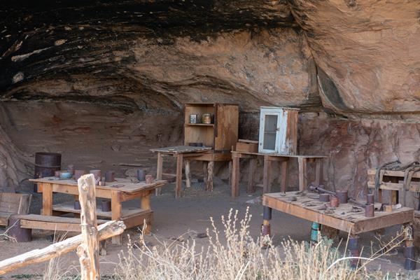
Water is scarce in this desert. From this trailhead, hike a short, 0.6-mile (1 km) loop leading to a historic cowboy camp and prehistoric rock markings, all made possible by a small but essential natural spring.
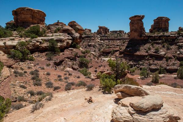
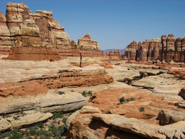
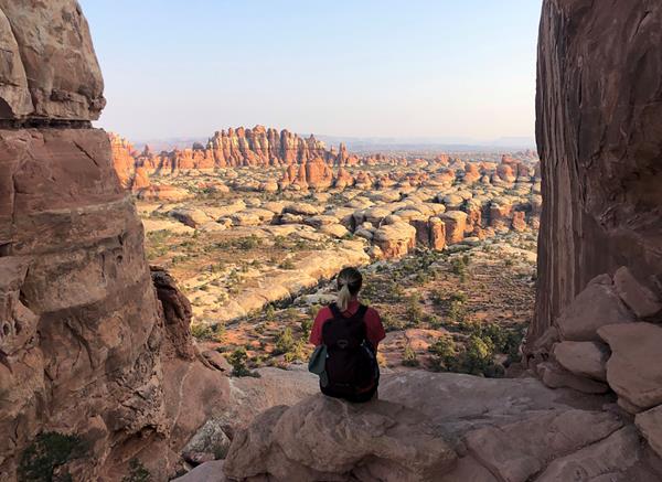
Chesler Park Loop and Joint Trail
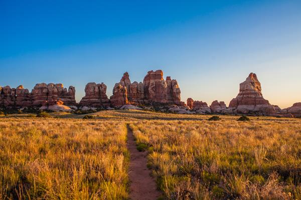
This trail provides many great panoramas of the Needles formations. The Joint Trail winds through deep, narrow fractures in the rock.
Chesler Park Viewpoint Trail
This popular trail leads to a pass overlooking a scenic expanse of desert grasses and shrubs surrounded by sandstone spires.
Confluence Overlook Trail
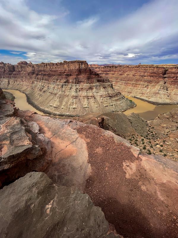
Unlike other Needles hikes, this trail traverses dry, open country along the northern edge of the geologic faults that shaped the Needles. The trail ends at a cliff overlooking the junction of the Green and Colorado rivers 1,000 ft (304 m) below.
Druid Arch Trail
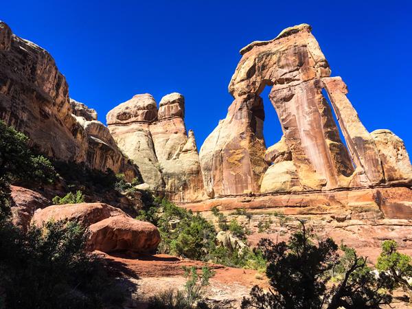
This trail offers one of the most spectacular views in The Needles. It follows the first part of the Chesler Park trail, then branches off to travel along the bottom of Elephant Canyon through deep sand and loose rock. The last 1.25 mile at the upper end is steep with one ladder and some scrambling.
Fort Bottom Trail
Fort Bottom Ruin is an ancient stone structure overlooking the Green River, built by Indigenous inhabitants of the Canyonlands area centuries ago. It is only reachable from the 4WD White Rim Road (permit required).
Gooseberry Trail
The steepest trail in this district of Canyonlands, Gooseberry descends over a thousand feet of scree slopes and switchbacks across sheer cliffs.
Gooseneck Overlook Trail
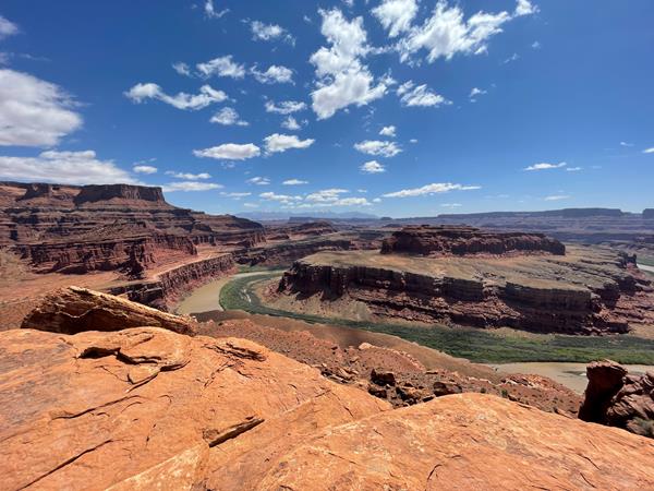
This short walk from the 4WD White Rim Road (permit required) ends abruptly at an overlook of a meandering gooseneck bend in the Colorado River.
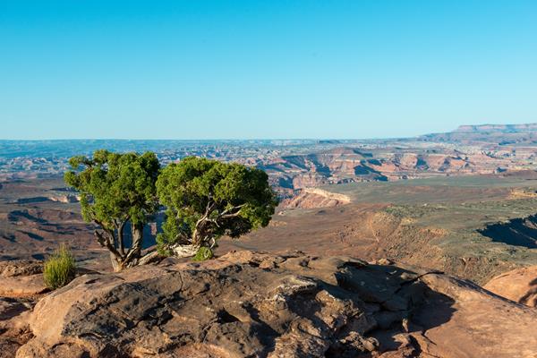
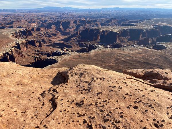
Grand View Point Overlook and Trail
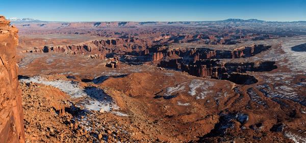
Grand View Point offers a spectacular view of the Canyonlands area. From this panoramic viewpoint at 6,080 feet elevation, you can see distant mountains, canyons, basins, and the four-wheel-drive White Rim Road far below. A short trail leads to even more views.
Lathrop Trail
The Lathrop Trail crosses a wide grassland on the mesa top, enjoys views of Colorado River, then descends into the canyon below. For a moderate trail option, hikers often turn around at the canyon rim. Continuing down to the White Rim Road means a strenuous hike back out.
Mesa Arch Trail
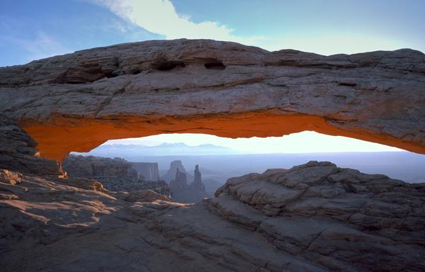
Short hike to a natural stone arch perched at the mesa's edge, framing views of La Sal Mountains and the canyon below.
Moses and Zeus Towers Trail
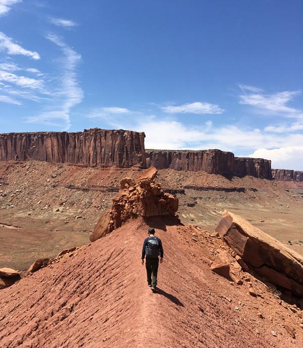
Moses and Zeus are two prominent towers overlooking Taylor Canyon. This trail leads to their base. Reaching this trail requires a hike down Alcove Spring Trail (11.2 mi/18.3 km roundtrip) or a permit to drive the 4WD White Rim Road.
Murphy Loop Trail
A great full-day hike with 1,400 feet (440 m) elevation change, the Murphy Loop Trail offers outstanding views from atop the Murphy Hogback and White Rim Road.
Murphy Point Trail
This mostly level hike leads past a historic corral on the mesa top. The trail ends with panoramic views of Candlestick Tower, the Green River, and the White Rim Road.
Neck Spring Trail
A walk back in time, this loop trail passes historic ranching features and two springs where cowboys watered cattle.
Peekaboo Trail
Steep slopes and nearby cliff edges make this a challenging route. Two ladders must be climbed.
Pothole Point Trail
This short loop trail (0.6 mi/1 km) crosses sandstone dimpled with pockets called potholes, which may be filled with surprising aquatic life.
Shafer Trail Viewpoint
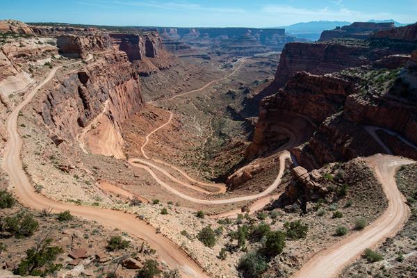
The Shafer Trail Viewpoint at Island in the Sky provides an incredible view of this iconic road that descends 1,500 feet (457 m) down colorful sandstone walls to the canyon basin.
Slickrock Trail
This trail features expansive 360-degree views into Big Spring Canyon and Little Spring Canyon, with the La Sal Mountains and Abajo Mountains in the background. Geology guide available at trailhead.
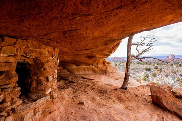
Stone Storehouse Trail
Visit one of the best preserved ancient structures in the park, built over 1,000 years ago.
Syncline Loop Trail
The Syncline Trail follows the canyons around Upheaval Dome and requires navigating steep switchbacks, climbing and scrambling through boulder fields, and a 1,300-foot (396 m) elevation change. Most park rescues occur on this trail.
Upheaval Dome
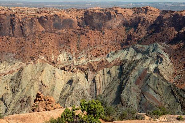
What created this unusually circular and tilted geologic formation? For the best view, hike the one-mile roundtrip (1.5 km) trail to the first overlook (climbing 100 feet/30 meters).
Upheaval Dome Overlooks Trail
Two short but steep hikes lead to overlooks of a spectacular and colorful geologic feature; Upheaval Dome.
Whale Rock Trail
This trail leads up the side of a sandstone dome, ending with broad views of the Island in the Sky. Great for kids who like to scramble on rock.
White Rim Overlook Trail
Walk to an east-facing overlook for views of the Colorado River, Monument Basin, and La Sal Mountains.
Wilhite Trail
A primitive trail with steep switchbacks drops 1,600 feet (488 m) into a long, sandy wash. Follow the wash to the White Rim Road. No shade.
Wooden Shoe Canyon to Lost Canyon Loop Trail
A wonderful loop hike with some difficult sections climbing between two canyons. One ladder must be climbed.