Arches
Moab, UT
Arches Visitor Center Nature Trail
Walk a short path behind the visitor center to learn about native desert plants and their traditional uses. Roundtrip Distance: 150 feet (45 m) Time: 10 min Elevation Change: 0 ft (0 m)
Balanced Rock Viewpoint and Trail
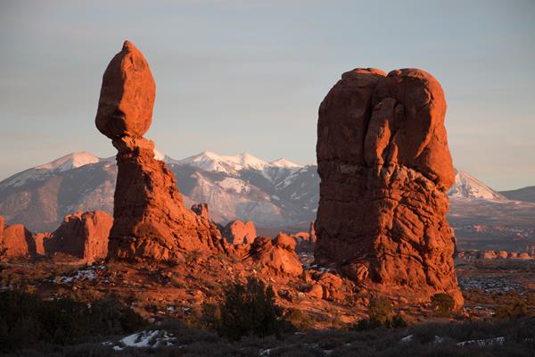
Balanced Rock is visible from the park road. Although parking is limited, many visitors stop to complete the short hike around the feature's base for unusual and up-close perspectives. This loop trail is partly paved and may be accessible to wheelchairs. Climbing on Balanced Rock is prohibited. Roundtrip Distance: 0.3 mi (0.4 km) Time: 15-30 min Elevation Change: 35 ft (11 m)
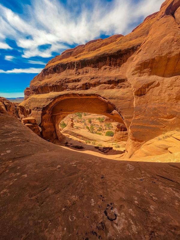
Broken Arch Trail
From the trailhead at the Sand Dune Arch parking area, the trail crosses a large meadow to Broken Arch. You can return from there or continue through the arch to the campground, then circle back through fins with sand dunes and some moderate scrambling. Roundtrip Distance: 1.2 mi (1.9 km) Time: 30-60 minutes Elevation Change: 59 ft (18 m)
Courthouse Towers Viewpoint and Trailhead
This is the north end of the Park Avenue Trail, which traces a mostly smooth canyon bottom uphill, then ascends rock-cut stairs to Park Avenue Viewpoint. For an easier walk, turn around at the base of the stairs. Roundtrip hikers: please remain on the trail both directions rather than walking along the road. Roundtrip Distance: 1.8 mi (3.2 km) Time: 1 hour Elevation Change: 322 ft (98 m) -- or much less if you skip the stairs
Courthouse Wash Panel Trail
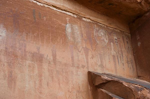
A rock markings panel above the Colorado River offers insight into the lives and movements of archaic peoples. View the panel from below (better with binoculars) or hike a short trail up to its base. First part of trail is paved and accessible to wheelchairs. Roundtrip Distance: 0.8 mi (1.4 km) Time: 30-60 min Elevation Change: 60 ft (18 m)
Delicate Arch Trail
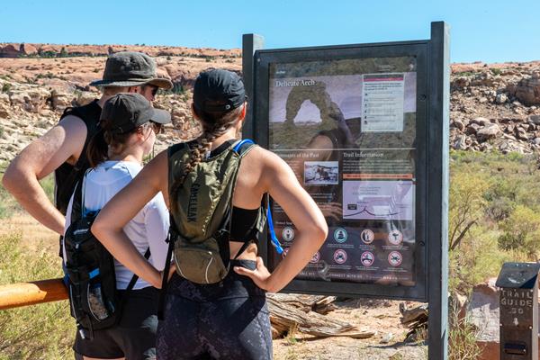
This trail hikes up 538 feet (164 m) to the most famous arch in the park, crossing open slickrock with no shade. Pass historic Wolfe Ranch and a rock markings panel, then climb steadily; follow the rock cairns and signs. Just before you get to Delicate Arch, the trail traverses a narrow rock ledge for about 200 yards (183 m). Take at least 2 quarts (2 L) of water per person. Roundtrip distance: 3 miles (4.8 km) Time: 2-3 hours
Delicate Arch Viewpoint Trails
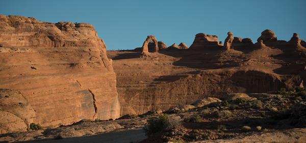
See the most famous arch in the park at a distance from one of these viewpoints. Lower Viewpoint is level and wheelchair-accessible; with a roundtrip distance of 200 ft (61 m). Upper Viewpoint is moderately strenuous: Roundtrip Distance: 0.5 mi (0.8 km) Time: 30-45 min Elevation Change: 171 ft (52 m)
Devils Garden Trail
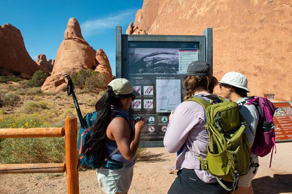
This trailhead offers a range of hikes, from short to strenuous. Beyond Landscape Arch (listed above), the trail climbs sandstone slabs. Footing is rocky, with narrow ledges, exposure to heights, rock scrambling, and few trail markers. Avoid when rock is wet or snowy. Bring at least 3 quarts (3 L) of water per person. Roundtrip just to Double O Arch: 4.0 miles (6.4 km), 2-3 hours. Whole Trail: 7.9 miles (12.7 km), 3-5 hours
Double Arch Viewpoint and Trail
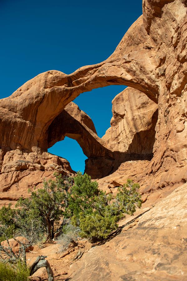
The tallest arch in the park at 122 ft (34 m), Double Arch is visible from The Windows parking loop. A relatively flat, gravel-surfaced path leads to the base of its two huge, arching spans. May be accessible to wheelchairs with some assistance. Roundtrip Distance: 0.6 mi (1 km) Time: 15-30 min Elevation Change: 30 ft (10 m)
Landscape Arch Trail
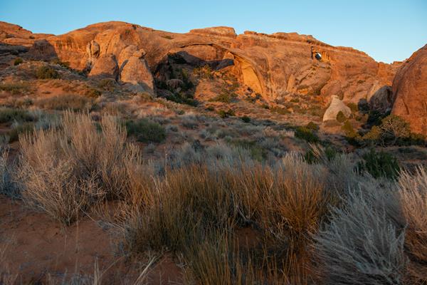
A hard-packed trail leads to a spectacular ribbon of rock, whose span is longer than 300 feet (91 m). Spur trails lead to Pine Tree Arch and Tunnel Arch. Steep slopes may be accessible to wheelchairs with assistance. After Landscape Arch, the Devils Garden Trail becomes difficult, with rock scrambling, narrow ledges, and exposure to heights. Roundtrip Distance: 1.8 mi (2.9 km) Time: 30-60 min Elevation Change: 40 ft (12 m)
Park Avenue Viewpoint and Trail
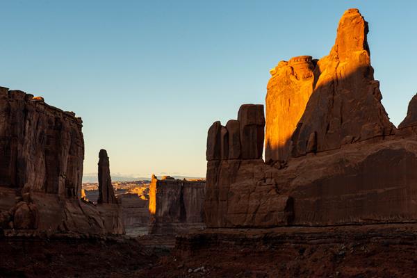
A paved sidewalk (wheelchair accessible) leads to a viewpoint down a corridor of towering rock walls and spires. Descend stairs to walk the trail among massive monoliths toward Courthouse Towers Viewpoint. For a roundtrip hike, return along the trail rather than walking along the road. Roundtrip Distance: 1.8 mi (3.2 km) Time: 1 hour Elevation Change: 322 ft (98 m)
Sand Dune Arch Trail
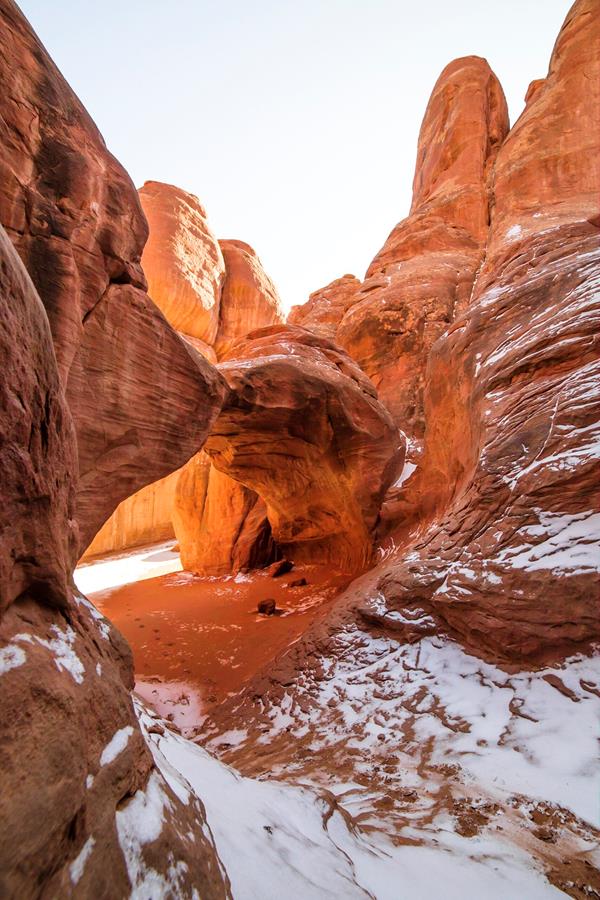
Hike through deep sand to find this hidden arch between tall sandstone walls. You may also choose to continue across a grassland to Broken Arch, returning via the same trail or making a loop through the campground. Roundtrip Distance: 0.4 mi (0.6 km) Time: 15-30 min Elevation Change: 0 ft (0 m)
Skyline Arch Trail
A short, out-and-back hike on well defined trail leads to an arch in a high wall. On a cold night in November 1940, a large chunk fell out of this arch, instantly doubling the size of its opening. Roundtrip Distance: 0.4 mi (0.6 km) Time: 10-20 min Elevation Change: 28 ft (8 m)
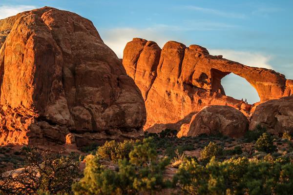
The Windows Viewpoint and Trail
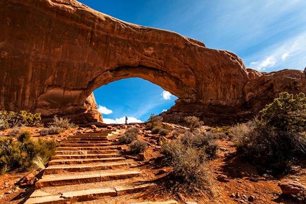
Massive North Window is visible from the parking lot. A gentle climb up a hard-packed trail and stone steps leads to North Window, South Window, and Turret Arch. Return to the parking lot via the same trail, or take the slightly longer primitive route around the back side. First 300 feet (91 m) of main trail may be accessible to wheelchairs with assistance. Roundtrip Distance: 1 mi (1.6 km) Time: 30-60 min Elevation Change: 99 ft (30 m)
Tower Arch Trail
This trail climbs up a rock wall, cuts across a valley, and then meanders through sandstone fins and sand dunes. Reaching this trailhead requires driving 8 mi (14 km) on unpaved roads, which wash out quickly in rainstorms. Roundtrip Distance: 2.6 mi (4.2 km) Time: 2-3 hours Elevation Change: 290 ft (89 m)
Wolfe Ranch
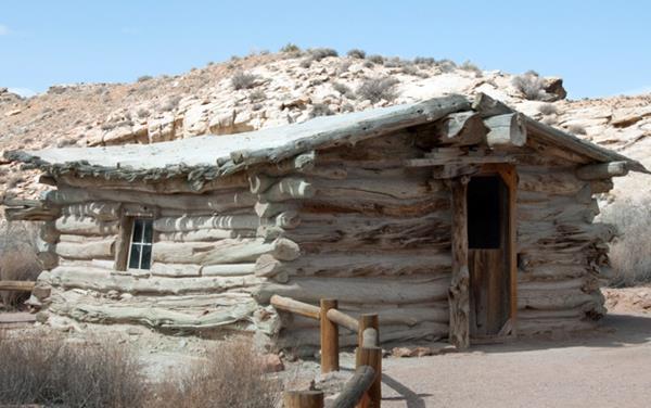
This humble, one-room cabin sits near the present-day trailhead for the hike to Delicate Arch. Visitors regularly peer through the doorway and wonder aloud, "Who lived here... and how?... And why?" For more than a decade, John Wesley Wolfe and his family lived and worked on the remote "Bar DX" ranch, eventually grazing more than 1,000 head of cattle on native grasses that once covered this area.